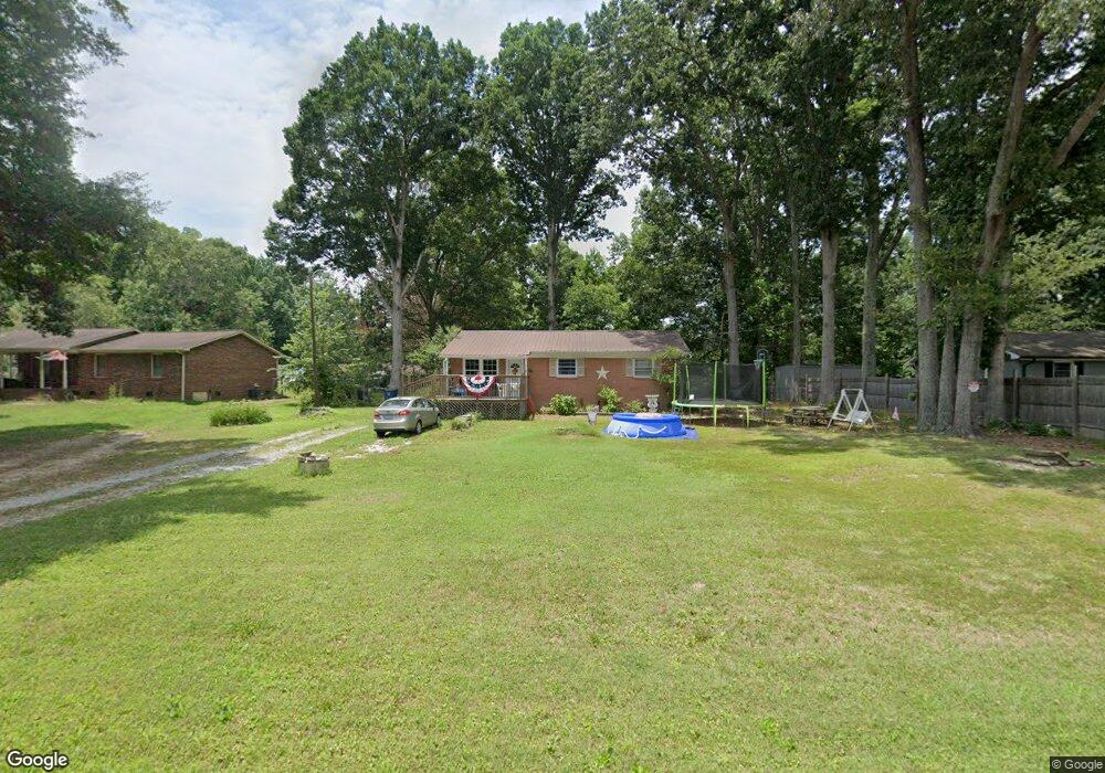
626 Ware Rd Shelby, NC 28152
Estimated Value: $132,968 - $239,000
--
Bed
--
Bath
1,025
Sq Ft
$188/Sq Ft
Est. Value
About This Home
This home is located at 626 Ware Rd, Shelby, NC 28152 and is currently estimated at $192,992, approximately $188 per square foot. 626 Ware Rd is a home located in Cleveland County with nearby schools including Marion Intermediate School, Shelby Middle School, and Shelby High School.
Ownership History
Date
Name
Owned For
Owner Type
Purchase Details
Closed on
Feb 29, 2008
Sold by
Tessener David Crawford and Tessener Janet
Bought by
Pearson Eugene and Pearson Tena W
Current Estimated Value
Home Financials for this Owner
Home Financials are based on the most recent Mortgage that was taken out on this home.
Original Mortgage
$46,500
Outstanding Balance
$28,829
Interest Rate
5.65%
Mortgage Type
Purchase Money Mortgage
Estimated Equity
$164,163
Purchase Details
Closed on
Sep 21, 2006
Sold by
Tessener William C
Bought by
Tessener David Crawford
Create a Home Valuation Report for This Property
The Home Valuation Report is an in-depth analysis detailing your home's value as well as a comparison with similar homes in the area
Home Values in the Area
Average Home Value in this Area
Purchase History
| Date | Buyer | Sale Price | Title Company |
|---|---|---|---|
| Pearson Eugene | $46,500 | None Available | |
| Tessener David Crawford | -- | None Available |
Source: Public Records
Mortgage History
| Date | Status | Borrower | Loan Amount |
|---|---|---|---|
| Open | Pearson Eugene | $46,500 |
Source: Public Records
Tax History Compared to Growth
Tax History
| Year | Tax Paid | Tax Assessment Tax Assessment Total Assessment is a certain percentage of the fair market value that is determined by local assessors to be the total taxable value of land and additions on the property. | Land | Improvement |
|---|---|---|---|---|
| 2025 | $773 | $121,663 | $12,210 | $109,453 |
| 2024 | $543 | $65,187 | $9,990 | $55,197 |
| 2023 | $541 | $65,187 | $9,990 | $55,197 |
| 2022 | $541 | $65,187 | $9,990 | $55,197 |
| 2021 | $543 | $65,187 | $9,990 | $55,197 |
| 2020 | $531 | $55,275 | $9,990 | $45,285 |
| 2019 | $531 | $55,275 | $9,990 | $45,285 |
| 2018 | $478 | $55,275 | $9,990 | $45,285 |
| 2017 | $476 | $55,275 | $9,990 | $45,285 |
| 2016 | $499 | $55,275 | $9,990 | $45,285 |
| 2015 | $508 | $56,469 | $9,990 | $46,479 |
| 2014 | $508 | $56,469 | $9,990 | $46,479 |
Source: Public Records
Map
Nearby Homes
- 135 Shadowgate Dr
- 2338 Hoey Church Rd
- 123 Pinecrest Dr
- 122 Pinecrest Dr
- 0 Pinecrest Dr
- 00 Pinecrest Dr
- 114 Tanya Ln
- 124 Tanya Ln
- 1900 E Dixon Blvd
- 329 Aniston Ln
- 2111 Windermere Ln
- 1108 Borders Rd
- 4022 Lynn Cir
- 2357 Pleasant Hill Church Rd
- 2344 Joes Lake Rd
- 313 Kellom Dr
- 0 Oates Dr
- The Jackson Plan at Kings View
- The Linfield - II Plan at Kings View
- The Weston Plan at Kings View
- 628 Ware Rd
- 624 Ware Rd
- 1051 Providence Rd
- 1075 Providence Rd
- 627 Ware Rd
- 620 Ware Rd
- 631 Ware Rd
- 636 Ware Rd
- 635 Ware Rd
- 1081 Providence Rd
- 1076 Providence Rd
- 642 Ware Rd
- 642 Ware Rd
- 1091 Providence Rd
- 639 Ware Rd
- 1080 Providence Rd
- 1022 Providence Rd
- 1101 Providence Rd
- 637 Ware Rd
- 112 Valentine Dr