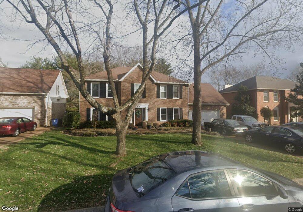
626 Watson Branch Dr Franklin, TN 37064
McEwen NeighborhoodEstimated Value: $708,000 - $761,000
--
Bed
3
Baths
2,668
Sq Ft
$275/Sq Ft
Est. Value
About This Home
This home is located at 626 Watson Branch Dr, Franklin, TN 37064 and is currently estimated at $732,914, approximately $274 per square foot. 626 Watson Branch Dr is a home located in Williamson County with nearby schools including Moore Elementary School, Freedom Intermediate School, and Freedom Middle School.
Ownership History
Date
Name
Owned For
Owner Type
Purchase Details
Closed on
Dec 12, 2005
Sold by
Weathers Timothy L and Weathers Donna G
Bought by
Beauchamp Andrew C and Beauchamp Elizabeth C
Current Estimated Value
Home Financials for this Owner
Home Financials are based on the most recent Mortgage that was taken out on this home.
Original Mortgage
$212,000
Outstanding Balance
$118,192
Interest Rate
6.23%
Mortgage Type
Fannie Mae Freddie Mac
Estimated Equity
$614,722
Purchase Details
Closed on
Jun 18, 1999
Sold by
Safstrom Douglas E and Safstrom Jacqueline F
Bought by
Weathers Timothy L and Weathers Donna G
Home Financials for this Owner
Home Financials are based on the most recent Mortgage that was taken out on this home.
Original Mortgage
$162,000
Interest Rate
7.04%
Mortgage Type
Balloon
Purchase Details
Closed on
Jun 28, 1996
Sold by
Humphreys Michael C
Bought by
Safstrom Douglas E
Purchase Details
Closed on
Jul 22, 1994
Sold by
Crawford John K
Bought by
Humphreys Michael P
Create a Home Valuation Report for This Property
The Home Valuation Report is an in-depth analysis detailing your home's value as well as a comparison with similar homes in the area
Home Values in the Area
Average Home Value in this Area
Purchase History
| Date | Buyer | Sale Price | Title Company |
|---|---|---|---|
| Beauchamp Andrew C | $265,000 | -- | |
| Weathers Timothy L | $192,000 | -- | |
| Safstrom Douglas E | $182,400 | -- | |
| Humphreys Michael P | -- | -- |
Source: Public Records
Mortgage History
| Date | Status | Borrower | Loan Amount |
|---|---|---|---|
| Open | Beauchamp Andrew C | $212,000 | |
| Previous Owner | Weathers Timothy L | $162,000 |
Source: Public Records
Tax History Compared to Growth
Tax History
| Year | Tax Paid | Tax Assessment Tax Assessment Total Assessment is a certain percentage of the fair market value that is determined by local assessors to be the total taxable value of land and additions on the property. | Land | Improvement |
|---|---|---|---|---|
| 2024 | $3,434 | $121,275 | $22,500 | $98,775 |
| 2023 | $3,300 | $121,275 | $22,500 | $98,775 |
| 2022 | $3,300 | $121,275 | $22,500 | $98,775 |
| 2021 | $3,300 | $121,275 | $22,500 | $98,775 |
| 2020 | $2,726 | $84,475 | $20,000 | $64,475 |
| 2019 | $2,726 | $84,475 | $20,000 | $64,475 |
| 2018 | $2,666 | $84,475 | $20,000 | $64,475 |
| 2017 | $2,624 | $84,475 | $20,000 | $64,475 |
| 2016 | $2,616 | $84,475 | $20,000 | $64,475 |
| 2015 | -- | $67,950 | $16,250 | $51,700 |
| 2014 | -- | $67,950 | $16,250 | $51,700 |
Source: Public Records
Map
Nearby Homes
- 521 Maplegrove Dr
- 205 Jennette Place
- 521 Shadycrest Ln
- 697 Watson Branch Dr
- 2741 Kennedy Ct Unit 2741
- 2801 Kennedy Ct Unit 2801
- 306 Battery Ct
- 713 Sugartree Ln
- 2433 Kennedy Ct Unit 2433
- 1011 Murfreesboro Rd Unit E3
- 1011 Murfreesboro Rd Unit B2
- 1011 Murfreesboro Rd Unit D3
- 624 Burghley Ln
- 1143 Buckingham Cir
- 100 Ralston Ln
- 520 Castlebury Ct
- 100 Basil Ct
- 2100 Roderick Place W
- 2077 Roderick Cir
- 1183 Buckingham Cir
- 624 Watson Branch Dr
- 628 Watson Branch Dr
- 620 Watson Branch Dr
- 630 Watson Branch Dr
- 625 Watson Branch Dr
- 629 Watson Branch Dr
- 623 Watson Branch Dr
- 631 Watson Branch Dr
- 618 Watson Branch Dr
- 621 Watson Branch Dr
- 634 Watson Branch Dr
- 635 Watson Branch Dr
- 619 Watson Branch Dr
- 529 Maplegrove Dr
- 525 Maplegrove Dr
- 533 Maplegrove Dr
- 636 Watson Branch Dr
- 616 Watson Branch Dr
- 704 Cool Springs Ct
- 637 Watson Branch Dr