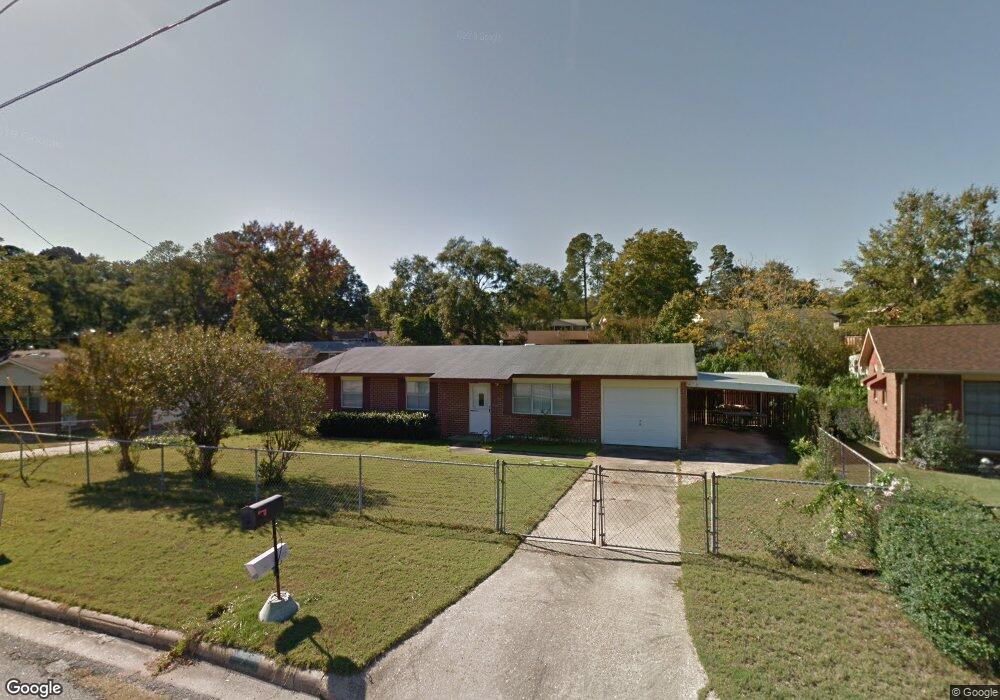
6265 Mill Branch Rd Columbus, GA 31907
Eastern Columbus NeighborhoodEstimated Value: $121,000 - $144,000
3
Beds
3
Baths
1,325
Sq Ft
$101/Sq Ft
Est. Value
About This Home
This home is located at 6265 Mill Branch Rd, Columbus, GA 31907 and is currently estimated at $133,991, approximately $101 per square foot. 6265 Mill Branch Rd is a home located in Muscogee County with nearby schools including Georgetown Elementary School, East Columbus Magnet Academy, and Kendrick High School.
Ownership History
Date
Name
Owned For
Owner Type
Purchase Details
Closed on
May 19, 2021
Sold by
Paschal Latarsha Monique
Bought by
Foster Roy James
Current Estimated Value
Purchase Details
Closed on
May 7, 2021
Sold by
Foster Roy James Sr Estate
Bought by
Paschal Latarsha Monique and Foster Laquesha Michele
Purchase Details
Closed on
Nov 26, 2014
Sold by
Wheeler Larry
Bought by
Foster Roy James
Home Financials for this Owner
Home Financials are based on the most recent Mortgage that was taken out on this home.
Original Mortgage
$68,630
Interest Rate
4.5%
Mortgage Type
FHA
Purchase Details
Closed on
Feb 22, 2013
Sold by
Riversouth Properties Llc
Bought by
Wheeler Larry
Create a Home Valuation Report for This Property
The Home Valuation Report is an in-depth analysis detailing your home's value as well as a comparison with similar homes in the area
Home Values in the Area
Average Home Value in this Area
Purchase History
| Date | Buyer | Sale Price | Title Company |
|---|---|---|---|
| Foster Roy James | -- | -- | |
| Paschal Latarsha Monique | -- | -- | |
| Foster Roy James | $69,900 | -- | |
| Wheeler Larry | $38,900 | -- | |
| Riversouth Properties Llc | $28,500 | -- |
Source: Public Records
Mortgage History
| Date | Status | Borrower | Loan Amount |
|---|---|---|---|
| Previous Owner | Foster Roy James | $68,630 |
Source: Public Records
Tax History Compared to Growth
Tax History
| Year | Tax Paid | Tax Assessment Tax Assessment Total Assessment is a certain percentage of the fair market value that is determined by local assessors to be the total taxable value of land and additions on the property. | Land | Improvement |
|---|---|---|---|---|
| 2025 | $527 | $43,700 | $5,604 | $38,096 |
| 2024 | $526 | $43,700 | $5,604 | $38,096 |
| 2023 | $22 | $43,700 | $5,604 | $38,096 |
| 2022 | $548 | $29,884 | $5,604 | $24,280 |
| 2021 | $541 | $26,652 | $5,604 | $21,048 |
| 2020 | $542 | $26,652 | $5,604 | $21,048 |
| 2019 | $545 | $26,652 | $5,604 | $21,048 |
| 2018 | $545 | $26,652 | $5,604 | $21,048 |
| 2017 | $549 | $26,652 | $5,604 | $21,048 |
| 2016 | $1,153 | $27,961 | $2,910 | $25,051 |
| 2015 | $1,155 | $27,961 | $2,910 | $25,051 |
| 2014 | $257 | $15,561 | $2,910 | $12,651 |
| 2013 | -- | $27,635 | $2,910 | $24,725 |
Source: Public Records
Map
Nearby Homes
- 6047 Capri Cir
- 6061 Luna Dr
- 6032 Cordova Rd
- 6033 Luna Dr
- 6119 Mill Branch Rd
- 6213 Fitzgerald Dr
- 6040 Luna Dr
- 1068 Valencia Dr
- 1322 Melford Dr
- 1607 Mazor Dr
- 6188 Valencia Dr
- 1826 Woodhollow Dr
- 5500 Amber Dr
- 1252 School House Dr
- 1925 Woodhollow Dr
- 1754 Mazor Dr
- 6620 Cove Cir
- 6223 Georgetown Dr
- 5828 Georgetown Dr
- 5619 Valleybrook Rd
- 6269 Mill Branch Rd
- 6259 Mill Branch Rd
- 6121 Newick Dr
- 6115 Newick Dr
- 6127 Newick Dr
- 6203 Newick Dr
- 6109 Newick Dr
- 6270 Mill Branch Rd
- 0 Newick Dr
- 6212 Cordova Rd
- 6276 Mill Branch Rd
- 6247 Mill Branch Rd
- 6213 Newick Dr
- 6220 Cordova Rd
- 6206 Cordova Rd
- 6248 Mill Branch Rd
- 6120 Newick Dr
- 6126 Newick Dr
- 6142 Newick Dr
- 6114 Newick Dr