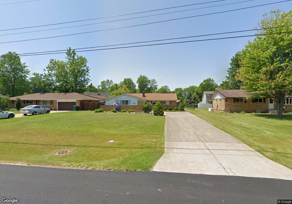
6266 Meldon Dr Mentor, OH 44060
Estimated Value: $184,000 - $265,522
3
Beds
2
Baths
1,160
Sq Ft
$206/Sq Ft
Est. Value
About This Home
This home is located at 6266 Meldon Dr, Mentor, OH 44060 and is currently estimated at $239,131, approximately $206 per square foot. 6266 Meldon Dr is a home located in Lake County with nearby schools including Fairfax Elementary School, Memorial Middle School, and Mentor High School.
Ownership History
Date
Name
Owned For
Owner Type
Purchase Details
Closed on
Jan 5, 2023
Sold by
Robinson Michele A and Robinson Steven L
Bought by
Robinson Steven L
Current Estimated Value
Home Financials for this Owner
Home Financials are based on the most recent Mortgage that was taken out on this home.
Original Mortgage
$117,000
Outstanding Balance
$112,810
Interest Rate
6.33%
Mortgage Type
New Conventional
Estimated Equity
$126,321
Purchase Details
Closed on
Mar 2, 1998
Sold by
Aspinwall Robert L and Gerzeny Laura J
Bought by
Robinson Steven L and Robinson Michele A
Home Financials for this Owner
Home Financials are based on the most recent Mortgage that was taken out on this home.
Original Mortgage
$94,000
Interest Rate
7.08%
Purchase Details
Closed on
Oct 29, 1992
Bought by
Aspinwall Robert L
Create a Home Valuation Report for This Property
The Home Valuation Report is an in-depth analysis detailing your home's value as well as a comparison with similar homes in the area
Home Values in the Area
Average Home Value in this Area
Purchase History
| Date | Buyer | Sale Price | Title Company |
|---|---|---|---|
| Robinson Steven L | -- | None Listed On Document | |
| Robinson Steven L | $114,000 | Real Estate Title | |
| Aspinwall Robert L | -- | -- |
Source: Public Records
Mortgage History
| Date | Status | Borrower | Loan Amount |
|---|---|---|---|
| Open | Robinson Steven L | $117,000 | |
| Previous Owner | Robinson Steven L | $94,000 |
Source: Public Records
Tax History
| Year | Tax Paid | Tax Assessment Tax Assessment Total Assessment is a certain percentage of the fair market value that is determined by local assessors to be the total taxable value of land and additions on the property. | Land | Improvement |
|---|---|---|---|---|
| 2025 | -- | $95,550 | $27,060 | $68,490 |
| 2024 | -- | $95,550 | $27,060 | $68,490 |
| 2023 | $6,140 | $59,090 | $19,150 | $39,940 |
| 2022 | $2,722 | $59,090 | $19,150 | $39,940 |
| 2021 | $2,730 | $59,090 | $19,150 | $39,940 |
| 2020 | $2,639 | $50,080 | $16,230 | $33,850 |
| 2019 | $2,642 | $50,080 | $16,230 | $33,850 |
| 2018 | $2,543 | $44,380 | $20,410 | $23,970 |
| 2017 | $2,453 | $44,380 | $20,410 | $23,970 |
| 2016 | $2,438 | $44,380 | $20,410 | $23,970 |
| 2015 | $2,223 | $44,380 | $20,410 | $23,970 |
| 2014 | $2,147 | $42,230 | $20,410 | $21,820 |
| 2013 | $2,149 | $42,230 | $20,410 | $21,820 |
Source: Public Records
Map
Nearby Homes
- 6240 Melshore Dr
- 8031 Munson Rd
- 6239 Dunbar Dr
- 6067 Collins Rd
- 6304 Meadowbrook Dr
- 0 Collins Rd
- 6082 Andrews Rd
- 6220 Glenwood Dr
- 8285 Munson Rd
- 8290 Quail Point Ln
- 5950 Galaxie Dr
- 5976 Silver Ct
- 6135 Thistlewood Dr
- 8352 Quail Point Ln Unit 8352
- 6443 Chase Dr
- 6168 Thistlewood Dr
- 6595 Devonshire Ct
- 7621 Miami Rd
- 7505 Dahlia Dr
- 7634 Pinehurst Dr
Your Personal Tour Guide
Ask me questions while you tour the home.