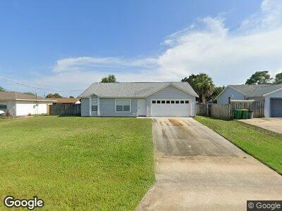
6275 Allmont St Cocoa, FL 32927
Port Saint John NeighborhoodEstimated Value: $274,332 - $311,000
3
Beds
2
Baths
1,190
Sq Ft
$251/Sq Ft
Est. Value
About This Home
This home is located at 6275 Allmont St, Cocoa, FL 32927 and is currently estimated at $298,333, approximately $250 per square foot. 6275 Allmont St is a home located in Brevard County with nearby schools including Enterprise Elementary School, Space Coast Junior/Senior High School, and East Atlantic Prep of Brevard County.
Ownership History
Date
Name
Owned For
Owner Type
Purchase Details
Closed on
Mar 4, 1994
Sold by
Maronda Homes Inc Fl
Bought by
Laplante John J
Current Estimated Value
Home Financials for this Owner
Home Financials are based on the most recent Mortgage that was taken out on this home.
Original Mortgage
$60,588
Interest Rate
7.04%
Purchase Details
Closed on
Dec 6, 1993
Sold by
Atlantic Gulf Com Corp
Bought by
Maronda Homes Inc Fl
Purchase Details
Closed on
Oct 15, 1993
Sold by
Nationsbank Fl
Bought by
Atlantic Gulf Communities Corp
Create a Home Valuation Report for This Property
The Home Valuation Report is an in-depth analysis detailing your home's value as well as a comparison with similar homes in the area
Home Values in the Area
Average Home Value in this Area
Purchase History
| Date | Buyer | Sale Price | Title Company |
|---|---|---|---|
| Laplante John J | $59,400 | -- | |
| Maronda Homes Inc Fl | $8,000 | -- | |
| Atlantic Gulf Communities Corp | -- | -- |
Source: Public Records
Mortgage History
| Date | Status | Borrower | Loan Amount |
|---|---|---|---|
| Closed | Laplante John J | $60,588 |
Source: Public Records
Tax History Compared to Growth
Tax History
| Year | Tax Paid | Tax Assessment Tax Assessment Total Assessment is a certain percentage of the fair market value that is determined by local assessors to be the total taxable value of land and additions on the property. | Land | Improvement |
|---|---|---|---|---|
| 2023 | $1,004 | $70,350 | $0 | $0 |
| 2022 | $948 | $68,310 | $0 | $0 |
| 2021 | $950 | $66,330 | $0 | $0 |
| 2020 | $904 | $65,420 | $0 | $0 |
| 2019 | $852 | $63,950 | $0 | $0 |
| 2018 | $853 | $62,760 | $0 | $0 |
| 2017 | $854 | $61,470 | $0 | $0 |
| 2016 | $861 | $60,210 | $18,000 | $42,210 |
| 2015 | $867 | $59,800 | $15,000 | $44,800 |
| 2014 | $872 | $59,330 | $11,000 | $48,330 |
Source: Public Records
Map
Nearby Homes
- 6260 Brandt St
- 6490 Bethel St
- 6480 Annapolis St
- 6490 Addax Ave
- 6481 Muller Ave
- 6280 Golfview Ave
- 6445 Beard Ave
- 6519 Bamboo Ave
- 6225 Homestead Ave
- 5895 Homestead Ave
- 00000 Golfview Ave
- 6070 Baltimore Ave
- Tbd Fay Blvd
- 5950 Edison St
- 6062 Balsam St
- 4650 N Highway 1 Hwy
- 6643 Emil Ave
- 6603 Emil Ave
- 6249 Gayle Dr
- 5670 Brandon St
- 6275 Allmont St
- 6285 Allmont St
- 6265 Allmont St
- 6272 Brandt St
- 6284 Brandt St
- 6295 Allmont St
- 6255 Allmont St
- 6270 Allmont St
- 0000 Bethel St
- 6280 Allmont St
- 6260 Allmont St
- 6296 Brandt St
- 6248 Brandt St
- 6290 Allmont St
- 6250 Allmont St
- 6305 Allmont St
- 6245 Allmont St
- 6236 Brandt St
- 6240 Allmont St
- 6275 Banyan St