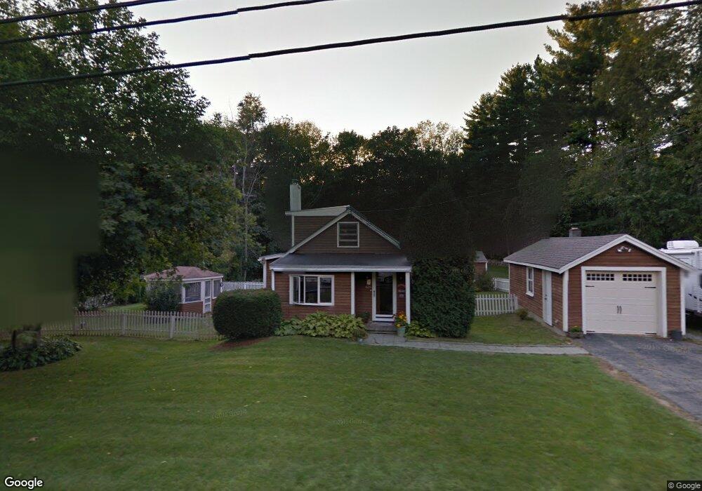
628 Main St Hampstead, NH 03841
Estimated Value: $386,738 - $499,000
2
Beds
2
Baths
1,038
Sq Ft
$409/Sq Ft
Est. Value
About This Home
This home is located at 628 Main St, Hampstead, NH 03841 and is currently estimated at $424,685, approximately $409 per square foot. 628 Main St is a home located in Rockingham County with nearby schools including Hampstead Central School, Hampstead Middle School, and Pinkerton Academy.
Ownership History
Date
Name
Owned For
Owner Type
Purchase Details
Closed on
Jul 19, 2006
Sold by
Bonin Peter G and Bonin Nicole
Bought by
Ingraham Angela L
Current Estimated Value
Home Financials for this Owner
Home Financials are based on the most recent Mortgage that was taken out on this home.
Original Mortgage
$188,000
Interest Rate
6.67%
Mortgage Type
Purchase Money Mortgage
Purchase Details
Closed on
Aug 20, 2001
Sold by
Roberts Timothy M
Bought by
Bonin Peter G
Home Financials for this Owner
Home Financials are based on the most recent Mortgage that was taken out on this home.
Original Mortgage
$152,000
Interest Rate
7.16%
Purchase Details
Closed on
Feb 29, 2000
Sold by
Coulombe Judith
Bought by
Roberts Timothy M
Create a Home Valuation Report for This Property
The Home Valuation Report is an in-depth analysis detailing your home's value as well as a comparison with similar homes in the area
Home Values in the Area
Average Home Value in this Area
Purchase History
| Date | Buyer | Sale Price | Title Company |
|---|---|---|---|
| Ingraham Angela L | $235,000 | -- | |
| Bonin Peter G | $160,000 | -- | |
| Roberts Timothy M | $129,900 | -- |
Source: Public Records
Mortgage History
| Date | Status | Borrower | Loan Amount |
|---|---|---|---|
| Open | Roberts Timothy M | $183,495 | |
| Closed | Roberts Timothy M | $60,745 | |
| Closed | Roberts Timothy M | $188,000 | |
| Previous Owner | Roberts Timothy M | $152,000 |
Source: Public Records
Tax History
| Year | Tax Paid | Tax Assessment Tax Assessment Total Assessment is a certain percentage of the fair market value that is determined by local assessors to be the total taxable value of land and additions on the property. | Land | Improvement |
|---|---|---|---|---|
| 2024 | $6,660 | $359,200 | $205,900 | $153,300 |
| 2023 | $6,106 | $240,000 | $147,600 | $92,400 |
| 2022 | $5,683 | $240,000 | $147,600 | $92,400 |
| 2021 | $5,460 | $240,000 | $147,600 | $92,400 |
| 2020 | $5,172 | $240,000 | $147,600 | $92,400 |
| 2016 | $3,894 | $160,900 | $79,100 | $81,800 |
| 2015 | $3,609 | $160,900 | $79,100 | $81,800 |
| 2014 | $3,609 | $160,900 | $79,100 | $81,800 |
| 2006 | $3,497 | $193,000 | $113,100 | $79,900 |
Source: Public Records
Map
Nearby Homes
- 7 Cameron Ct Unit 7
- 1 Cameron Ct Unit 1
- 14 N Salem Rd Unit A
- 30 Geisser Ln
- 98 Lantern Dr
- 82 Lantern Dr
- 78 Lantern Dr
- 72 Lantern Dr
- 67 Lantern Dr
- 83 Lantern Dr
- 596 Haverhill Rd
- 54 Hampstead Rd
- 42 N Shore Rd
- 228 Main St
- 24 Oak Ridge Rd
- 41 Drew Woods Dr
- 47 Drew Woods Dr
- 11 Sunset Ave
- 2 Remington Ct
- 118-1 Mills Shore Dr
Your Personal Tour Guide
Ask me questions while you tour the home.