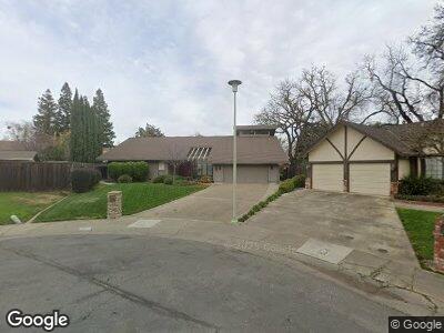
6287 Grangers Dairy Dr Unit D Sacramento, CA 95831
Pocket-Greenhaven NeighborhoodEstimated Value: $737,000 - $871,000
3
Beds
3
Baths
2,482
Sq Ft
$320/Sq Ft
Est. Value
About This Home
This home is located at 6287 Grangers Dairy Dr Unit D, Sacramento, CA 95831 and is currently estimated at $795,328, approximately $320 per square foot. 6287 Grangers Dairy Dr Unit D is a home located in Sacramento County with nearby schools including Genevieve Didion School, Sam Brannan Middle School, and John F. Kennedy High School.
Ownership History
Date
Name
Owned For
Owner Type
Purchase Details
Closed on
Nov 12, 2008
Sold by
Morishita Donald N and Morishita Sherilyn A
Bought by
Morishita Donald N and Morishita Sherilyn A
Current Estimated Value
Create a Home Valuation Report for This Property
The Home Valuation Report is an in-depth analysis detailing your home's value as well as a comparison with similar homes in the area
Home Values in the Area
Average Home Value in this Area
Purchase History
| Date | Buyer | Sale Price | Title Company |
|---|---|---|---|
| Morishita Donald N | -- | None Available |
Source: Public Records
Mortgage History
| Date | Status | Borrower | Loan Amount |
|---|---|---|---|
| Closed | Morishita Donald N | $100,000 | |
| Closed | Morishita Donald N | $25,000 | |
| Closed | Morishita Donald N | $100,000 | |
| Closed | Morishita Donald N | $250,000 |
Source: Public Records
Tax History Compared to Growth
Tax History
| Year | Tax Paid | Tax Assessment Tax Assessment Total Assessment is a certain percentage of the fair market value that is determined by local assessors to be the total taxable value of land and additions on the property. | Land | Improvement |
|---|---|---|---|---|
| 2024 | $3,213 | $259,027 | $54,401 | $204,626 |
| 2023 | $3,130 | $253,949 | $53,335 | $200,614 |
| 2022 | $3,090 | $248,971 | $52,290 | $196,681 |
| 2021 | $2,940 | $244,090 | $51,265 | $192,825 |
| 2020 | $2,957 | $241,588 | $50,740 | $190,848 |
| 2019 | $2,894 | $236,852 | $49,746 | $187,106 |
| 2018 | $2,818 | $232,209 | $48,771 | $183,438 |
| 2017 | $2,773 | $227,657 | $47,815 | $179,842 |
| 2016 | $2,726 | $223,194 | $46,878 | $176,316 |
| 2015 | $2,680 | $219,842 | $46,174 | $173,668 |
| 2014 | $2,617 | $215,537 | $45,270 | $170,267 |
Source: Public Records
Map
Nearby Homes
- 708 Riverlake Way
- 6550 Riverside Blvd
- 6768 Frates Way
- 6241 Riverside Blvd Unit 102
- 6250 Havenside Dr Unit 2
- 11 Mast Ct
- 6788 Langston Way
- 1109 Roundtree Ct
- 2 Springbrook Cir
- 487 Twin River Way
- 6990 Riverboat Way
- 2950 Bevan Rd
- 887 Parklin Ave
- 6270 Greenhaven Dr
- 6641 Gloria Dr
- 6275 Greenhaven Dr
- 90 Parklite Cir
- 35 Pebble River Cir
- 2550 Tapley Rd
- 24 Sage River Cir
- 6287 Grangers Dairy Dr Unit D
- 6293 Grangers Dairy Dr Unit D
- 6275 Grangers Dairy Dr Unit D
- 6275 Grangers Dairy Dr
- 6237 N Point Way
- 6241 N Point Way
- 6233 N Point Way
- 6245 N Point Way
- 6 Kathy Ct
- 6299 Grangers Dairy Dr
- 8 Kathy Ct
- 6229 N Point Way
- 6311 Grangers Dairy Dr Unit D
- 8 N Point Way
- 6270 Grangers Dairy Dr Unit D
- 6329 Grangers Dairy Dr
- 6290 Grangers Dairy Dr Unit D
- 4 Kathy Ct
- 6260 Grangers Dairy Dr
- 5 Kathy Ct