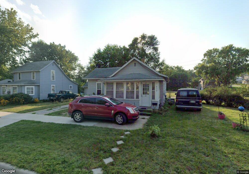
629 Euclid Ave Cherokee, IA 51012
Estimated Value: $45,000 - $68,000
2
Beds
3
Baths
728
Sq Ft
$77/Sq Ft
Est. Value
About This Home
This home is located at 629 Euclid Ave, Cherokee, IA 51012 and is currently estimated at $56,095, approximately $77 per square foot. 629 Euclid Ave is a home located in Cherokee County with nearby schools including Cherokee Elementary School, Cherokee Middle School, and Washington High School.
Ownership History
Date
Name
Owned For
Owner Type
Purchase Details
Closed on
Dec 26, 2022
Sold by
Gustafson Bradley W and Cameo Jo
Bought by
Ballou William C and Ballou Denise W
Current Estimated Value
Purchase Details
Closed on
Sep 6, 2016
Sold by
Pilot Investments Inc
Bought by
Gustafson Bradley
Purchase Details
Closed on
Dec 31, 2008
Sold by
Estate Of Mary Virginia Robinson
Bought by
Pilot Investments Inc
Create a Home Valuation Report for This Property
The Home Valuation Report is an in-depth analysis detailing your home's value as well as a comparison with similar homes in the area
Home Values in the Area
Average Home Value in this Area
Purchase History
| Date | Buyer | Sale Price | Title Company |
|---|---|---|---|
| Ballou William C | $35,000 | None Listed On Document | |
| Gustafson Bradley | $19,000 | None Available | |
| Pilot Investments Inc | $15,000 | None Available |
Source: Public Records
Tax History Compared to Growth
Tax History
| Year | Tax Paid | Tax Assessment Tax Assessment Total Assessment is a certain percentage of the fair market value that is determined by local assessors to be the total taxable value of land and additions on the property. | Land | Improvement |
|---|---|---|---|---|
| 2025 | -- | $49,010 | $12,100 | $36,910 |
| 2024 | $488 | $44,510 | $12,100 | $32,410 |
| 2023 | $488 | $44,510 | $12,100 | $32,410 |
| 2022 | $650 | $35,280 | $9,080 | $26,200 |
| 2021 | $650 | $35,280 | $9,080 | $26,200 |
| 2020 | $666 | $35,280 | $9,080 | $26,200 |
| 2019 | $704 | $35,280 | $0 | $0 |
| 2018 | $384 | $19,760 | $0 | $0 |
| 2017 | $614 | $31,017 | $0 | $0 |
| 2016 | $600 | $31,017 | $0 | $0 |
| 2015 | $526 | $26,510 | $0 | $0 |
| 2014 | $526 | $26,510 | $0 | $0 |
Source: Public Records
Map
Nearby Homes
- 627 Euclid Ave
- 625 Euclid Ave
- 632 Euclid Ave
- 630 Euclid Ave
- 0 Ash St Unit 44019816
- 0 Ash St Unit 44018852
- 634 Euclid Ave
- 617 Euclid Ave
- 628 Euclid Ave
- 223 Spruce St
- 622 Euclid Ave
- 613 Euclid Ave
- 628 1/2 N 1st St
- 628 1/2 N 1st St Unit St
- 618 Euclid Ave
- 315 Spruce St
- 635 Central St
- 635 Central St Unit Street
- 634 Central St
- 302 Spruce St