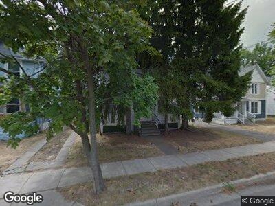
63 Wabash Ave N Battle Creek, MI 49017
Estimated Value: $99,833 - $141,000
3
Beds
2
Baths
1,536
Sq Ft
$83/Sq Ft
Est. Value
About This Home
This home is located at 63 Wabash Ave N, Battle Creek, MI 49017 and is currently estimated at $127,958, approximately $83 per square foot. 63 Wabash Ave N is a home located in Calhoun County with nearby schools including Verona Elementary School, Northwestern Middle School, and Battle Creek Central High School.
Ownership History
Date
Name
Owned For
Owner Type
Purchase Details
Closed on
Sep 14, 2015
Sold by
Battle Creek Area Habitat For Humanity
Bought by
Sims Brandon S
Current Estimated Value
Purchase Details
Closed on
Jun 19, 2014
Sold by
Shirk Julia A
Bought by
Battle Creek Area Habitat For Humanity
Purchase Details
Closed on
Jun 13, 2014
Sold by
Hirzel Patrick S and Estate Of Louis B Atchley
Bought by
Shirk Julia
Create a Home Valuation Report for This Property
The Home Valuation Report is an in-depth analysis detailing your home's value as well as a comparison with similar homes in the area
Home Values in the Area
Average Home Value in this Area
Purchase History
| Date | Buyer | Sale Price | Title Company |
|---|---|---|---|
| Sims Brandon S | $5,500 | None Available | |
| Battle Creek Area Habitat For Humanity | -- | None Available | |
| Shirk Julia | -- | None Available |
Source: Public Records
Mortgage History
| Date | Status | Borrower | Loan Amount |
|---|---|---|---|
| Open | Sims Brandon S | $16,500 | |
| Closed | Sims Brandon S | $5,550 | |
| Closed | Sims Brandon S | $11,000 |
Source: Public Records
Tax History Compared to Growth
Tax History
| Year | Tax Paid | Tax Assessment Tax Assessment Total Assessment is a certain percentage of the fair market value that is determined by local assessors to be the total taxable value of land and additions on the property. | Land | Improvement |
|---|---|---|---|---|
| 2024 | $794 | $31,460 | $0 | $0 |
| 2023 | $1,284 | $28,651 | $0 | $0 |
| 2022 | $717 | $22,234 | $0 | $0 |
| 2021 | $857 | $20,664 | $0 | $0 |
| 2020 | $848 | $19,419 | $0 | $0 |
| 2019 | $831 | $18,919 | $0 | $0 |
| 2018 | $831 | $17,331 | $821 | $16,510 |
| 2017 | $1,029 | $20,067 | $0 | $0 |
| 2016 | $1,054 | $22,825 | $0 | $0 |
| 2015 | $1,156 | $23,760 | $2,129 | $21,631 |
| 2014 | $1,156 | $17,989 | $2,129 | $15,860 |
Source: Public Records
Map
Nearby Homes
- 48 Union St N
- 132 Union St N
- 131 Mckinley Ave N
- 15 Broad St S
- 176 Union St N
- 28 Orchard Place
- 25 East Ave S
- 31 Orchard Place
- 38 East Ave N
- 25 Orchard Place
- 45 Merritt St
- 120 Radley St
- 85 Mckinley Ave S
- 81 & 79 S Mckinley
- 261 Emmett St E
- 24 Poplar St
- 298 Capital Ave NE
- 40 Poplar St
- 286 Capital Ave NE
- 84 Magnolia Ave
- 63 Wabash Ave N
- 63 Wabash Ave N
- 57 Wabash Ave N
- 69 Wabash Ave N
- 55 Wabash Ave N
- 62 Wabash Ave N
- 73 Wabash Ave N
- 58 Wabash Ave N
- 68 Wabash Ave N
- 54 N Wabash Ave
- 72 Wabash Ave N
- 49 Wabash Ave N
- 77 Wabash Ave N
- 68 Mckinley Ave N
- 78 Mckinley Ave N
- 64 Mckinley Ave N
- 74 Mckinley Ave N
- 78 Wabash Ave N
- 45 Wabash Ave N
- 62 Mckinley Ave N