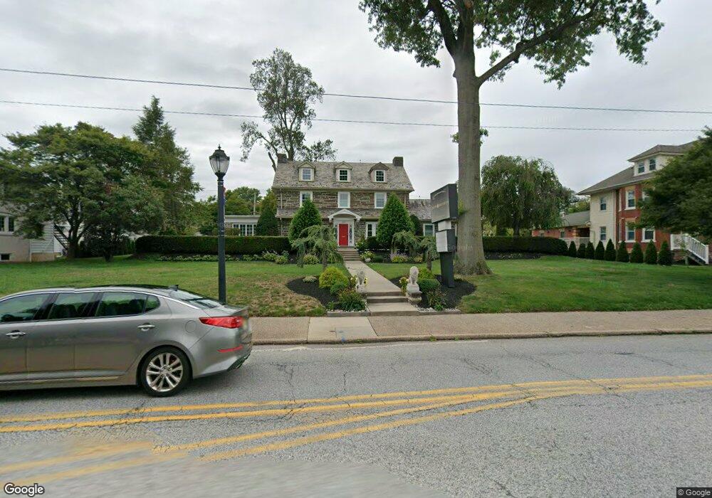
630 W Main St Lansdale, PA 19446
Estimated Value: $738,842
6
Beds
3
Baths
5,000
Sq Ft
$148/Sq Ft
Est. Value
About This Home
This home is located at 630 W Main St, Lansdale, PA 19446 and is currently estimated at $738,842, approximately $147 per square foot. 630 W Main St is a home located in Montgomery County with nearby schools including York Avenue Elementary School, Penndale Middle School, and North Penn Senior High School.
Ownership History
Date
Name
Owned For
Owner Type
Purchase Details
Closed on
Jun 30, 2021
Sold by
Niche Investments Limited
Bought by
Messina Rosario and Messina Rosario
Current Estimated Value
Purchase Details
Closed on
Oct 28, 2008
Sold by
Slotter Johnathan and Slotter Wayne S
Bought by
Niche Invest Ltd
Home Financials for this Owner
Home Financials are based on the most recent Mortgage that was taken out on this home.
Original Mortgage
$548,000
Interest Rate
6.13%
Mortgage Type
Commercial
Create a Home Valuation Report for This Property
The Home Valuation Report is an in-depth analysis detailing your home's value as well as a comparison with similar homes in the area
Home Values in the Area
Average Home Value in this Area
Purchase History
| Date | Buyer | Sale Price | Title Company |
|---|---|---|---|
| Messina Rosario | $575,000 | None Available | |
| Niche Invest Ltd | $560,000 | None Available |
Source: Public Records
Mortgage History
| Date | Status | Borrower | Loan Amount |
|---|---|---|---|
| Previous Owner | Niche Invest Ltd | $548,000 |
Source: Public Records
Tax History Compared to Growth
Tax History
| Year | Tax Paid | Tax Assessment Tax Assessment Total Assessment is a certain percentage of the fair market value that is determined by local assessors to be the total taxable value of land and additions on the property. | Land | Improvement |
|---|---|---|---|---|
| 2025 | $13,229 | $314,470 | $107,450 | $207,020 |
| 2024 | $13,229 | $314,470 | $107,450 | $207,020 |
| 2023 | $12,373 | $314,470 | $107,450 | $207,020 |
| 2022 | $11,981 | $314,470 | $107,450 | $207,020 |
| 2021 | $11,493 | $314,470 | $107,450 | $207,020 |
| 2020 | $11,146 | $314,470 | $107,450 | $207,020 |
| 2019 | $10,962 | $314,470 | $107,450 | $207,020 |
| 2018 | $2,941 | $314,470 | $107,450 | $207,020 |
| 2017 | $10,232 | $314,470 | $107,450 | $207,020 |
| 2016 | $10,110 | $314,470 | $107,450 | $207,020 |
| 2015 | $9,382 | $314,470 | $107,450 | $207,020 |
| 2014 | $9,382 | $314,470 | $107,450 | $207,020 |
Source: Public Records
Map
Nearby Homes
- 405 Derstine Ave
- 831 W Main St
- 21 S Valley Forge Rd Unit 213
- 920 Columbia Ave
- 108 Allison Ct Unit 8
- 204 N Valley Forge Rd Unit 7B
- 833 W 4th St
- 13 W End Dr
- 1061 York Ave
- 128 S Broad St
- 129 W Fifth St
- 1028 Poplar St Unit 75
- 532 Green St
- 534 Green St
- 302 W 8th St Unit 21
- 1035 Forest Ave
- 340 Central Dr
- 39 E 5th St
- 816 Kenilworth Ave
- 100 Penn St
- 628 W Main St
- 619 Derstine Ave
- 621 Derstine Ave
- 617 Derstine Ave
- 700 W Main St
- 623 Derstine Ave
- 615 Derstine Ave
- 613 Derstine Ave
- 627 Derstine Ave
- 611 Derstine Ave
- 609 W Main St
- 615 W Main St
- 609 Derstine Ave
- 702 W Main St
- 613 W Main St
- 607 Derstine Ave
- 611 W Main St
- 5 N Cannon Ave Unit 201
- 5 N Cannon Ave
- 605 Derstine Ave