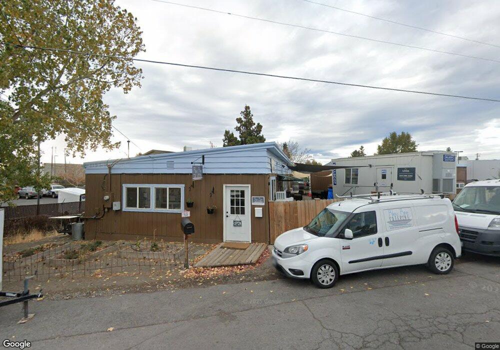
63060 Nels Anderson Rd Bend, OR 97703
Boyd Acres NeighborhoodEstimated Value: $594,900
--
Bed
--
Bath
1,655
Sq Ft
$359/Sq Ft
Est. Value
About This Home
This home is located at 63060 Nels Anderson Rd, Bend, OR 97703 and is currently estimated at $594,900, approximately $359 per square foot. 63060 Nels Anderson Rd is a home located in Deschutes County with nearby schools including North Star Elementary School, Sky View Middle School, and Mountain View Senior High School.
Ownership History
Date
Name
Owned For
Owner Type
Purchase Details
Closed on
Mar 30, 2021
Sold by
Crown Equity Inc
Bought by
Wkh Properties Llc
Current Estimated Value
Home Financials for this Owner
Home Financials are based on the most recent Mortgage that was taken out on this home.
Original Mortgage
$360,000
Outstanding Balance
$311,355
Interest Rate
2.8%
Mortgage Type
Purchase Money Mortgage
Estimated Equity
$283,545
Purchase Details
Closed on
Dec 5, 2019
Sold by
Cheatham Cerstin
Bought by
Crown Equity Inc
Purchase Details
Closed on
Jul 2, 2009
Sold by
Boone Daniel C and Boone Corinna C
Bought by
Cheatham Cerstin
Create a Home Valuation Report for This Property
The Home Valuation Report is an in-depth analysis detailing your home's value as well as a comparison with similar homes in the area
Home Values in the Area
Average Home Value in this Area
Purchase History
| Date | Buyer | Sale Price | Title Company |
|---|---|---|---|
| Wkh Properties Llc | $440,000 | Western Title | |
| Crown Equity Inc | -- | First American Title | |
| Cheatham Cerstin | $225,000 | None Available | |
| Cheatham Cerstin | $225,000 | Amerititle |
Source: Public Records
Mortgage History
| Date | Status | Borrower | Loan Amount |
|---|---|---|---|
| Open | Wkh Properties Llc | $360,000 |
Source: Public Records
Tax History Compared to Growth
Tax History
| Year | Tax Paid | Tax Assessment Tax Assessment Total Assessment is a certain percentage of the fair market value that is determined by local assessors to be the total taxable value of land and additions on the property. | Land | Improvement |
|---|---|---|---|---|
| 2025 | $2,564 | $151,770 | -- | -- |
| 2024 | $2,467 | $147,350 | -- | -- |
| 2023 | $2,287 | $143,060 | $0 | $0 |
| 2022 | $2,134 | $134,860 | $0 | $0 |
| 2021 | $2,137 | $130,940 | $0 | $0 |
| 2020 | $2,028 | $130,940 | $0 | $0 |
| 2019 | $1,971 | $127,130 | $0 | $0 |
| 2018 | $1,916 | $123,430 | $0 | $0 |
| 2017 | $1,860 | $119,840 | $0 | $0 |
| 2016 | $1,773 | $116,350 | $0 | $0 |
| 2015 | $1,724 | $112,970 | $0 | $0 |
| 2014 | $1,674 | $109,680 | $0 | $0 |
Source: Public Records
Map
Nearby Homes
- 3650 N Hwy 97
- 20269 Schaeffer Dr
- 20514 NE Empire Ave
- 63117 De Haviland Ct
- 20528 NE Empire Ave
- 20530 NE Empire Ave
- 63131 NE De Haviland St
- 63143 Beaufort Ct
- 20532 NE Empire Ave
- 3192 NW Golf View Dr
- 20560 Boyd Ct
- 20577 NE Sierra Dr
- 3178 NW Clubhouse Dr
- 3269 NW Fairway Heights Dr
- 3299 NW Fairway Heights Dr
- 20585 Fred Meyers Rd
- 20298 Poe Sholes Dr
- 20570 Fred Meyers Rd
- 3035 NW Golf View Dr
- 63341 NW Lavacrest St
- 3600 N Highway 97
- 1120 N Highway 97
- 1180 N Highway 97
- 3650 N Highway 97
- 3650 N Highway 97 Unit 2
- 3650 N Highway 97 Unit 1
- 63065 Sherman Rd
- 63040 N Highway 97
- 9020 N Highway 97
- 63089 Sherman Rd
- 3520 N Highway 97
- 3520 N Highway 97
- 63033 Sherman Rd
- 63032 Sherman Rd
- 20365 Empire Ave
- 9415 N Highway 97
- 63017 Sherman Rd
- 63008 Sherman Rd
- 29955 Highway 20
- 29201 Highway 20