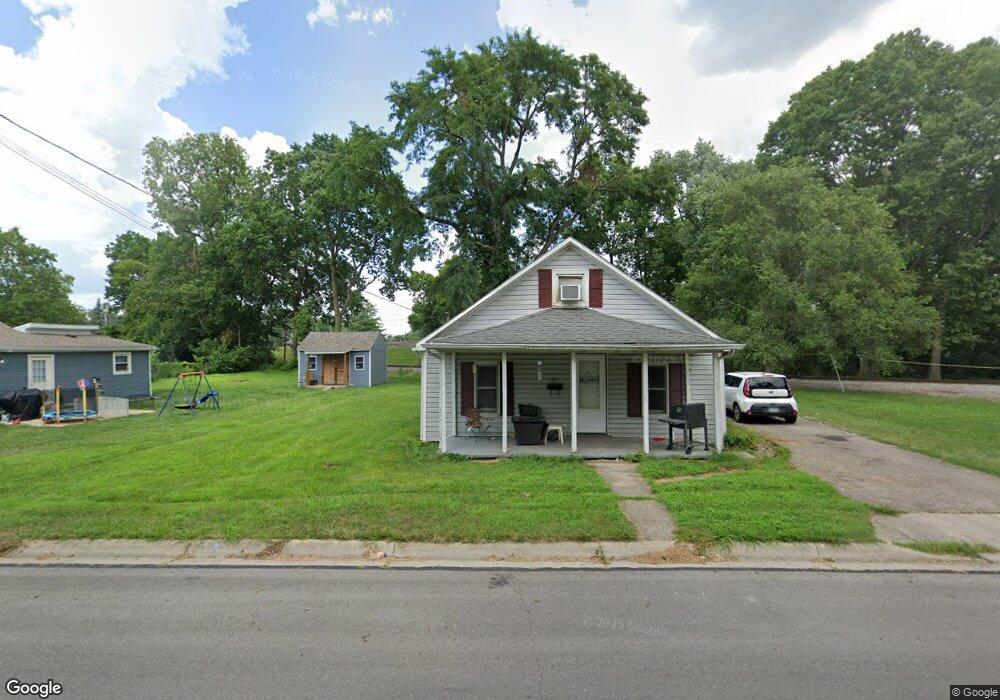
631 Forest Ave Franklin, OH 45005
Estimated Value: $121,025 - $193,000
4
Beds
1
Bath
1,602
Sq Ft
$96/Sq Ft
Est. Value
About This Home
This home is located at 631 Forest Ave, Franklin, OH 45005 and is currently estimated at $153,006, approximately $95 per square foot. 631 Forest Ave is a home located in Warren County with nearby schools including Franklin High School.
Ownership History
Date
Name
Owned For
Owner Type
Purchase Details
Closed on
Aug 4, 2025
Sold by
Lewis Freda R and Bruggeman Freda R
Bought by
Bruggeman Freda R and Bruggeman James
Current Estimated Value
Purchase Details
Closed on
Sep 4, 2009
Sold by
Crowe Timothy E and Crowe Melody K
Bought by
Hensley Henry L and Hensley Rachel M
Purchase Details
Closed on
Feb 26, 2007
Sold by
National City Bank
Bought by
Crowe Timothy E and Crowe Melody K
Purchase Details
Closed on
Jan 23, 2007
Sold by
Williams Marianna C and Case #06Cv65759
Bought by
National City Bank
Purchase Details
Closed on
Jul 15, 1993
Sold by
Devotie Richard A and Devotie Pam
Bought by
Devotie and Devotie Richard A
Purchase Details
Closed on
Mar 4, 1982
Sold by
Mcquinn Mcquinn and Mcquinn Wm H
Create a Home Valuation Report for This Property
The Home Valuation Report is an in-depth analysis detailing your home's value as well as a comparison with similar homes in the area
Home Values in the Area
Average Home Value in this Area
Purchase History
| Date | Buyer | Sale Price | Title Company |
|---|---|---|---|
| Bruggeman Freda R | -- | None Listed On Document | |
| Hensley Henry L | $55,000 | Attorney | |
| Crowe Timothy E | $19,733 | Freedom Title Co | |
| National City Bank | $50,000 | None Available | |
| Devotie | $27,500 | -- | |
| -- | $7,000 | -- |
Source: Public Records
Tax History
| Year | Tax Paid | Tax Assessment Tax Assessment Total Assessment is a certain percentage of the fair market value that is determined by local assessors to be the total taxable value of land and additions on the property. | Land | Improvement |
|---|---|---|---|---|
| 2025 | $1,525 | $31,110 | $3,570 | $27,540 |
| 2024 | $1,525 | $31,110 | $3,570 | $27,540 |
| 2023 | $1,355 | $24,542 | $3,447 | $21,094 |
| 2022 | $1,304 | $24,542 | $3,448 | $21,095 |
| 2021 | $1,237 | $24,542 | $3,448 | $21,095 |
| 2020 | $1,188 | $20,797 | $2,923 | $17,875 |
| 2019 | $1,084 | $20,797 | $2,923 | $17,875 |
| 2018 | $1,056 | $20,797 | $2,923 | $17,875 |
| 2017 | $1,170 | $20,510 | $2,933 | $17,577 |
| 2016 | $1,192 | $20,510 | $2,933 | $17,577 |
| 2015 | $1,192 | $20,510 | $2,933 | $17,577 |
| 2014 | $1,223 | $20,510 | $2,930 | $17,580 |
| 2013 | $1,030 | $22,720 | $3,250 | $19,470 |
Source: Public Records
Map
Nearby Homes
- 639 Forest Ave
- 647 Forest Ave
- 245 Chestnut St
- 602 Park Ave
- 239 Cedar St
- 233 Cedar St
- 227 Cedar St
- 600 Park Ave
- 702 Forest Ave
- 707 Forest Ave
- 3031 Sleeping Bear Ct
- 3085 Kit Fox Way
- 3125 Kit Fox Way
- 3097 Kit Fox Way
- 3023 Canvasback Ct
- 3110 Kit Fox Way
- 3122 Kit Fox Way
- 3073 Kit Fox Way
- 3079 Kit Fox Way
- 3134 Kit Fox Way
Your Personal Tour Guide
Ask me questions while you tour the home.