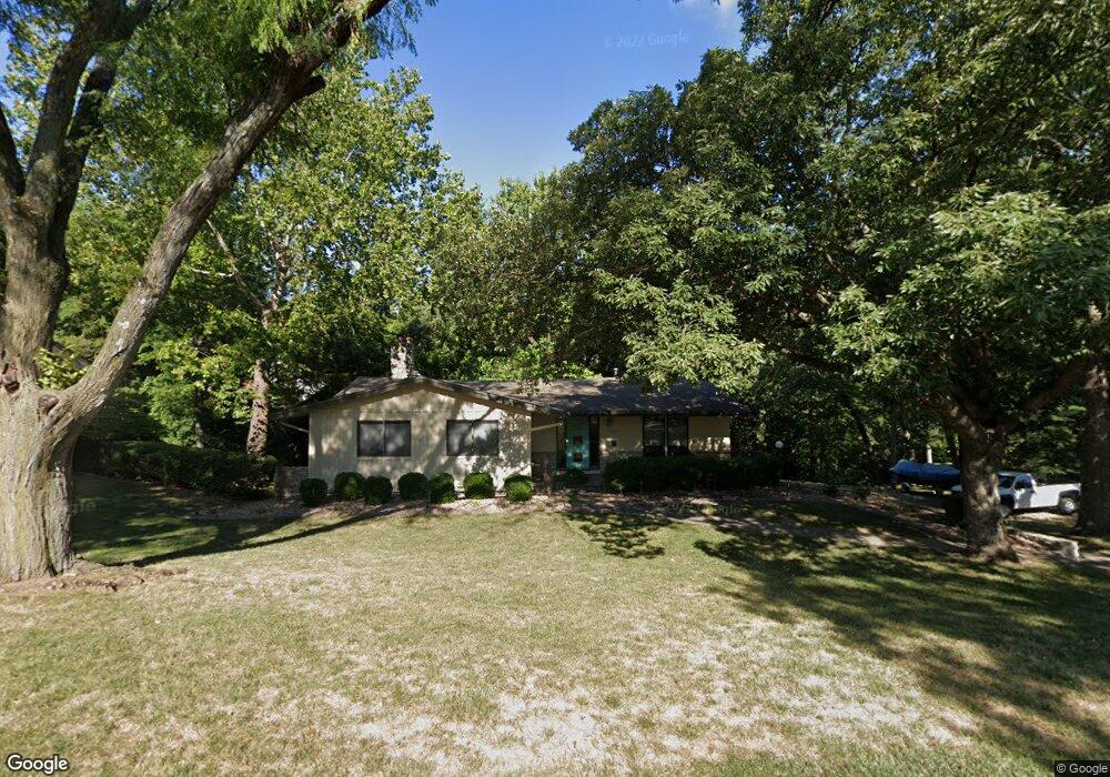
6313 Robinhood Ln Shawnee, KS 66203
Estimated Value: $384,000 - $406,000
3
Beds
3
Baths
1,592
Sq Ft
$249/Sq Ft
Est. Value
About This Home
This home is located at 6313 Robinhood Ln, Shawnee, KS 66203 and is currently estimated at $396,228, approximately $248 per square foot. 6313 Robinhood Ln is a home located in Johnson County with nearby schools including Merriam Park Elementary School, Hocker Grove Middle School, and Shawnee Mission North High School.
Ownership History
Date
Name
Owned For
Owner Type
Purchase Details
Closed on
Nov 5, 2009
Sold by
Jb Construction Co Llc
Bought by
Lammers Phillip R and Lammers Sarah L
Current Estimated Value
Home Financials for this Owner
Home Financials are based on the most recent Mortgage that was taken out on this home.
Original Mortgage
$157,000
Outstanding Balance
$101,573
Interest Rate
4.9%
Mortgage Type
New Conventional
Estimated Equity
$294,655
Purchase Details
Closed on
Apr 30, 2004
Sold by
Pottratz Marvin M
Bought by
Pottratz Marvin M and Marvin M Pottratz Trust
Create a Home Valuation Report for This Property
The Home Valuation Report is an in-depth analysis detailing your home's value as well as a comparison with similar homes in the area
Home Values in the Area
Average Home Value in this Area
Purchase History
| Date | Buyer | Sale Price | Title Company |
|---|---|---|---|
| Lammers Phillip R | -- | Kansas City Title | |
| Pottratz Marvin M | -- | -- |
Source: Public Records
Mortgage History
| Date | Status | Borrower | Loan Amount |
|---|---|---|---|
| Open | Lammers Phillip R | $157,000 |
Source: Public Records
Tax History Compared to Growth
Tax History
| Year | Tax Paid | Tax Assessment Tax Assessment Total Assessment is a certain percentage of the fair market value that is determined by local assessors to be the total taxable value of land and additions on the property. | Land | Improvement |
|---|---|---|---|---|
| 2024 | $4,535 | $41,607 | $7,871 | $33,736 |
| 2023 | $4,135 | $38,755 | $7,871 | $30,884 |
| 2022 | $4,028 | $36,340 | $7,160 | $29,180 |
| 2021 | $4,028 | $35,121 | $6,213 | $28,908 |
| 2020 | $3,782 | $32,395 | $6,213 | $26,182 |
| 2019 | $3,869 | $33,108 | $5,406 | $27,702 |
| 2018 | $4,034 | $34,351 | $4,922 | $29,429 |
| 2017 | $3,658 | $30,567 | $4,922 | $25,645 |
| 2016 | $3,456 | $28,693 | $4,922 | $23,771 |
| 2015 | $3,277 | $27,393 | $4,922 | $22,471 |
| 2013 | -- | $25,093 | $4,922 | $20,171 |
Source: Public Records
Map
Nearby Homes
- 10120 W 65th St
- 6420 Ballentine St
- 10924 W 67th St
- 10103 Johnson Dr
- 5933 Knox Ave
- 10235 W 70th St
- 10024 W 70th Terrace
- 9906 Edelweiss Cir
- 6901 Grandview St
- 11217 W 69th Terrace
- 10406 W 71st Place
- 10914 W 71st St
- 10152 Edelweiss Cir
- Ashwood Plan at Bristol Highlands - North
- The Fleetwood Plan at Bristol Highlands - The Villas
- Cypress II Plan at Bristol Highlands - North
- The Fleetwood Plan at Bristol Highlands - The Manors
- The Brentwood Plan at Bristol Highlands - The Villas
- Yorkshire V Plan at Bristol Highlands - North
- The Kirkwood Plan at Bristol Highlands - The Villas
- 6313 Robin Hood Dr
- 6309 Robinhood Dr
- 6315 Robinhood Ln
- 6309 Robin Hood Dr
- 6315 Robin Hood Dr
- 6309 Robinhood Ln
- 6315 Sherwood Ln
- 6310 Robinhood Ln
- 6310 Robin Hood Dr
- 6309 Sherwood Ln
- 6307 Robin Hood Dr
- 6307 Robinhood Dr
- 6311 Sherwood Ln
- 6317 Robinhood Ln
- 6306 Robinhood Ln
- 6321 Sherwood Ln
- 6305 Sherwood Ln
- 6305 Robinhood Dr
- 6305 Robinhood Ln
- 6310 Sherwood Ln