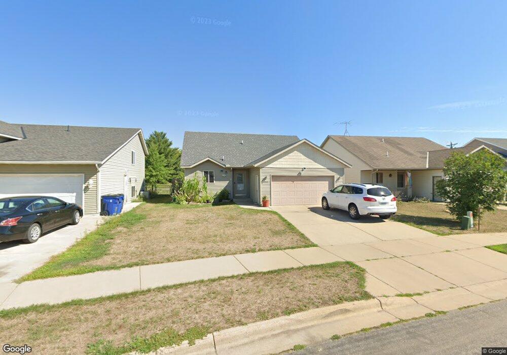
6319 Cape Ct W Saint Cloud, MN 56303
Westwood Parkway NeighborhoodEstimated Value: $262,362 - $290,000
3
Beds
2
Baths
1,008
Sq Ft
$276/Sq Ft
Est. Value
About This Home
This home is located at 6319 Cape Ct W, Saint Cloud, MN 56303 and is currently estimated at $278,591, approximately $276 per square foot. 6319 Cape Ct W is a home located in Stearns County with nearby schools including Westwood Elementary School, North Junior High School, and Apollo Senior High School.
Ownership History
Date
Name
Owned For
Owner Type
Purchase Details
Closed on
Jul 30, 2019
Sold by
Ruhland Steven A
Bought by
Lopez-Ramirez Edwin
Current Estimated Value
Purchase Details
Closed on
May 13, 2016
Sold by
Loehrer Spencor Spencor
Bought by
Ruhland Steven Steven
Home Financials for this Owner
Home Financials are based on the most recent Mortgage that was taken out on this home.
Original Mortgage
$146,500
Interest Rate
3.57%
Create a Home Valuation Report for This Property
The Home Valuation Report is an in-depth analysis detailing your home's value as well as a comparison with similar homes in the area
Home Values in the Area
Average Home Value in this Area
Purchase History
| Date | Buyer | Sale Price | Title Company |
|---|---|---|---|
| Lopez-Ramirez Edwin | $194,400 | -- | |
| Ruhland Steven Steven | $147,500 | -- |
Source: Public Records
Mortgage History
| Date | Status | Borrower | Loan Amount |
|---|---|---|---|
| Previous Owner | Ruhland Steven Steven | $146,500 |
Source: Public Records
Tax History
| Year | Tax Paid | Tax Assessment Tax Assessment Total Assessment is a certain percentage of the fair market value that is determined by local assessors to be the total taxable value of land and additions on the property. | Land | Improvement |
|---|---|---|---|---|
| 2025 | $2,950 | $241,900 | $60,000 | $181,900 |
| 2024 | $2,950 | $241,900 | $60,000 | $181,900 |
| 2023 | $4,590 | $241,900 | $35,000 | $206,900 |
| 2022 | $2,296 | $177,700 | $35,000 | $142,700 |
| 2021 | $2,168 | $177,700 | $35,000 | $142,700 |
| 2020 | $2,120 | $169,600 | $35,000 | $134,600 |
| 2019 | $1,978 | $162,000 | $35,000 | $127,000 |
| 2018 | $1,830 | $140,900 | $35,000 | $105,900 |
| 2017 | $1,824 | $133,900 | $35,000 | $98,900 |
| 2016 | $1,684 | $0 | $0 | $0 |
| 2015 | $1,648 | $0 | $0 | $0 |
| 2014 | -- | $0 | $0 | $0 |
Source: Public Records
Map
Nearby Homes
- 6346 Cape West Ct
- 6201 Cape East Ct
- 6545 Westwood Pkwy
- 6204 Laurel Rd
- 939 Cypress Rd Unit 4
- 939 Cypress Rd Unit 42
- 939 Cypress Rd Unit 25
- 6536 Kenwood Rd
- 1773 Wildwood Rd
- 1766 Cottonwood Cir
- 1161 Yellowstone Ave
- 34 Glenview Loop
- 611 Brookwood Ln
- 1924 Pleasant Ave
- 144 Glenview Loop
- 5815 Rivers Edge Dr
- 1804 Amblewood Dr
- 6825 Haven Ct
- 6010 Prairie Rose Dr
- 6827 22nd St N
- 6319 Cape West Ct
- 6315 Cape Ct W
- 6323 Cape Ct W
- 6315 Cape West Ct
- 6323 Cape West Ct
- 6311 Cape West Ct
- 6327 Cape West Ct
- 6318 Cape West Ct
- 6331 Cape West Ct
- 6331 Cape Ct W
- 6307 Cape Ct W
- 6318 Cape Ct W
- 6322 Cape West Ct
- 6307 Cape West Ct
- 6314 Cape West Ct
- 6310 Cape West Ct
- 6322 Cape Ct W
- 6335 Cape Ct W
- 6303 Cape West Ct
- 6303 Cape Ct W
Your Personal Tour Guide
Ask me questions while you tour the home.