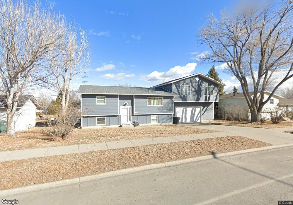
633 Aronson Ave Billings, MT 59105
Billings Heights NeighborhoodEstimated Value: $382,000 - $444,000
4
Beds
2
Baths
2,042
Sq Ft
$202/Sq Ft
Est. Value
About This Home
This home is located at 633 Aronson Ave, Billings, MT 59105 and is currently estimated at $413,331, approximately $202 per square foot. 633 Aronson Ave is a home located in Yellowstone County with nearby schools including Alkali Creek School, Castle Rock Junior High School, and Skyview High School.
Ownership History
Date
Name
Owned For
Owner Type
Purchase Details
Closed on
May 27, 2021
Sold by
Bradley Adam S
Bought by
Bradley Adam S and Faraday Beverly
Current Estimated Value
Home Financials for this Owner
Home Financials are based on the most recent Mortgage that was taken out on this home.
Original Mortgage
$123,000
Outstanding Balance
$102,469
Interest Rate
2.9%
Mortgage Type
New Conventional
Estimated Equity
$310,862
Purchase Details
Closed on
Dec 16, 2009
Sold by
Ellwein Timothy J and Ellwein Sunetta D
Bought by
Bradley Adam S and Bradley Nicole A
Home Financials for this Owner
Home Financials are based on the most recent Mortgage that was taken out on this home.
Original Mortgage
$151,920
Interest Rate
4.91%
Mortgage Type
New Conventional
Create a Home Valuation Report for This Property
The Home Valuation Report is an in-depth analysis detailing your home's value as well as a comparison with similar homes in the area
Home Values in the Area
Average Home Value in this Area
Purchase History
| Date | Buyer | Sale Price | Title Company |
|---|---|---|---|
| Bradley Adam S | -- | Stewart Title Company | |
| Bradley Adam S | -- | Stewart Title Company | |
| Bradley Adam S | -- | None Available |
Source: Public Records
Mortgage History
| Date | Status | Borrower | Loan Amount |
|---|---|---|---|
| Open | Bradley Adam S | $123,000 | |
| Closed | Bradley Adam S | $151,920 |
Source: Public Records
Tax History Compared to Growth
Tax History
| Year | Tax Paid | Tax Assessment Tax Assessment Total Assessment is a certain percentage of the fair market value that is determined by local assessors to be the total taxable value of land and additions on the property. | Land | Improvement |
|---|---|---|---|---|
| 2025 | $3,877 | $415,600 | $82,257 | $333,343 |
| 2024 | $3,877 | $362,300 | $66,808 | $295,492 |
| 2023 | $3,919 | $362,300 | $66,808 | $295,492 |
| 2022 | $3,489 | $281,200 | $72,802 | $208,398 |
| 2021 | $3,272 | $281,200 | $0 | $0 |
| 2020 | $3,404 | $282,400 | $0 | $0 |
| 2019 | $3,262 | $282,400 | $0 | $0 |
| 2018 | $3,035 | $255,300 | $0 | $0 |
| 2017 | $2,363 | $255,300 | $0 | $0 |
| 2016 | $2,689 | $232,700 | $0 | $0 |
| 2015 | $2,632 | $232,700 | $0 | $0 |
| 2014 | $2,324 | $106,848 | $0 | $0 |
Source: Public Records
Map
Nearby Homes
- 325 Sahara Dr
- 361 Tabriz Dr
- 153 W Hilltop Rd
- TBD Antelope Place
- 844 Governors Blvd
- 521 Indian Trail
- NKN Antelope
- 324 Stewart Ct N
- 961 Governors Blvd
- 2011 Gleneagles Blvd
- 2059 Gleneagles Blvd
- 2027 Gleneagles Blvd
- 2019 Gleneagles Blvd
- 2067 Gleneagles Blvd
- Lot C Alkali Creek Rd
- 1017 Toole Cir
- 307 Moccasin Trail
- 651 Tumbleweed Dr
- 540 Pinon Dr
- 663 Valle Vista Ave
- 629 Aronson Ave
- 643 Aronson Ave
- 630 Aronson Ave
- 624 Aronson Ave
- 615 Aronson Ave
- 277 Sphinx Place
- 657 Aronson Ave
- 644 Aronson Ave
- 260 Sahara Dr
- 266 Sahara Dr
- 618 Aronson Ave
- 267 Sphinx Place
- 274 Sphinx Place
- 272 Sahara Dr
- 665 Aronson Ave
- 597 Sudan Place
- 252 Sahara Dr
- 609 Aronson Ave
- 654 Aronson Ave
- 596 Sudan Place