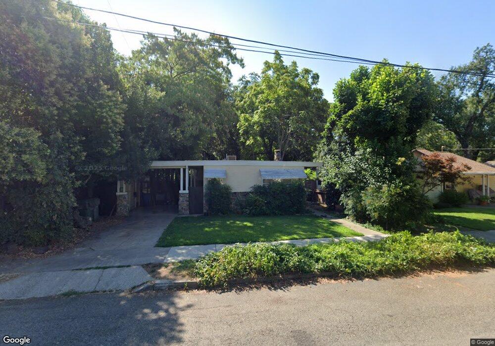
633 State St Redding, CA 96001
Parkview NeighborhoodEstimated Value: $182,000 - $251,404
2
Beds
1
Bath
1,100
Sq Ft
$195/Sq Ft
Est. Value
About This Home
This home is located at 633 State St, Redding, CA 96001 and is currently estimated at $214,351, approximately $194 per square foot. 633 State St is a home located in Shasta County with nearby schools including Juniper, Sequoia Middle School, and Shasta High School.
Ownership History
Date
Name
Owned For
Owner Type
Purchase Details
Closed on
Mar 11, 2008
Sold by
Rhodes Myrtle Loeta
Bought by
Rhodes Myrtle Loeta and Rhodes Bryan W
Current Estimated Value
Purchase Details
Closed on
May 28, 2004
Sold by
Spicer Donald W and Spicer Mona L
Bought by
Freimann Adele F and The Adele F Freimann Revocable Trust Of
Home Financials for this Owner
Home Financials are based on the most recent Mortgage that was taken out on this home.
Original Mortgage
$105,000
Outstanding Balance
$50,680
Interest Rate
5.92%
Mortgage Type
Seller Take Back
Estimated Equity
$163,671
Purchase Details
Closed on
May 20, 2004
Sold by
Freimann Adele F
Bought by
Rhodes Myrtle Loeta
Home Financials for this Owner
Home Financials are based on the most recent Mortgage that was taken out on this home.
Original Mortgage
$105,000
Outstanding Balance
$50,680
Interest Rate
5.92%
Mortgage Type
Seller Take Back
Estimated Equity
$163,671
Purchase Details
Closed on
Jun 26, 2003
Sold by
Freimann Adele F
Bought by
Freimann Adele F and The Adele F Freimann Revocable Tr 2003
Create a Home Valuation Report for This Property
The Home Valuation Report is an in-depth analysis detailing your home's value as well as a comparison with similar homes in the area
Home Values in the Area
Average Home Value in this Area
Purchase History
| Date | Buyer | Sale Price | Title Company |
|---|---|---|---|
| Rhodes Myrtle Loeta | -- | None Available | |
| Freimann Adele F | -- | Chicago Title Co | |
| Rhodes Myrtle Loeta | $110,000 | Chicago Title Co | |
| Freimann Adele F | -- | -- |
Source: Public Records
Mortgage History
| Date | Status | Borrower | Loan Amount |
|---|---|---|---|
| Open | Rhodes Myrtle Loeta | $105,000 |
Source: Public Records
Tax History
| Year | Tax Paid | Tax Assessment Tax Assessment Total Assessment is a certain percentage of the fair market value that is determined by local assessors to be the total taxable value of land and additions on the property. | Land | Improvement |
|---|---|---|---|---|
| 2025 | $1,495 | $142,224 | $45,510 | $96,714 |
| 2024 | $1,472 | $139,436 | $44,618 | $94,818 |
| 2023 | $1,472 | $136,703 | $43,744 | $92,959 |
| 2022 | $1,447 | $134,024 | $42,887 | $91,137 |
| 2021 | $1,439 | $131,397 | $42,047 | $89,350 |
| 2020 | $1,458 | $130,050 | $41,616 | $88,434 |
| 2019 | $1,385 | $127,500 | $40,800 | $86,700 |
| 2018 | $1,397 | $125,000 | $40,000 | $85,000 |
| 2017 | $1,446 | $134,746 | $36,747 | $97,999 |
| 2016 | $1,322 | $125,000 | $40,000 | $85,000 |
| 2015 | $1,270 | $120,000 | $40,000 | $80,000 |
| 2014 | $1,297 | $121,000 | $40,000 | $81,000 |
Source: Public Records
Map
Nearby Homes
- 745 Parkview Ave
- 864 Kite Ln
- 1012 State St
- 351 Weldon St
- 2514 California St
- 2590 Henderson Rd
- 2405 Cliff Dr
- 815 Locust St
- 3244 Veda St
- 2239 Garden Ave
- 350 Park Marina Cir
- 3443 West St
- 1005 Gold St
- 2123 Waldon St
- 2056 Canal Dr
- 2845 River Mist Walk
- 649 Lowe St
- 2857 River Mist Walk
- 2865 River Mist Walk
- 2630 Wyndham Ln
Your Personal Tour Guide
Ask me questions while you tour the home.