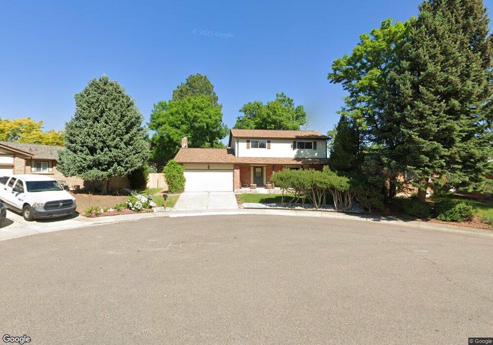
6331 S Jellison St Littleton, CO 80123
Kipling Hills NeighborhoodEstimated Value: $583,000 - $637,000
4
Beds
5
Baths
1,941
Sq Ft
$317/Sq Ft
Est. Value
About This Home
This home is located at 6331 S Jellison St, Littleton, CO 80123 and is currently estimated at $615,148, approximately $316 per square foot. 6331 S Jellison St is a home located in Jefferson County with nearby schools including Powderhorn Elementary School, Summit Ridge Middle School, and Dakota Ridge Senior High School.
Ownership History
Date
Name
Owned For
Owner Type
Purchase Details
Closed on
Dec 2, 2024
Sold by
Bailey Charlene M and Ruybal Charlene M
Bought by
Cmarie Living Trust
Current Estimated Value
Purchase Details
Closed on
Dec 8, 1997
Sold by
Ruybal Dean A
Bought by
Ruybal Charlene M
Create a Home Valuation Report for This Property
The Home Valuation Report is an in-depth analysis detailing your home's value as well as a comparison with similar homes in the area
Home Values in the Area
Average Home Value in this Area
Purchase History
| Date | Buyer | Sale Price | Title Company |
|---|---|---|---|
| Cmarie Living Trust | -- | None Listed On Document | |
| Cmarie Living Trust | -- | None Listed On Document | |
| Ruybal Charlene M | -- | -- |
Source: Public Records
Tax History Compared to Growth
Tax History
| Year | Tax Paid | Tax Assessment Tax Assessment Total Assessment is a certain percentage of the fair market value that is determined by local assessors to be the total taxable value of land and additions on the property. | Land | Improvement |
|---|---|---|---|---|
| 2024 | $3,993 | $37,550 | $11,792 | $25,758 |
| 2023 | $3,993 | $37,550 | $11,792 | $25,758 |
| 2022 | $3,731 | $34,493 | $9,568 | $24,925 |
| 2021 | $3,783 | $35,485 | $9,843 | $25,642 |
| 2020 | $3,384 | $31,639 | $7,838 | $23,801 |
| 2019 | $3,340 | $31,639 | $7,838 | $23,801 |
| 2018 | $3,016 | $27,506 | $7,324 | $20,182 |
| 2017 | $2,776 | $27,506 | $7,324 | $20,182 |
| 2016 | $2,375 | $22,582 | $6,328 | $16,254 |
| 2015 | $2,135 | $22,582 | $6,328 | $16,254 |
| 2014 | $2,135 | $18,878 | $5,672 | $13,206 |
Source: Public Records
Map
Nearby Homes
- 9934 W Caley Ave
- 6327 S Johnson St
- 10115 W Arbor Place
- 6316 S Kline St
- 6436 S Kline St
- 10064 W Lake Dr
- 6451 S Hoyt St
- 0 S Miller St Unit 18 REC8546751
- 10279 W Walker Ave
- 5976 S Jellison St Unit E
- 9526 W Walker Place
- 10480 W Fair Ave Unit B
- 10500 W Fair Ave Unit B
- 10587 W Maplewood Dr Unit C
- 9603 W Euclid Dr
- 9505 W Coal Mine Ave Unit F
- 6306 S Miller Ct
- 9519 W Coal Mine Ave Unit F
- 6625 S Lee St
- 10258 W Coal Mine Place
- 6321 S Jellison St
- 6306 S Johnson St
- 6341 S Jellison St
- 6312 S Johnson St
- 6304 S Johnson St
- 6311 S Jellison St
- 9894 W Caley Ave
- 6340 S Jellison St
- 6320 S Jellison St
- 6316 S Johnson St
- 6330 S Jellison St
- 6310 S Jellison St
- 9871 W Polk Dr
- 9851 W Polk Dr
- 6315R S Johnson St
- 6313 S Johnson St
- 6307 S Johnson St
- 9831 W Polk Dr
- 6315 S Johnson St
- 6324 S Johnson St