
Seller's Agent in 2026
Traci Kunkel
Solid Rock REALTORS - Vinita
(918) 533-4899
93 Total Sales
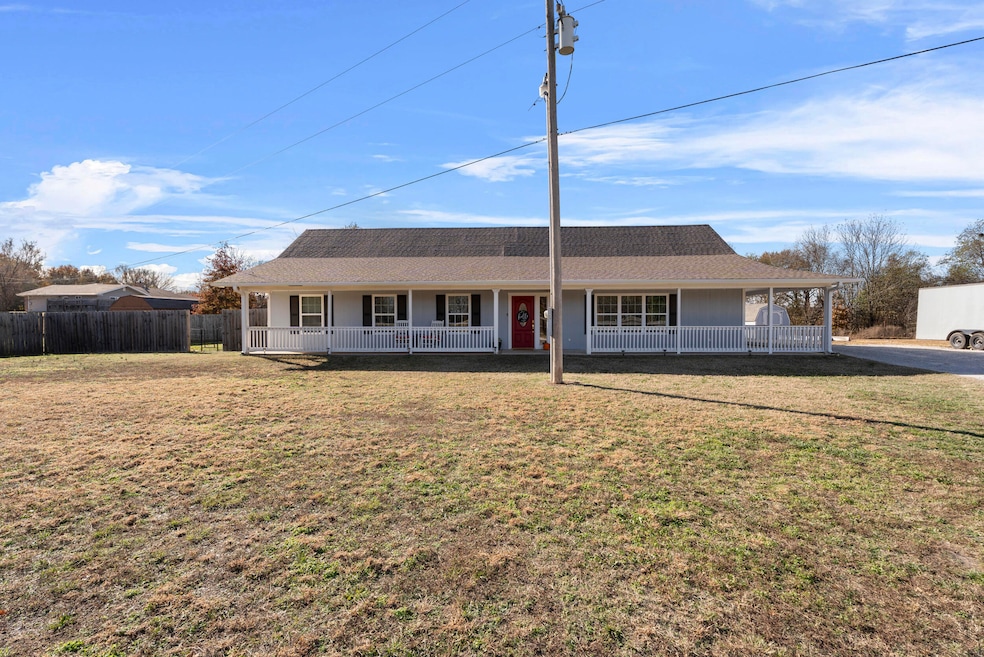
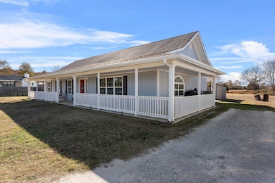
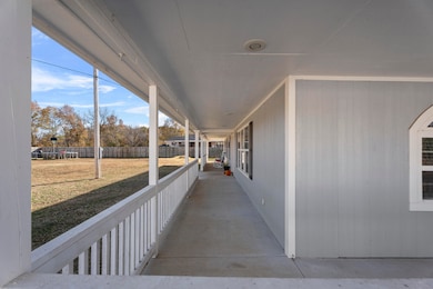
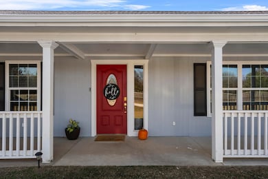
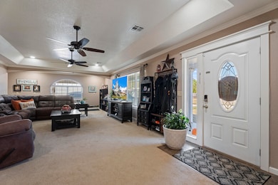
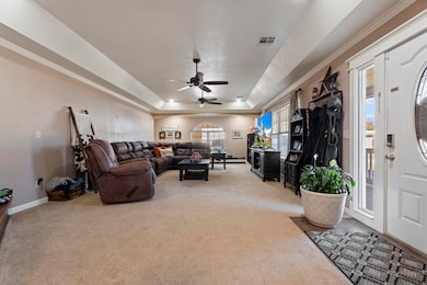
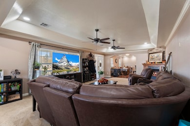
Welcome to this charming three-bedroom, two-bath country home set on 2.82 acres! A long driveway leads you to the home with a full-length front porch—perfect for relaxing and enjoying peaceful country views. Inside, you'll find a spacious family room ideal for large gatherings, a beautifully updated kitchen featuring granite countertops, and a newly added 100+ sq. ft. pantry with abundant storage. The property also includes a versatile shop/storage building, offering plenty of room for projects or extra parking. This inviting home blends comfort, functionality, and country charm—ready for your family to enjoy!
Last Agent to Sell the Property
Solid Rock REALTORS - Vinita Brokerage Phone: 918-533-4899 License #152575 Listed on: 11/07/2025
| Date | Type | Sale Price | Title Company |
|---|---|---|---|
| Warranty Deed | $294,500 | Ottawa County Abstract & Title | |
| Warranty Deed | $215,000 | None Available | |
| Deed | -- | -- | |
| Warranty Deed | $6,500 | -- |
| Date | Status | Loan Amount | Loan Type |
|---|---|---|---|
| Open | $289,165 | FHA | |
| Previous Owner | $204,250 | New Conventional | |
| Previous Owner | $176,108 | No Value Available | |
| Previous Owner | -- | No Value Available |
| Date | Event | Price | List to Sale | Price per Sq Ft |
|---|---|---|---|---|
| 01/14/2026 01/14/26 | Sold | $294,500 | -1.7% | $155 / Sq Ft |
| 12/12/2025 12/12/25 | Pending | -- | -- | -- |
| 11/07/2025 11/07/25 | For Sale | $299,500 | -- | $158 / Sq Ft |
| Year | Tax Paid | Tax Assessment Tax Assessment Total Assessment is a certain percentage of the fair market value that is determined by local assessors to be the total taxable value of land and additions on the property. | Land | Improvement |
|---|---|---|---|---|
| 2025 | $2,266 | $24,510 | $4,332 | $20,178 |
| 2024 | $2,266 | $24,510 | $4,332 | $20,178 |
| 2023 | $2,266 | $24,510 | $4,332 | $20,178 |
| 2022 | $2,266 | $24,510 | $4,332 | $20,178 |
| 2021 | $1,076 | $11,385 | $1,752 | $9,633 |
| 2020 | $1,033 | $10,844 | $1,646 | $9,198 |
| 2019 | $766 | $10,327 | $1,630 | $8,697 |
| 2018 | $746 | $10,026 | $1,621 | $8,405 |
| 2017 | $734 | $9,734 | $1,612 | $8,122 |
| 2016 | $688 | $9,559 | $1,592 | $7,967 |
| 2015 | $49 | $580 | $580 | $0 |
| 2014 | $1,009 | $12,323 | $1,618 | $10,705 |
Seller's Agent in 2026
Traci Kunkel
Solid Rock REALTORS - Vinita
(918) 533-4899
93 Total Sales
K
Buyer's Agent in 2026
KaCheylah Kenney
Keller Williams Realty Grand Lake
(918) 540-4268
20 Total Sales
Source: Northeast Oklahoma Board of REALTORS®
MLS Number: 25-2397
APN: 0000-20-028-024-0-014-03
Disclaimer: Certain information contained herein is derived from information provided by parties other than Homes.com. All information provided is deemed reliable, but is not guaranteed to be accurate and should be independently verified.
![]() IDX information is provided exclusively for personal, non-commercial use, and may not be used for any purpose other than to identify prospective properties consumers may be interested in purchasing. Information is deemed reliable but not guaranteed.
IDX information is provided exclusively for personal, non-commercial use, and may not be used for any purpose other than to identify prospective properties consumers may be interested in purchasing. Information is deemed reliable but not guaranteed.
Ask me questions while you tour the home.