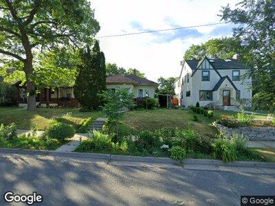
635 Cedar Lake Rd S Minneapolis, MN 55405
Bryn Mawr NeighborhoodEstimated Value: $399,000 - $453,000
3
Beds
3
Baths
1,230
Sq Ft
$343/Sq Ft
Est. Value
About This Home
This home is located at 635 Cedar Lake Rd S, Minneapolis, MN 55405 and is currently estimated at $422,358, approximately $343 per square foot. 635 Cedar Lake Rd S is a home located in Hennepin County with nearby schools including Bryn Mawr Elementary School, Anwatin Middle School, and North Community High School.
Ownership History
Date
Name
Owned For
Owner Type
Purchase Details
Closed on
May 27, 2022
Sold by
Broberg Richard M
Bought by
Aronsohn Diane L and Broberg Richard M
Current Estimated Value
Purchase Details
Closed on
May 6, 2021
Sold by
Aronsohn Diane L
Bought by
Broberg Richard M
Purchase Details
Closed on
Feb 18, 2004
Sold by
Aronsohn Claudia
Bought by
Aronsohn Diane
Create a Home Valuation Report for This Property
The Home Valuation Report is an in-depth analysis detailing your home's value as well as a comparison with similar homes in the area
Home Values in the Area
Average Home Value in this Area
Purchase History
| Date | Buyer | Sale Price | Title Company |
|---|---|---|---|
| Aronsohn Diane L | $882,352 | None Listed On Document | |
| Broberg Richard M | -- | None Available | |
| Aronsohn Diane | $215,000 | -- |
Source: Public Records
Mortgage History
| Date | Status | Borrower | Loan Amount |
|---|---|---|---|
| Previous Owner | Aronsohn Daniel L | $147,850 | |
| Previous Owner | Aronsohn Diane L | $183,000 | |
| Previous Owner | Aronsohn Diane L | $178,000 |
Source: Public Records
Tax History Compared to Growth
Tax History
| Year | Tax Paid | Tax Assessment Tax Assessment Total Assessment is a certain percentage of the fair market value that is determined by local assessors to be the total taxable value of land and additions on the property. | Land | Improvement |
|---|---|---|---|---|
| 2023 | $5,017 | $388,000 | $177,000 | $211,000 |
| 2022 | $4,745 | $380,000 | $158,000 | $222,000 |
| 2021 | $4,149 | $349,000 | $130,000 | $219,000 |
| 2020 | $4,394 | $319,000 | $123,000 | $196,000 |
| 2019 | $4,526 | $312,500 | $103,600 | $208,900 |
| 2018 | $4,216 | $312,500 | $103,600 | $208,900 |
| 2017 | $3,959 | $270,000 | $94,200 | $175,800 |
| 2016 | $3,758 | $250,700 | $94,200 | $156,500 |
| 2015 | $3,816 | $231,500 | $95,800 | $135,700 |
| 2014 | -- | $201,500 | $85,300 | $116,200 |
Source: Public Records
Map
Nearby Homes
- 720 Cedar Lake Rd S
- 428 Sheridan Ave S
- 437 Upton Ave S
- 1045 Thomas Ave S
- 601 Queen Ave S
- 1058 Cedar View Dr
- 2323 Laurel Ave
- 1112 Vincent Ave S
- 241 Queen Ave S
- 632 Morgan Ave S
- 1700 Kenwood Pkwy
- 1600 Kenwood Pkwy
- 8 Queen Ave S
- 1128 Kenwood Pkwy Unit 1
- 2110 Hawthorne Ave
- 1911 Laurel Ave
- 1448 Lakeview Ave S
- 1967 Sheridan Ave S
- 1984 Kenwood Pkwy
- 1824 Oliver Ave S
- 635 Cedar Lake Rd S
- 629 Cedar Lake Rd S
- 637 Cedar Lake Rd S
- 625 Cedar Lake Rd S
- 621 Thomas Ave S
- 621 Cedar Lake Rd S
- 2436 Mount View Ave
- 2432 Mount View Ave
- 617 Cedar Lake Rd S
- 628 Cedar Lake Rd S
- 2428 Mount View Ave
- 612 Thomas Ave S
- 613 Cedar Lake Rd S
- 624 Cedar Lake Rd S
- 704 Cedar Lake Rd S
- 2424 Mount View Ave
- 620 Cedar Lake Rd S
- 708 Cedar Lake Rd S
- 608 Thomas Ave S
- 609 Cedar Lake Rd S