Estimated Value: $2,020,000 - $2,465,000
4
Beds
4
Baths
4,975
Sq Ft
$442/Sq Ft
Est. Value
About This Home
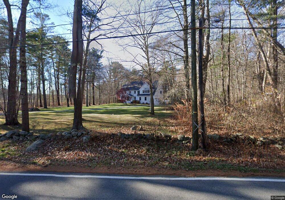
This home is located at 635 Long John Rd, Rye, NH 03870 and is currently estimated at $2,198,415, approximately $441 per square foot. 635 Long John Rd is a home located in Rockingham County with nearby schools including Rye Elementary School, Rye Junior High School, and Rye Country Day School.
Ownership History
Date
Name
Owned For
Owner Type
Purchase Details
Closed on
Jan 21, 2010
Sold by
Probert Edward W and Probert Andrea A
Bought by
Pincomb-Moran Jessica and Moran Timothy
Current Estimated Value
Home Financials for this Owner
Home Financials are based on the most recent Mortgage that was taken out on this home.
Original Mortgage
$778,600
Interest Rate
4.79%
Mortgage Type
Purchase Money Mortgage
Purchase Details
Closed on
Jun 2, 2003
Sold by
Greco Steven F and Greco Linda A
Bought by
Probert Edward W and Probert Andrea A
Create a Home Valuation Report for This Property
The Home Valuation Report is an in-depth analysis detailing your home's value as well as a comparison with similar homes in the area
Home Values in the Area
Average Home Value in this Area
Purchase History
| Date | Buyer | Sale Price | Title Company |
|---|---|---|---|
| Pincomb-Moran Jessica | $973,300 | -- | |
| Probert Edward W | $738,500 | -- |
Source: Public Records
Mortgage History
| Date | Status | Borrower | Loan Amount |
|---|---|---|---|
| Open | Probert Edward W | $771,984 | |
| Closed | Probert Edward W | $778,600 | |
| Previous Owner | Probert Edward W | $30,000 | |
| Previous Owner | Probert Edward W | $60,000 |
Source: Public Records
Tax History Compared to Growth
Tax History
| Year | Tax Paid | Tax Assessment Tax Assessment Total Assessment is a certain percentage of the fair market value that is determined by local assessors to be the total taxable value of land and additions on the property. | Land | Improvement |
|---|---|---|---|---|
| 2024 | $12,007 | $1,386,500 | $475,600 | $910,900 |
| 2023 | $11,134 | $1,386,500 | $475,600 | $910,900 |
| 2022 | $9,604 | $1,375,900 | $475,600 | $900,300 |
| 2021 | $9,701 | $949,200 | $329,200 | $620,000 |
| 2020 | $9,701 | $949,200 | $329,200 | $620,000 |
| 2019 | $9,701 | $949,200 | $329,200 | $620,000 |
| 2018 | $9,596 | $949,200 | $329,200 | $620,000 |
| 2017 | $9,596 | $949,200 | $329,200 | $620,000 |
| 2016 | $9,276 | $868,500 | $245,300 | $623,200 |
| 2013 | $9,509 | $866,800 | $245,300 | $621,500 |
Source: Public Records
Map
Nearby Homes
- 480 Sagamore Rd
- 389 Sagamore Rd
- 665 Wallis Rd
- 665 Wallis Rd Unit 1
- 665 Wallis Rd Unit 2
- 137 Clark Rd
- 51 Wallis Rd
- 310 Springbrook Cir
- 916 Springbrook Cir
- 703 Springbrook Cir
- 1191 - 1193 Ocean Blvd
- 1215 Ocean Blvd Unit 2
- 1215 Ocean Blvd Unit 3
- 1215 Ocean Blvd Unit 6
- 1215 Ocean Blvd Unit 4
- 1193 Ocean Blvd
- 801 Springbrook Cir
- 809 Springbrook Cir
- 1643 Ocean Blvd
- 45 F w Hartford Dr
- 607 Long John Rd
- 595 Long John Rd
- 640 Long John Rd
- 596 Long John Rd
- 637 Long John Rd
- 581 Long John Rd
- 0 Long John Rd
- 4 Young Ln
- 649 Long John Rd
- 650 Long John Rd
- 6 Young Ln
- 658 Long John Rd
- 659 Long John Rd
- 575 Long John Rd
- 3 Young Ln
- 410 Wallis Rd
- 402 Wallis Rd
- 2 Marden Woods Dr
- 8 Young Ln
- 414 Wallis Rd