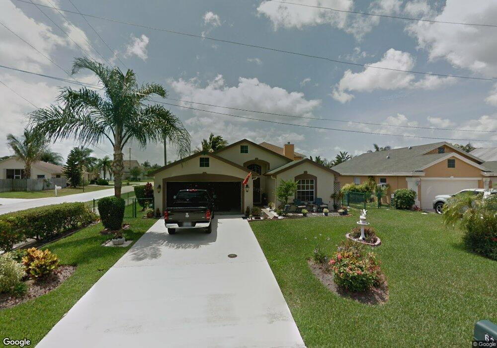
6356 Michael St Jupiter, FL 33458
North Palm Beach Heights NeighborhoodEstimated Value: $585,000 - $646,000
3
Beds
2
Baths
1,614
Sq Ft
$384/Sq Ft
Est. Value
About This Home
This home is located at 6356 Michael St, Jupiter, FL 33458 and is currently estimated at $620,034, approximately $384 per square foot. 6356 Michael St is a home located in Palm Beach County with nearby schools including Lighthouse Elementary School, William T. Dwyer High School, and Beacon Cove Intermediate School.
Ownership History
Date
Name
Owned For
Owner Type
Purchase Details
Closed on
Jun 5, 2000
Sold by
Hembree Rhudy Corp
Bought by
Brufau Juan A
Current Estimated Value
Home Financials for this Owner
Home Financials are based on the most recent Mortgage that was taken out on this home.
Original Mortgage
$115,000
Interest Rate
8.14%
Mortgage Type
New Conventional
Purchase Details
Closed on
May 19, 2000
Sold by
North Palm Beach Heights Inc
Bought by
E P Enterprises Inc
Home Financials for this Owner
Home Financials are based on the most recent Mortgage that was taken out on this home.
Original Mortgage
$115,000
Interest Rate
8.14%
Mortgage Type
New Conventional
Create a Home Valuation Report for This Property
The Home Valuation Report is an in-depth analysis detailing your home's value as well as a comparison with similar homes in the area
Home Values in the Area
Average Home Value in this Area
Purchase History
| Date | Buyer | Sale Price | Title Company |
|---|---|---|---|
| Brufau Juan A | $28,000 | -- | |
| E P Enterprises Inc | -- | -- |
Source: Public Records
Mortgage History
| Date | Status | Borrower | Loan Amount |
|---|---|---|---|
| Open | E P Enterprises Inc | $150,000 | |
| Closed | E P Enterprises Inc | $31,000 | |
| Closed | E P Enterprises Inc | $115,000 |
Source: Public Records
Tax History
| Year | Tax Paid | Tax Assessment Tax Assessment Total Assessment is a certain percentage of the fair market value that is determined by local assessors to be the total taxable value of land and additions on the property. | Land | Improvement |
|---|---|---|---|---|
| 2025 | $3,016 | $199,330 | -- | -- |
| 2024 | $3,016 | $193,712 | -- | -- |
| 2023 | $2,955 | $188,070 | $0 | $0 |
| 2022 | $2,921 | $182,592 | $0 | $0 |
| 2021 | $2,878 | $177,274 | $0 | $0 |
| 2020 | $2,864 | $174,826 | $0 | $0 |
| 2019 | $2,819 | $170,895 | $0 | $0 |
| 2018 | $2,670 | $167,709 | $0 | $0 |
| 2017 | $2,651 | $164,260 | $0 | $0 |
| 2016 | $2,618 | $160,881 | $0 | $0 |
| 2015 | $2,698 | $159,763 | $0 | $0 |
| 2014 | $2,706 | $158,495 | $0 | $0 |
Source: Public Records
Map
Nearby Homes
- 6267 Garrett St
- 6395 Barbara St
- 6229 Lucerne St
- 6249 Foster St
- 6261 Pompano St
- 429 Oriole Cir
- 6945 150th Place N
- 6799 149th Place N
- 234 San Remo Dr
- 6031 Robinson St
- 6039 Adams St
- 3518 Community Dr
- 15314 70th Trail N
- 231 Sparrow Point
- 6578 146th Rd N
- 164 Soriano Dr
- 6130 Francis St
- 136 Ashley Ct
- 124 Ashley Ct
- 3151 E Community Dr
- 6358 Michael St
- 15173 Harriet Ave
- 15184 Harriet Ave
- 6362 Michael St
- 6351 Lucerne St
- 15163 Harriet Ave
- 6352 Michael St
- 6351 Michael St
- 6341 Lucerne St
- 15153 Harriet Ave
- 15129 Harriet Ave
- 6334 Michael St
- 6343 Michael St
- 6335 Lucerne St
- 15133 Harriet Ave
- 6350 Lucerne St
- 6400 Garrett St
- 6335 Michael St
- 6326 Michael St
- 6398 Garrett St
Your Personal Tour Guide
Ask me questions while you tour the home.