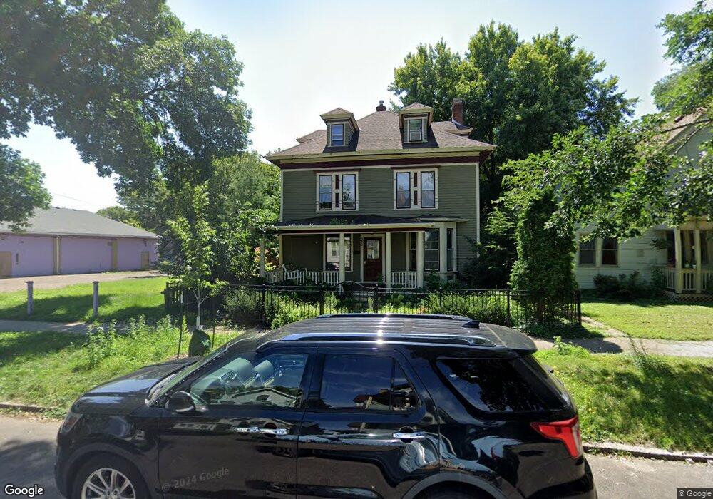
636 636 Laurel Ave St. Paul, MN 55104
Summit-University NeighborhoodEstimated Value: $460,000 - $765,000
3
Beds
3
Baths
2,437
Sq Ft
$234/Sq Ft
Est. Value
About This Home
This home is located at 636 636 Laurel Ave, St. Paul, MN 55104 and is currently estimated at $569,711, approximately $233 per square foot. 636 636 Laurel Ave is a home located in Ramsey County with nearby schools including Maxfield Magnet Elementary School, Hidden River Middle School, and Central Senior High School.
Ownership History
Date
Name
Owned For
Owner Type
Purchase Details
Closed on
Jun 3, 2025
Sold by
Us Bank National Association
Bought by
Chabel Simon and Stephens Monica
Current Estimated Value
Home Financials for this Owner
Home Financials are based on the most recent Mortgage that was taken out on this home.
Original Mortgage
$276,600
Outstanding Balance
$275,168
Interest Rate
6.81%
Mortgage Type
New Conventional
Estimated Equity
$294,543
Purchase Details
Closed on
Mar 18, 2015
Sold by
Kirmeier Rand A and Kirmeier Kim R
Bought by
Peterson Richard and Peterson Sharron
Home Financials for this Owner
Home Financials are based on the most recent Mortgage that was taken out on this home.
Original Mortgage
$305,758
Interest Rate
3.37%
Mortgage Type
FHA
Purchase Details
Closed on
Mar 31, 2011
Sold by
Kirmeier Rand A and Kirmeier Kim R
Bought by
Peterson Richard and Peterson Sharron
Create a Home Valuation Report for This Property
The Home Valuation Report is an in-depth analysis detailing your home's value as well as a comparison with similar homes in the area
Home Values in the Area
Average Home Value in this Area
Purchase History
| Date | Buyer | Sale Price | Title Company |
|---|---|---|---|
| Chabel Simon | $461,000 | Titlesmart | |
| Peterson Richard | $343,090 | Watermark Title Agency Llc | |
| Peterson Richard | $333,000 | -- |
Source: Public Records
Mortgage History
| Date | Status | Borrower | Loan Amount |
|---|---|---|---|
| Open | Chabel Simon | $276,600 | |
| Previous Owner | Peterson Richard | $305,758 | |
| Closed | Peterson Richard | -- |
Source: Public Records
Tax History
| Year | Tax Paid | Tax Assessment Tax Assessment Total Assessment is a certain percentage of the fair market value that is determined by local assessors to be the total taxable value of land and additions on the property. | Land | Improvement |
|---|---|---|---|---|
| 2025 | $9,584 | $617,400 | $130,000 | $487,400 |
| 2023 | $9,584 | $568,400 | $130,000 | $438,400 |
| 2022 | $7,842 | $522,900 | $130,000 | $392,900 |
| 2021 | $7,064 | $480,800 | $130,000 | $350,800 |
| 2020 | $7,554 | $424,700 | $130,000 | $294,700 |
| 2019 | $7,118 | $447,100 | $130,000 | $317,100 |
| 2018 | $6,810 | $418,600 | $130,000 | $288,600 |
| 2017 | $6,124 | $412,100 | $136,500 | $275,600 |
| 2016 | $5,700 | $0 | $0 | $0 |
| 2015 | $2,936 | $348,500 | $126,000 | $222,500 |
| 2014 | $5,546 | $0 | $0 | $0 |
Source: Public Records
Map
Nearby Homes
- 674 Holly Ave
- 570 Laurel Ave
- 565 Holly Ave
- 47 Saint Albans St N
- 652 Dayton Ave
- 546 Ashland Ave Unit 546
- 518 Laurel Ave
- 718 Portland Ave Unit I
- 672 Summit Ave Unit 102
- 520 Holly Ave
- 542 Portland Ave
- 582 Summit Ave
- 505 Selby Ave Unit 7
- 505 Selby Ave Unit 3
- 505 Selby Ave Unit 1
- 635 Grand Ave Unit 4
- 802 Ashland Ave
- 614 Grand Ave Unit C
- 614 Grand Ave Unit 3EE
- 700 Grand Ave Unit 204
- 640 Laurel Ave
- 644 Laurel Ave
- 648 Laurel Ave
- 639 Ashland Ave
- 643 Laurel Ave
- 643 Laurel Ave Unit Lower
- 641 Ashland Ave Unit 2
- 641 641 Ashland Ave
- 641 641 Ashland-Avenue-
- 641 Ashland Ave
- 633 Ashland Ave
- 654 Laurel Ave
- 647 Ashland Ave
- 629 Ashland Ave
- 637 Laurel Ave
- 633 Laurel Ave
- 651 Ashland Ave Unit A
- 651 Ashland Ave Unit B
- 627 Ashland Ave
- 645 Laurel Ave
Your Personal Tour Guide
Ask me questions while you tour the home.