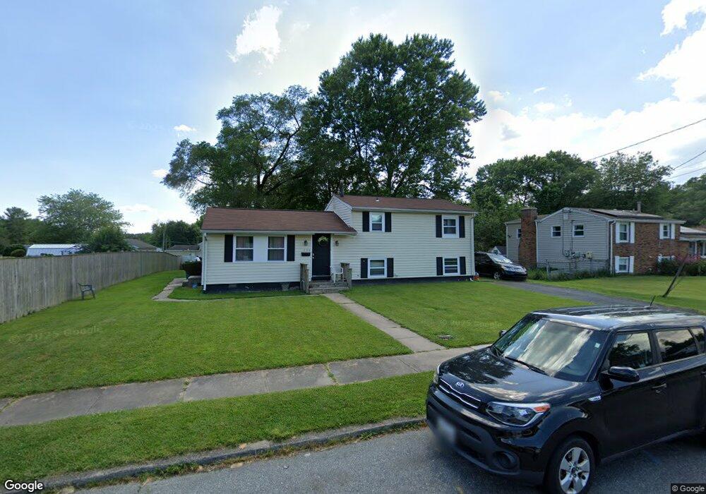
636 Elm St Aberdeen, MD 21001
Estimated Value: $212,000 - $301,000
3
Beds
1
Bath
1,371
Sq Ft
$190/Sq Ft
Est. Value
About This Home
This home is located at 636 Elm St, Aberdeen, MD 21001 and is currently estimated at $260,812, approximately $190 per square foot. 636 Elm St is a home located in Harford County with nearby schools including Bakerfield Elementary School, Aberdeen Middle School, and Aberdeen High School.
Ownership History
Date
Name
Owned For
Owner Type
Purchase Details
Closed on
Oct 31, 2013
Sold by
Whitson Priscilla L
Bought by
Huff Carrie
Current Estimated Value
Home Financials for this Owner
Home Financials are based on the most recent Mortgage that was taken out on this home.
Original Mortgage
$105,356
Outstanding Balance
$82,352
Interest Rate
5.5%
Mortgage Type
FHA
Estimated Equity
$178,460
Purchase Details
Closed on
Dec 28, 1995
Sold by
Brown Sabrina L
Bought by
Brown Sabrina L and Whitson Priscilla L
Purchase Details
Closed on
Jun 26, 1991
Sold by
Fields Thomas H and Fields Wf
Bought by
Brown Sabrina L
Home Financials for this Owner
Home Financials are based on the most recent Mortgage that was taken out on this home.
Original Mortgage
$70,300
Interest Rate
9.65%
Create a Home Valuation Report for This Property
The Home Valuation Report is an in-depth analysis detailing your home's value as well as a comparison with similar homes in the area
Home Values in the Area
Average Home Value in this Area
Purchase History
| Date | Buyer | Sale Price | Title Company |
|---|---|---|---|
| Huff Carrie | $107,300 | Getz Title Group Llc | |
| Brown Sabrina L | -- | -- | |
| Brown Sabrina L | $69,900 | -- |
Source: Public Records
Mortgage History
| Date | Status | Borrower | Loan Amount |
|---|---|---|---|
| Open | Huff Carrie | $105,356 | |
| Previous Owner | Brown Sabrina L | $70,300 |
Source: Public Records
Tax History
| Year | Tax Paid | Tax Assessment Tax Assessment Total Assessment is a certain percentage of the fair market value that is determined by local assessors to be the total taxable value of land and additions on the property. | Land | Improvement |
|---|---|---|---|---|
| 2025 | $1,535 | $172,333 | $0 | $0 |
| 2024 | $1,535 | $161,067 | $0 | $0 |
| 2023 | $1,428 | $149,800 | $45,000 | $104,800 |
| 2022 | $1,390 | $145,800 | $0 | $0 |
| 2021 | $1,386 | $141,800 | $0 | $0 |
| 2020 | $1,386 | $137,800 | $45,000 | $92,800 |
| 2019 | $1,359 | $135,167 | $0 | $0 |
| 2018 | $1,321 | $132,533 | $0 | $0 |
| 2017 | $1,295 | $129,900 | $0 | $0 |
| 2016 | -- | $127,300 | $0 | $0 |
| 2015 | $1,449 | $124,700 | $0 | $0 |
| 2014 | $1,449 | $122,100 | $0 | $0 |
Source: Public Records
Map
Nearby Homes
- 647 Elm St
- 444 Chestnut St
- 125 Valley Rd
- 740 Bur Oak Ct Unit 78
- 722 Bur Oak Ct Unit 77
- 770 Custis St
- 687 Plater St
- 754 Custis St
- 511 Ohio Ct
- 107 Moyer Dr
- 0 Harford St Unit MDHR2039982
- 21 Gunnison Dr
- 631 W Bel Air Ave
- 449 S Law St
- 0 Arthur Rd Unit MDHR2050208
- 69 Baker St
- 45 Mount Royal Ave
- 890 Oxford Ave
- 136 S Parke St
- 11 Bush Chapel Rd
Your Personal Tour Guide
Ask me questions while you tour the home.