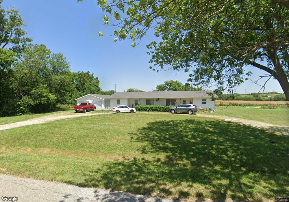
637 Maple Rd Uniontown, KS 66779
Estimated Value: $140,000 - $159,928
4
Beds
2
Baths
1,992
Sq Ft
$75/Sq Ft
Est. Value
About This Home
This home is located at 637 Maple Rd, Uniontown, KS 66779 and is currently estimated at $149,964, approximately $75 per square foot. 637 Maple Rd is a home located in Bourbon County with nearby schools including West Bourbon Elementary School and Uniontown High School.
Ownership History
Date
Name
Owned For
Owner Type
Purchase Details
Closed on
Sep 3, 2014
Sold by
Holt Kent L Living Trust
Bought by
Shinn David Alan and Shinn Rebecca Lynn
Current Estimated Value
Home Financials for this Owner
Home Financials are based on the most recent Mortgage that was taken out on this home.
Original Mortgage
$29,000
Interest Rate
4.15%
Mortgage Type
New Conventional
Create a Home Valuation Report for This Property
The Home Valuation Report is an in-depth analysis detailing your home's value as well as a comparison with similar homes in the area
Purchase History
| Date | Buyer | Sale Price | Title Company |
|---|---|---|---|
| Shinn David Alan | $36,250 | Security First Title |
Source: Public Records
Mortgage History
| Date | Status | Borrower | Loan Amount |
|---|---|---|---|
| Closed | Shinn David Alan | $29,000 |
Source: Public Records
Tax History
| Year | Tax Paid | Tax Assessment Tax Assessment Total Assessment is a certain percentage of the fair market value that is determined by local assessors to be the total taxable value of land and additions on the property. | Land | Improvement |
|---|---|---|---|---|
| 2025 | -- | $12,544 | $2,093 | $10,451 |
| 2024 | $17 | $11,835 | $2,093 | $9,742 |
| 2023 | $1,614 | $10,857 | $2,093 | $8,764 |
| 2022 | $1,568 | $10,541 | $2,093 | $8,448 |
| 2021 | $1,594 | $10,229 | $2,093 | $8,136 |
| 2020 | $1,578 | $10,019 | $2,093 | $7,926 |
| 2019 | $1,492 | $9,478 | $2,208 | $7,270 |
| 2018 | $1,483 | $9,384 | $2,208 | $7,176 |
| 2017 | $1,411 | $8,902 | $2,082 | $6,820 |
| 2016 | -- | $8,691 | $1,724 | $6,967 |
| 2015 | -- | $8,215 | $577 | $7,638 |
| 2014 | -- | $8,498 | $577 | $7,921 |
Source: Public Records
Map
Nearby Homes
- 606 Sherman St
- 0 Indian Rd Unit 25875456
- 273 Ivory Rd
- 804 Kansas 3
- 0 Central Ave
- 00000 Poplar Rd
- 918 120th St
- 1481 135th St
- 1104 Tomahawk Rd
- 00 165th and Poplar Rd
- 1350 Range Rd
- 135? Range Rd
- 1254 Grand Rd
- 0000 Rt 1
- 00000 Rt 1 N A
- 4722 Arizona Rd
- W Third St
- 000 W Third St 0 38 Acres
- 00 Prairie Rd
- 1194-1198 Unity Rd
- 631 Maple Rd
- 641 Maple Rd
- 630 Maple Rd
- 643 Maple Rd
- 612 Maple Rd
- 624 Maple Rd
- 625 Maple Rd
- 647 Maple Rd
- 654 Maple Rd
- 655 Maple Rd Uniontown N A
- 655 Maple Rd Uniontown
- 655 Maple Rd
- 613 Maple Rd
- 660 Maple Rd
- 0 Limestone Rd Unit 318556
- 22 W Shore Dr Unit MAPLETON, KS 66754
- 20 W Shore Dr Unit MAPLETON, KS 66754
- 65th & Soldier Rd
- 0 20th & Birch Rd Unit 1740090
- 0 20th & Birch Rd Unit 52532