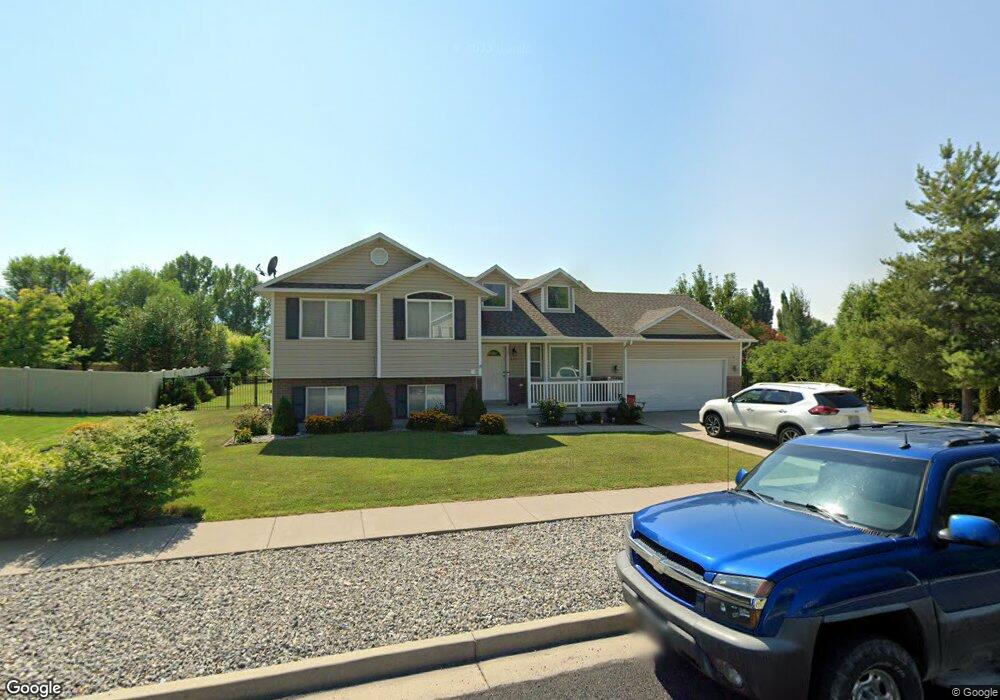
637 S 1360 W Logan, UT 84321
Woodruff NeighborhoodEstimated Value: $432,000 - $491,000
5
Beds
3
Baths
2,010
Sq Ft
$230/Sq Ft
Est. Value
About This Home
This home is located at 637 S 1360 W, Logan, UT 84321 and is currently estimated at $462,646, approximately $230 per square foot. 637 S 1360 W is a home located in Cache County with nearby schools including Woodruff School, Mount Logan Middle School, and Logan High School.
Ownership History
Date
Name
Owned For
Owner Type
Purchase Details
Closed on
Jun 20, 2025
Sold by
Lim Dary
Bought by
Kea Sothea and Lim Dary
Current Estimated Value
Purchase Details
Closed on
Mar 25, 2019
Sold by
Eng Than and Lim Dara
Bought by
Lim Dary and Eng Than
Home Financials for this Owner
Home Financials are based on the most recent Mortgage that was taken out on this home.
Original Mortgage
$148,500
Interest Rate
4.3%
Mortgage Type
New Conventional
Purchase Details
Closed on
Nov 29, 2012
Sold by
Sessoms John G and Legge Robert Joshua
Bought by
Eng Than and Lim Dara
Home Financials for this Owner
Home Financials are based on the most recent Mortgage that was taken out on this home.
Original Mortgage
$174,677
Interest Rate
3.25%
Mortgage Type
FHA
Purchase Details
Closed on
Aug 18, 2009
Sold by
Schofield Frank D and Schofield Kendra L
Bought by
Sessoms John G and Legge Robert Joshua
Create a Home Valuation Report for This Property
The Home Valuation Report is an in-depth analysis detailing your home's value as well as a comparison with similar homes in the area
Home Values in the Area
Average Home Value in this Area
Purchase History
| Date | Buyer | Sale Price | Title Company |
|---|---|---|---|
| Kea Sothea | -- | Hickman Land Title | |
| Kea Sothea | -- | Hickman Land Title | |
| Lim Dary | -- | Hickman Land Title Logan | |
| Eng Than | -- | Northern Title Company | |
| Sessoms John G | -- | Capital Title Ins Agency |
Source: Public Records
Mortgage History
| Date | Status | Borrower | Loan Amount |
|---|---|---|---|
| Previous Owner | Lim Dary | $148,500 | |
| Previous Owner | Eng Than | $174,677 |
Source: Public Records
Tax History Compared to Growth
Tax History
| Year | Tax Paid | Tax Assessment Tax Assessment Total Assessment is a certain percentage of the fair market value that is determined by local assessors to be the total taxable value of land and additions on the property. | Land | Improvement |
|---|---|---|---|---|
| 2025 | $1,659 | $214,595 | $0 | $0 |
| 2024 | $1,716 | $214,905 | $0 | $0 |
| 2023 | $1,781 | $212,690 | $0 | $0 |
| 2022 | $1,592 | $177,485 | $0 | $0 |
| 2021 | $1,554 | $267,765 | $48,000 | $219,765 |
| 2020 | $1,647 | $255,345 | $48,000 | $207,345 |
| 2019 | $1,722 | $255,345 | $48,000 | $207,345 |
| 2018 | $1,686 | $228,300 | $48,000 | $180,300 |
| 2017 | $1,444 | $103,400 | $0 | $0 |
| 2016 | $1,497 | $103,400 | $0 | $0 |
| 2015 | $1,373 | $94,715 | $0 | $0 |
| 2014 | $1,241 | $94,715 | $0 | $0 |
| 2013 | -- | $94,715 | $0 | $0 |
Source: Public Records
Map
Nearby Homes
- 1506 Silver Canoe Loop
- 1506 Silver Canoe Loop Unit 102
- Hemlock Plan at Sugar Creek - Logan
- Eucalyptus Plan at Sugar Creek - Logan
- Blackberry Plan at Sugar Creek - Logan
- Magnolia Plan at Sugar Creek - Logan
- 1239 W 575 S Unit 152
- 548 S 1225 W Unit 115
- 542 S 1225 W Unit 116
- 1220 W 575 S
- 518 S 1225 W
- 552 Rivergate Dr
- 506 S 1225 W
- 1227 W 500 S Unit 151
- 524 Rivergate Dr
- 1585 W Silver Canoe Way
- 1615 Silver Canoe Way
- 763 S 1500 W
- 1603 Silver Canoe Way
- 2157 S 1580 W
- 637 S 1360 W Unit 30
- 621 S 1360 W
- 621 S 1360 W Unit 31
- 665 S 1360 W Unit 29
- 665 S 1360 W
- 648 S 1360 W Unit 35
- 648 S 1360 W
- 623 Legend Dr
- 624 S 1360 W
- 624 S 1360 W Unit 34
- 607 S 1360 W Unit 32
- 607 S 1360 W
- 677 S 1360 W Unit 28
- 670 S 1360 W
- 646 Legend Dr
- 638 Legend Dr
- 646 S 1430 W
- 664 Legend Dr
- 608 S 1360 W Unit 33
- 608 S 1360 W