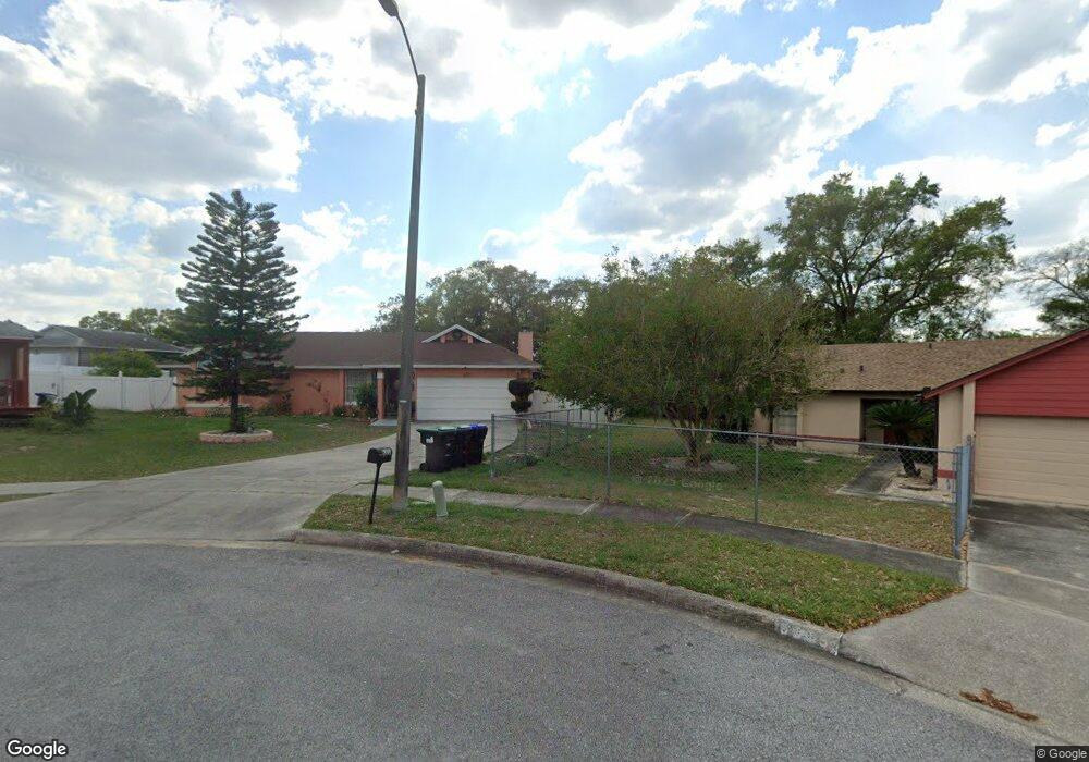
6371 Powers Pointe Cir Orlando, FL 32818
Estimated Value: $334,000 - $404,000
4
Beds
2
Baths
1,800
Sq Ft
$204/Sq Ft
Est. Value
About This Home
This home is located at 6371 Powers Pointe Cir, Orlando, FL 32818 and is currently estimated at $367,975, approximately $204 per square foot. 6371 Powers Pointe Cir is a home located in Orange County with nearby schools including Lake Gem Elementary School, Meadowbrook Middle School, and Evans High School.
Ownership History
Date
Name
Owned For
Owner Type
Purchase Details
Closed on
Jan 12, 2022
Sold by
Beverley Richard W and Beverley Sherland
Bought by
Beverley Sherland
Current Estimated Value
Purchase Details
Closed on
Dec 15, 2006
Sold by
Deonarine Dhaneshwar and Singh Savitree
Bought by
Beverley Richard W and Beverley Sherland D
Home Financials for this Owner
Home Financials are based on the most recent Mortgage that was taken out on this home.
Original Mortgage
$220,000
Interest Rate
6.31%
Mortgage Type
Purchase Money Mortgage
Purchase Details
Closed on
Apr 12, 2002
Sold by
Samuel K Anderson M and L V Anderson M
Bought by
Deonarine Dhaneshwar and Singh Savitree
Home Financials for this Owner
Home Financials are based on the most recent Mortgage that was taken out on this home.
Original Mortgage
$116,166
Interest Rate
6.8%
Mortgage Type
FHA
Create a Home Valuation Report for This Property
The Home Valuation Report is an in-depth analysis detailing your home's value as well as a comparison with similar homes in the area
Purchase History
| Date | Buyer | Sale Price | Title Company |
|---|---|---|---|
| Beverley Sherland | -- | None Listed On Document | |
| Beverley Richard W | $240,000 | Vic Fidelity Title Corp | |
| Deonarine Dhaneshwar | $118,000 | -- |
Source: Public Records
Mortgage History
| Date | Status | Borrower | Loan Amount |
|---|---|---|---|
| Previous Owner | Beverley Richard W | $220,000 | |
| Previous Owner | Deonarine Dhaneshwar | $116,166 |
Source: Public Records
Tax History
| Year | Tax Paid | Tax Assessment Tax Assessment Total Assessment is a certain percentage of the fair market value that is determined by local assessors to be the total taxable value of land and additions on the property. | Land | Improvement |
|---|---|---|---|---|
| 2025 | $1,567 | $106,372 | -- | -- |
| 2024 | $1,340 | $103,374 | -- | -- |
| 2023 | $1,340 | $97,535 | $0 | $0 |
| 2022 | $1,258 | $94,694 | $0 | $0 |
| 2021 | $1,224 | $91,936 | $0 | $0 |
| 2020 | $1,158 | $90,667 | $0 | $0 |
| 2019 | $1,165 | $88,629 | $0 | $0 |
| 2018 | $1,141 | $86,976 | $0 | $0 |
| 2017 | $1,110 | $146,374 | $25,000 | $121,374 |
| 2016 | $1,079 | $107,979 | $12,000 | $95,979 |
| 2015 | $1,092 | $102,569 | $13,000 | $89,569 |
| 2014 | $1,127 | $86,636 | $15,000 | $71,636 |
Source: Public Records
Map
Nearby Homes
- 6360 Powers Pointe Cir
- 6906 Colony Oaks Ln
- 5102 Hickory Ridge Rd
- 6311 Boylston Way
- 6780 Rubens Ct
- 4618 Miranda Cir
- 6239 Fox Hunt Trail
- 6131 Sparling Hills Cir
- 0 Fort Christmas Rd Unit MFRO6244659
- 0 Fort Christmas Rd Unit MFRO6244658
- 0 Fort Christmas Rd Unit MFRO6244660
- 6137 Sparling Hills Cir
- 6416 Lake Horseshoe Dr
- 5306 Camrose Ct
- 6112 Fox Hunt Trail
- 4520 N Hiawassee Rd
- 5342 Broken Pine Cir
- 5331 Broken Pine Cir
- 6964 Hyland Oaks Dr
- 5972 Kenlyn Ct
- 6377 Powers Pointe Cir
- 6365 Powers Pointe Cir
- 6441 Jennifer Jean Dr
- 6435 Jennifer Jean Dr
- 6383 Powers Pointe Cir
- 5009 Scarsdale Manor Ln
- 5003 Scarsdale Manor Ln
- 4834 Devore Ct
- 4738 Jonathan Charles Dr
- 6389 Powers Pointe Cir
- 5015 Scarsdale Manor Ln
- 4840 Devore Ct
- 6390 Powers Pointe Cir
- 4828 Devore Ct
- 6423 Jennifer Jean Dr
- 4732 Jonathan Charles Dr
- 6436 Jennifer Jean Dr
- 5021 Scarsdale Manor Ln
- 6395 Powers Pointe Cir
- 6808 Westborough Ln
Your Personal Tour Guide
Ask me questions while you tour the home.