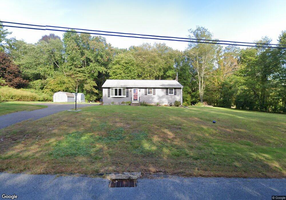
638 Buff Cap Rd Tolland, CT 06084
Estimated Value: $273,000 - $335,000
3
Beds
2
Baths
1,008
Sq Ft
$304/Sq Ft
Est. Value
About This Home
This home is located at 638 Buff Cap Rd, Tolland, CT 06084 and is currently estimated at $306,879, approximately $304 per square foot. 638 Buff Cap Rd is a home located in Tolland County with nearby schools including Birch Grove Primary School, Tolland Intermediate School, and Tolland Middle School.
Ownership History
Date
Name
Owned For
Owner Type
Purchase Details
Closed on
Apr 1, 2002
Sold by
Mahoney Dennis and Mahoney Ann
Bought by
Sandow Donald and Gemme Karen
Current Estimated Value
Home Financials for this Owner
Home Financials are based on the most recent Mortgage that was taken out on this home.
Original Mortgage
$121,400
Interest Rate
6.88%
Create a Home Valuation Report for This Property
The Home Valuation Report is an in-depth analysis detailing your home's value as well as a comparison with similar homes in the area
Home Values in the Area
Average Home Value in this Area
Purchase History
| Date | Buyer | Sale Price | Title Company |
|---|---|---|---|
| Sandow Donald | $134,900 | -- | |
| Sandow Donald | $134,900 | -- |
Source: Public Records
Mortgage History
| Date | Status | Borrower | Loan Amount |
|---|---|---|---|
| Open | Sandow Donald | $123,750 | |
| Closed | Sandow Donald | $121,400 | |
| Previous Owner | Sandow Donald | $86,250 |
Source: Public Records
Tax History Compared to Growth
Tax History
| Year | Tax Paid | Tax Assessment Tax Assessment Total Assessment is a certain percentage of the fair market value that is determined by local assessors to be the total taxable value of land and additions on the property. | Land | Improvement |
|---|---|---|---|---|
| 2025 | $4,685 | $172,300 | $65,600 | $106,700 |
| 2024 | $4,574 | $121,100 | $62,500 | $58,600 |
| 2023 | $4,521 | $121,100 | $62,500 | $58,600 |
| 2022 | $4,430 | $121,100 | $62,500 | $58,600 |
| 2021 | $4,494 | $121,100 | $62,500 | $58,600 |
| 2020 | $4,366 | $121,100 | $62,500 | $58,600 |
| 2019 | $4,196 | $116,400 | $64,500 | $51,900 |
| 2018 | $4,074 | $116,400 | $64,500 | $51,900 |
| 2017 | $3,980 | $116,400 | $64,500 | $51,900 |
| 2016 | $3,980 | $116,400 | $64,500 | $51,900 |
| 2015 | $3,883 | $116,400 | $64,500 | $51,900 |
| 2014 | $3,946 | $127,100 | $71,600 | $55,500 |
Source: Public Records
Map
Nearby Homes
- 644 Buff Cap Rd
- 745 Old Stafford Rd
- 8 Neff Hill Rd
- 15 Usher Ridge
- 68 Usher Ridge
- 36 Usher Ridge
- 110 Neff Hill Rd
- 130 Neff Hill Rd
- 105 Neff Hill Rd
- 137 Neff Hill Rd
- 100 Neff Hill Rd
- 77 Neff Hill Rd
- 84 Neff Hill Rd
- 71 Neff Hill Rd
- 42 Ladd Rd
- 487 Buff Cap Rd
- 0 Tolland Turnpike
- 127 Sandy Beach Rd
- 68 Cook Rd
- 476 Old Stafford Rd
- 650 Buff Cap Rd
- 630 Buff Cap Rd
- 775 Old Stafford Rd
- 654 Buff Cap Rd
- 784 Old Stafford Rd
- 645 Buff Cap Rd
- 768 Old Stafford Rd
- 783 Old Stafford Rd
- 751 Old Stafford Rd
- 662 Buff Cap Rd
- 799 Old Stafford Rd
- 754 Old Stafford Rd
- 670 Buff Cap Rd
- 811 Old Stafford Rd
- 737 Old Stafford Rd
- 614 Buff Cap Rd
- 678 Buff Cap Rd
- 740 Old Stafford Rd
- 735 Old Stafford Rd
- 669 Buff Cap Rd