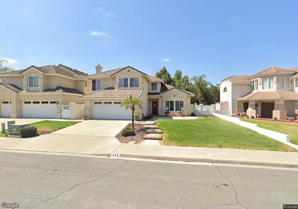
638 Port Claridge Chula Vista, CA 91913
Eastlake NeighborhoodEstimated Value: $954,258 - $1,175,000
3
Beds
3
Baths
2,157
Sq Ft
$492/Sq Ft
Est. Value
About This Home
This home is located at 638 Port Claridge, Chula Vista, CA 91913 and is currently estimated at $1,061,315, approximately $492 per square foot. 638 Port Claridge is a home located in San Diego County with nearby schools including Eastlake Elementary School, Bonita Vista Middle School, and Bonita Vista Senior High School.
Ownership History
Date
Name
Owned For
Owner Type
Purchase Details
Closed on
Nov 2, 1999
Sold by
Ringstad Jarvis P
Bought by
Ringstad Jarvis P and Ringstad Joan C Gaethke
Current Estimated Value
Purchase Details
Closed on
Jul 28, 1999
Sold by
Tomita and Yoko
Bought by
Ringstad Jarvis P
Home Financials for this Owner
Home Financials are based on the most recent Mortgage that was taken out on this home.
Original Mortgage
$150,000
Outstanding Balance
$43,273
Interest Rate
7.7%
Estimated Equity
$1,018,042
Purchase Details
Closed on
Jun 27, 1991
Purchase Details
Closed on
Oct 5, 1990
Purchase Details
Closed on
Sep 28, 1988
Create a Home Valuation Report for This Property
The Home Valuation Report is an in-depth analysis detailing your home's value as well as a comparison with similar homes in the area
Home Values in the Area
Average Home Value in this Area
Purchase History
| Date | Buyer | Sale Price | Title Company |
|---|---|---|---|
| Ringstad Jarvis P | -- | -- | |
| Ringstad Jarvis P | $260,000 | First American Title Ins Co | |
| -- | $270,000 | -- | |
| -- | $282,000 | -- | |
| -- | $218,900 | -- |
Source: Public Records
Mortgage History
| Date | Status | Borrower | Loan Amount |
|---|---|---|---|
| Open | Ringstad Jarvis P | $150,000 |
Source: Public Records
Tax History Compared to Growth
Tax History
| Year | Tax Paid | Tax Assessment Tax Assessment Total Assessment is a certain percentage of the fair market value that is determined by local assessors to be the total taxable value of land and additions on the property. | Land | Improvement |
|---|---|---|---|---|
| 2025 | $4,496 | $399,588 | $135,855 | $263,733 |
| 2024 | $4,496 | $391,754 | $133,192 | $258,562 |
| 2023 | $4,420 | $384,074 | $130,581 | $253,493 |
| 2022 | $4,292 | $376,544 | $128,021 | $248,523 |
| 2021 | $4,185 | $369,161 | $125,511 | $243,650 |
| 2020 | $4,083 | $365,377 | $124,225 | $241,152 |
| 2019 | $3,973 | $358,214 | $121,790 | $236,424 |
| 2018 | $3,907 | $351,191 | $119,402 | $231,789 |
| 2017 | $11 | $344,306 | $117,061 | $227,245 |
| 2016 | $3,727 | $337,556 | $114,766 | $222,790 |
| 2015 | $3,671 | $332,487 | $113,043 | $219,444 |
| 2014 | $3,604 | $325,975 | $110,829 | $215,146 |
Source: Public Records
Map
Nearby Homes
- 609 Rue Bayonne
- 678 Rue Avallon
- 1950 Rue Michelle
- 2018 Bridgeport
- 2015 Lakeridge Cir Unit 301
- 725 Brookstone Rd Unit 101
- 731 Baylor Ave
- 2100 Northshore Dr Unit A
- 749 Brookstone Rd Unit 101
- 731 Brookstone Rd Unit 103
- 773 Brookstone Rd Unit 304
- 761 Brookstone Rd Unit 203
- 1761 Harvard St
- 2083 Lakeridge Cir Unit 104
- 4334 Corral Canyon Rd
- 1665 Yale St
- 2151 Northshore Dr
- 1654 Yale St
- 742 Eastshore Terrace Unit 98
- 278 Avenida Loretta
- 634 Port Claridge
- 642 Port Claridge
- 646 Port Claridge
- 643 Port Dunbar
- 639 Port Dunbar
- 630 Port Claridge
- 647 Port Dunbar
- 635 Port Dunbar
- 650 Port Claridge
- 651 Port Dunbar Unit 19
- 631 Port Dunbar
- 655 Port Dunbar
- 1854 Port Albans Unit 18
- 654 Port Claridge
- 1858 Port Albans
- 659 Port Dunbar
- 623 Port Dunbar
- 644 Port Dunbar
- 640 Port Dunbar
- 658 Port Claridge