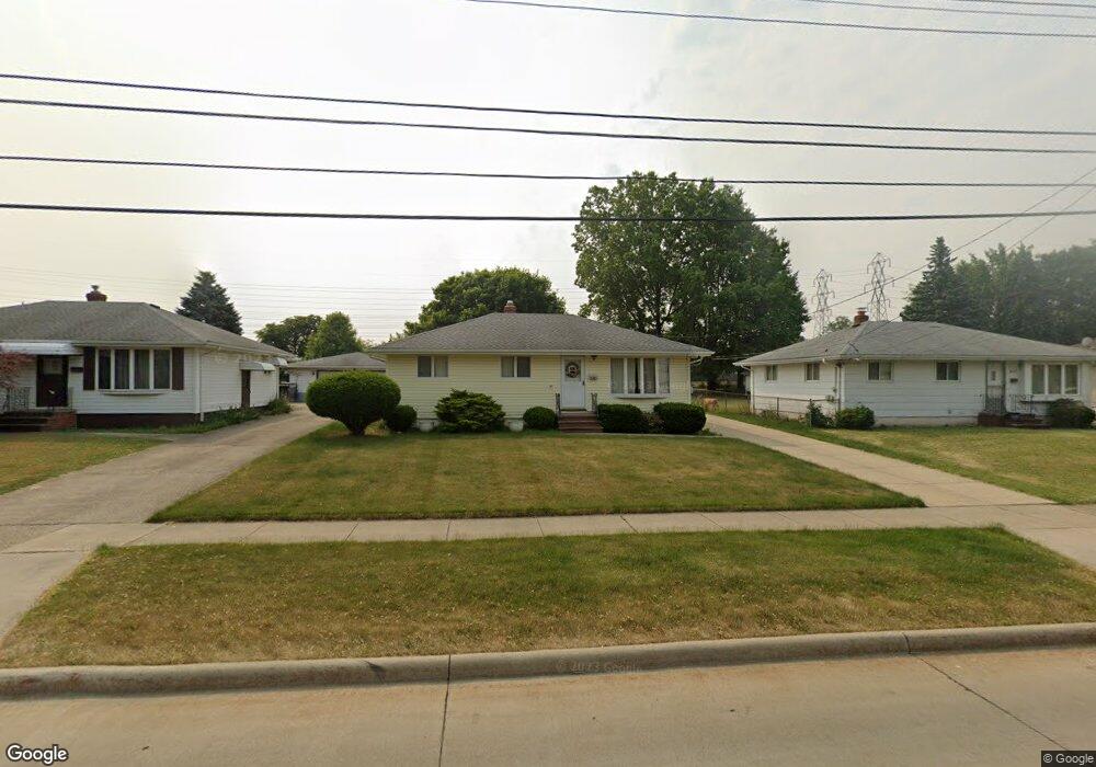
6385 Michael Dr Brookpark, OH 44142
Brook Park AreaEstimated Value: $193,000 - $232,000
About This Home
This home is located at 6385 Michael Dr, Brookpark, OH 44142 and is currently estimated at $211,770, approximately $214 per square foot. 6385 Michael Dr is a home located in Cuyahoga County with nearby schools including Berea-Midpark Middle School, Berea-Midpark High School, and Huber Heights Preparatory Academy Parma Academy.
Ownership History
We collect this data history from publicly available records. To have your information removed, we recommend requesting removal directly through your county’s website.
Purchase Details
Purchase Details
Home Values in the Area
Average Home Value in this Area
Purchase History
We collect this data history from publicly available records. To have your information removed, we recommend requesting removal directly through your county’s website.
| Date | Buyer | Sale Price | Title Company |
|---|---|---|---|
| -- | -- | ||
| -- | -- |
Tax History
We collect this data history from publicly available records. To have your information removed, we recommend requesting removal directly through your county’s website.
| Year | Tax Paid | Tax Assessment Tax Assessment Total Assessment is a certain percentage of the fair market value that is determined by local assessors to be the total taxable value of land and additions on the property. | Land | Improvement |
|---|---|---|---|---|
| 2025 | $2,502 | $60,060 | $12,880 | $47,180 |
| 2024 | $2,535 | $60,060 | $12,880 | $47,180 |
| 2023 | $2,428 | $49,040 | $10,750 | $38,290 |
| 2022 | $2,437 | $49,040 | $10,750 | $38,290 |
| 2021 | $2,423 | $49,040 | $10,750 | $38,290 |
| 2020 | $2,061 | $38,920 | $8,540 | $30,380 |
| 2019 | $1,999 | $111,200 | $24,400 | $86,800 |
| 2018 | $1,991 | $38,920 | $8,540 | $30,380 |
| 2017 | $1,853 | $34,690 | $7,600 | $27,090 |
| 2016 | $1,838 | $34,690 | $7,600 | $27,090 |
| 2015 | $1,725 | $34,690 | $7,600 | $27,090 |
| 2014 | $1,725 | $34,690 | $7,600 | $27,090 |
Map
- 6379 Edgehurst Dr
- 6444 Schaaf Dr
- 6176 Carol Dr
- 15500 Richard Dr
- 15424 Holland Rd
- 6377 Ledgebrook Dr
- 6130 Smith Rd
- 15541 Susan Dr
- 13901 Franklyn Blvd
- 14121 Donald Dr
- 15504 Roxboro Dr
- 6526 Stonecrest Dr
- 16124 Holland Rd
- 6391 Almont Dr
- 13963 Havendale Dr
- 13610 Starlite Dr
- 16457 Emerald Point Unit B16457
- 14291 Gallatin Blvd
- 13370 Newton Rd
- 13548 Holland Rd
- 6381 Michael Dr
- 6389 Michael Dr
- 6375 Michael Dr
- 6393 Michael Dr
- 6369 Michael Dr
- 6397 Michael Dr
- 6388 Michael Dr
- 6378 Michael Dr
- 6363 Michael Dr
- 6401 Michael Dr
- 6392 Michael Dr
- 6372 Michael Dr
- 6396 Michael Dr
- 6298 Middlebrook Blvd
- 6366 Michael Dr
- 6357 Michael Dr
- 6405 Michael Dr
- 6400 Michael Dr
- 6274 Middlebrook Blvd
- 14966 Lindmont Dr
Ask me questions while you tour the home.