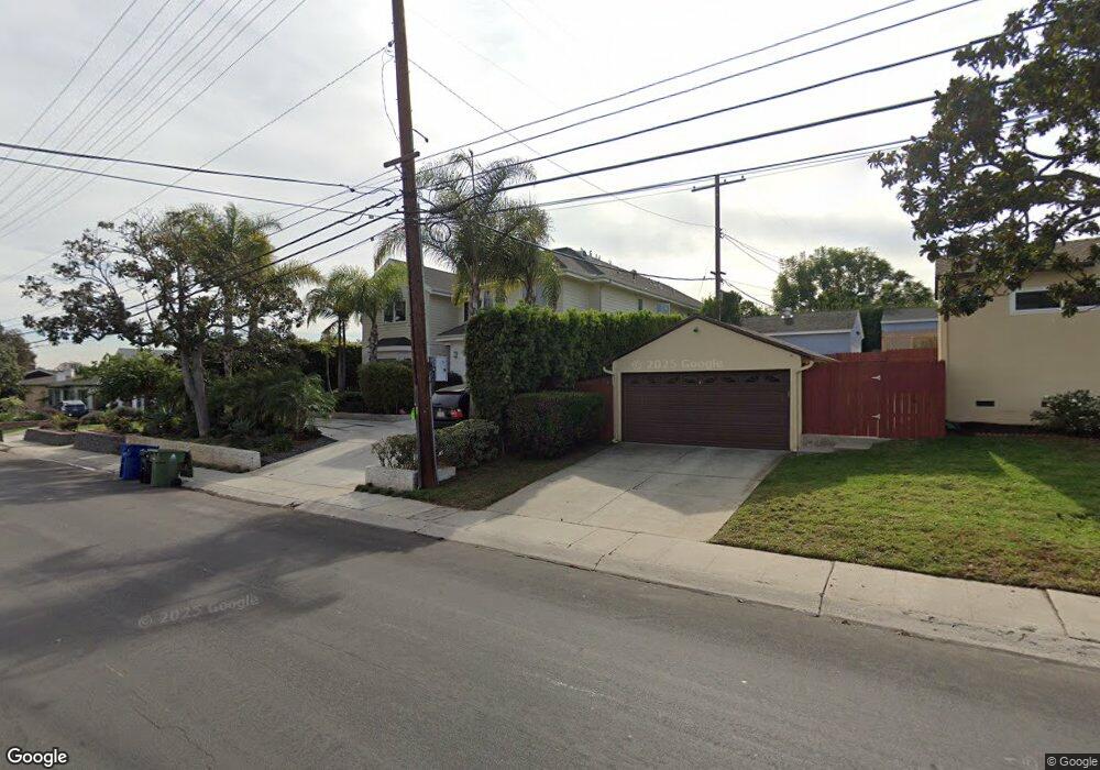
6388 W 77th St Los Angeles, CA 90045
Westchester NeighborhoodEstimated Value: $2,009,000 - $4,498,862
2
Beds
2
Baths
1,721
Sq Ft
$1,940/Sq Ft
Est. Value
About This Home
This home is located at 6388 W 77th St, Los Angeles, CA 90045 and is currently estimated at $3,338,466, approximately $1,939 per square foot. 6388 W 77th St is a home located in Los Angeles County with nearby schools including Cowan Avenue Elementary School, Wright Middle School STEAM Magnet, and Westchester Enriched Sciences Magnets.
Ownership History
Date
Name
Owned For
Owner Type
Purchase Details
Closed on
Jun 12, 2013
Sold by
Tremayne Cuyler B
Bought by
Tremayne Cuyler B and Tremayne Lexine M
Current Estimated Value
Purchase Details
Closed on
Jun 27, 2006
Sold by
Frank Anita V and The Frank Family Trust
Bought by
Tremayne Cuyler B
Home Financials for this Owner
Home Financials are based on the most recent Mortgage that was taken out on this home.
Original Mortgage
$712,500
Interest Rate
6.57%
Mortgage Type
Purchase Money Mortgage
Purchase Details
Closed on
Jan 13, 2004
Sold by
Frank Arthur Henry and Frank Anita V
Bought by
Frank Arthur H
Create a Home Valuation Report for This Property
The Home Valuation Report is an in-depth analysis detailing your home's value as well as a comparison with similar homes in the area
Home Values in the Area
Average Home Value in this Area
Purchase History
| Date | Buyer | Sale Price | Title Company |
|---|---|---|---|
| Tremayne Cuyler B | -- | None Available | |
| Tremayne Cuyler B | $950,000 | Equity Title Company | |
| Frank Arthur H | -- | -- |
Source: Public Records
Mortgage History
| Date | Status | Borrower | Loan Amount |
|---|---|---|---|
| Closed | Tremayne Cuyler B | $712,500 |
Source: Public Records
Tax History Compared to Growth
Tax History
| Year | Tax Paid | Tax Assessment Tax Assessment Total Assessment is a certain percentage of the fair market value that is determined by local assessors to be the total taxable value of land and additions on the property. | Land | Improvement |
|---|---|---|---|---|
| 2025 | $32,722 | $2,721,380 | $1,272,793 | $1,448,587 |
| 2024 | $32,722 | $2,668,021 | $1,247,837 | $1,420,184 |
| 2023 | $32,090 | $2,615,708 | $1,223,370 | $1,392,338 |
| 2022 | $30,600 | $2,564,421 | $1,199,383 | $1,365,038 |
| 2021 | $30,207 | $2,514,139 | $1,175,866 | $1,338,273 |
| 2019 | $29,301 | $2,439,570 | $1,140,990 | $1,298,580 |
| 2018 | $29,160 | $2,391,736 | $1,118,618 | $1,273,118 |
| 2016 | $27,858 | $2,298,864 | $1,075,182 | $1,223,682 |
| 2015 | $27,449 | $2,264,334 | $1,059,032 | $1,205,302 |
| 2014 | $27,285 | $2,200,000 | $1,540,000 | $660,000 |
Source: Public Records
Map
Nearby Homes
- 7221 Arizona Ave
- 7449 Kentwood Ave
- 7403 S Sepulveda Blvd Unit 108
- 6322 W 78th Place
- 7404 Kentwood Ave
- 6427 Hedding St
- 7733 Henefer Ave
- 8004 El Manor Ave
- 6154 W 75th Place
- 8008 El Manor Ave
- 6882 Arizona Ave
- 6537 Hedding St
- 7831 Beland Ave
- 7920 Anise Ave Unit 1
- 8001 Alverstone Ave
- 6534 Kentwood Bluffs Dr
- 8044 Cowan Ave
- 8056 Kentwood Ave
- 7024 Kentwood Ave
- 8049 Kentwood Ave
- 6382 W 77th St
- 7706 El Manor Ave
- 7712 El Manor Ave
- 7700 El Manor Ave
- 6376 W 77th St
- 7718 El Manor Ave
- 6370 W 77th St
- 7625 Dunfield Ave
- 7722 El Manor Ave
- 7620 El Manor Ave
- 6389 W 78th St
- 6385 W 78th St
- 6381 W 78th St
- 7621 Dunfield Ave
- 7728 El Manor Ave
- 6364 W 77th St
- 7616 El Manor Ave
- 7701 El Manor Ave
- 7711 El Manor Ave
- 6377 W 78th St