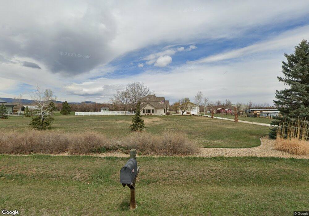
6389 Corinth Rd Longmont, CO 80503
Estimated Value: $988,000 - $1,218,000
3
Beds
3
Baths
2,524
Sq Ft
$435/Sq Ft
Est. Value
About This Home
This home is located at 6389 Corinth Rd, Longmont, CO 80503 and is currently estimated at $1,096,771, approximately $434 per square foot. 6389 Corinth Rd is a home located in Boulder County with nearby schools including Blue Mountain Elementary School, Altona Middle School, and Silver Creek High School.
Ownership History
Date
Name
Owned For
Owner Type
Purchase Details
Closed on
Aug 8, 2011
Sold by
Cunningham Timothy A and Cunningham Christine C
Bought by
Cunningham Timothy A
Current Estimated Value
Purchase Details
Closed on
Jun 6, 2002
Sold by
Cunningham Timothy A and Cunningham Christine C
Bought by
Cunningham Timothy A
Purchase Details
Closed on
Dec 16, 1991
Bought by
Cunningham Timothy A and Cunningham Christine C
Purchase Details
Closed on
May 13, 1991
Bought by
Cunningham Timothy A and Cunningham Christine C
Purchase Details
Closed on
Jul 21, 1980
Bought by
Cunningham Timothy A and Cunningham Christine C
Create a Home Valuation Report for This Property
The Home Valuation Report is an in-depth analysis detailing your home's value as well as a comparison with similar homes in the area
Purchase History
We collect this data history from publicly available records. To have your information removed, we recommend requesting removal directly through your county’s website.
| Date | Buyer | Sale Price | Title Company |
|---|---|---|---|
| Cunningham Timothy A | -- | None Available | |
| Cunningham Timothy A | -- | -- | |
| Cunningham Timothy A | $127,000 | -- | |
| Cunningham Timothy A | $23,000 | -- | |
| Cunningham Timothy A | $63,300 | -- |
Source: Public Records
Tax History
| Year | Tax Paid | Tax Assessment Tax Assessment Total Assessment is a certain percentage of the fair market value that is determined by local assessors to be the total taxable value of land and additions on the property. | Land | Improvement |
|---|---|---|---|---|
| 2025 | $6,027 | $65,294 | $15,035 | $50,259 |
| 2024 | $6,067 | $60,013 | $13,819 | $46,194 |
| 2023 | $5,962 | $69,405 | $9,829 | $63,261 |
| 2022 | $4,293 | $50,268 | $9,014 | $41,254 |
| 2021 | $4,301 | $51,715 | $9,274 | $42,441 |
| 2020 | $3,675 | $46,082 | $10,582 | $35,500 |
| 2019 | $3,612 | $46,082 | $10,582 | $35,500 |
| 2018 | $3,402 | $44,093 | $10,656 | $33,437 |
| 2017 | $3,316 | $48,748 | $11,781 | $36,967 |
| 2016 | $3,196 | $43,215 | $13,214 | $30,001 |
| 2015 | $2,925 | $39,800 | $13,930 | $25,870 |
| 2014 | $4,059 | $39,800 | $13,930 | $25,870 |
Source: Public Records
Map
Nearby Homes
- 6263 Laodicea Rd
- 10045 N 75th St
- 150 N 75th St
- 5336 Caribou Springs Trail
- 6152 Hygiene Rd
- 725 Kubat Ln Unit A
- 729 Kubat Ln Unit 3-A
- 727 Kubat Ln Unit 2-B
- 11229 N 75th St
- 750 Kubat Ln Unit B
- 5101 Saint Vrain Rd
- 5687 Cottontail Dr
- 5717 Four Leaf Dr
- 5611 Wheaton Ave
- 5613 Four Leaf Dr
- 5604 Grandville Ave
- 5584 Moosehead Cir
- 1083 Mountain Dr Unit B
- 763 Mountain Dr
- 759 Mountain Dr
- 6357 Corinth Rd
- 6394 Corinth Rd
- 6362 Corinth Rd
- 10370 Phillipi Way
- 6323 Corinth Rd
- 6326 Corinth Rd
- 6381 Ephesus Rd
- 6350 Ephesus Rd
- 6314 Corinth Rd
- 10338 Phillipi Way
- 6323 Ephesus Rd
- 6289 Corinth Rd
- 10403 N 65th St
- 6305 Ephesus Rd
- 10353 N 65th St
- 6280 Corinth Rd
- 10292 Phillipi Way
- 6368 Ephesus Rd
- 6271 Corinth Rd
- 6386 Ephesus Rd
Your Personal Tour Guide
Ask me questions while you tour the home.