Estimated Value: $489,000 - $818,000
5
Beds
4
Baths
3,784
Sq Ft
$175/Sq Ft
Est. Value
About This Home
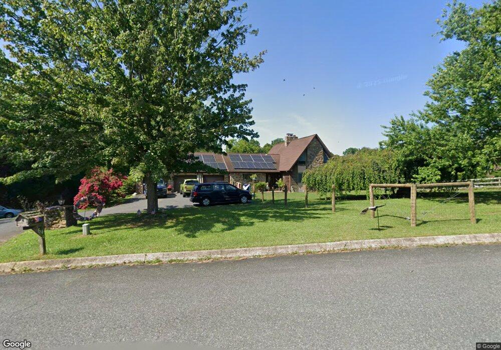
This home is located at 64 Amber Dr, Delta, PA 17314 and is currently estimated at $663,576, approximately $175 per square foot. 64 Amber Dr is a home located in York County with nearby schools including Clearview Elementary School, Red Lion Area Junior High School, and Red Lion Area Senior High School.
Ownership History
Date
Name
Owned For
Owner Type
Purchase Details
Closed on
Oct 2, 2009
Sold by
Burton Edward Preston
Bought by
Hallock Thomas V and Hallock Kimberly A
Current Estimated Value
Home Financials for this Owner
Home Financials are based on the most recent Mortgage that was taken out on this home.
Original Mortgage
$348,000
Outstanding Balance
$227,934
Interest Rate
5.14%
Mortgage Type
New Conventional
Estimated Equity
$435,642
Create a Home Valuation Report for This Property
The Home Valuation Report is an in-depth analysis detailing your home's value as well as a comparison with similar homes in the area
Home Values in the Area
Average Home Value in this Area
Purchase History
| Date | Buyer | Sale Price | Title Company |
|---|---|---|---|
| Hallock Thomas V | $435,000 | None Available |
Source: Public Records
Mortgage History
| Date | Status | Borrower | Loan Amount |
|---|---|---|---|
| Open | Hallock Thomas V | $348,000 |
Source: Public Records
Tax History Compared to Growth
Tax History
| Year | Tax Paid | Tax Assessment Tax Assessment Total Assessment is a certain percentage of the fair market value that is determined by local assessors to be the total taxable value of land and additions on the property. | Land | Improvement |
|---|---|---|---|---|
| 2025 | $10,525 | $335,640 | $56,080 | $279,560 |
| 2024 | $10,196 | $335,640 | $56,080 | $279,560 |
| 2023 | $10,163 | $335,640 | $56,080 | $279,560 |
| 2022 | $10,163 | $335,640 | $56,080 | $279,560 |
| 2021 | $9,827 | $335,640 | $56,080 | $279,560 |
| 2020 | $9,827 | $335,640 | $56,080 | $279,560 |
| 2019 | $9,760 | $335,640 | $56,080 | $279,560 |
| 2018 | $9,760 | $335,640 | $56,080 | $279,560 |
| 2017 | $9,750 | $335,640 | $56,080 | $279,560 |
| 2016 | $0 | $335,640 | $56,080 | $279,560 |
| 2015 | -- | $335,640 | $56,080 | $279,560 |
| 2014 | -- | $335,640 | $56,080 | $279,560 |
Source: Public Records
Map
Nearby Homes
- 65 W Mckinley Rd
- 115 Highfield Rd
- 55 Highfield Rd
- 136 Greenwich Rd
- 556 Bair Rd
- 45 Wenzel Rd
- 0 Highview Dr
- 0 Valley Ln
- 76 Laurel Dr
- 46 Corn Tassel Rd
- Parcel 859 Neill Run Rd
- 53 Dogwood Rd
- 0 Dogwood Rd
- 216 Meadow Trail
- 523 River Rd
- Lot C Bryansville Rd
- 8290 Woodbine Rd
- 293 Grove Rd
- 57 Pendyrus St
- 102 Chestnut St