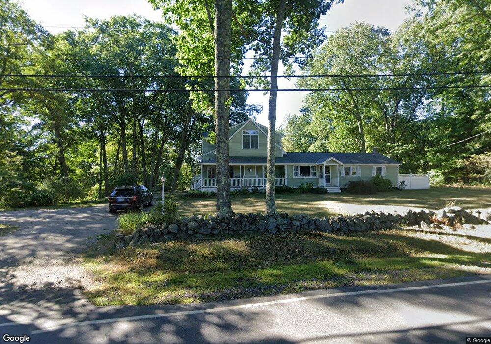
64 Walnut Ave North Hampton, NH 03862
Estimated Value: $706,737 - $883,000
3
Beds
3
Baths
2,316
Sq Ft
$355/Sq Ft
Est. Value
About This Home
This home is located at 64 Walnut Ave, North Hampton, NH 03862 and is currently estimated at $822,184, approximately $355 per square foot. 64 Walnut Ave is a home with nearby schools including North Hampton School, Winnacunnet High School, and Appleseeds Day School.
Ownership History
Date
Name
Owned For
Owner Type
Purchase Details
Closed on
Nov 2, 2023
Sold by
Dewing Jerome B and Dewing Barbara K
Bought by
Dewing Ft and Dewing
Current Estimated Value
Purchase Details
Closed on
Dec 22, 1992
Bought by
Dewing Jerome B and Dewing Barbara J
Create a Home Valuation Report for This Property
The Home Valuation Report is an in-depth analysis detailing your home's value as well as a comparison with similar homes in the area
Home Values in the Area
Average Home Value in this Area
Purchase History
| Date | Buyer | Sale Price | Title Company |
|---|---|---|---|
| Dewing Ft | -- | None Available | |
| Dewing Jerome B | $86,000 | -- |
Source: Public Records
Mortgage History
| Date | Status | Borrower | Loan Amount |
|---|---|---|---|
| Previous Owner | Dewing Jerome B | $165,000 | |
| Previous Owner | Dewing Jerome B | $100,000 | |
| Previous Owner | Dewing Jerome B | $150,000 |
Source: Public Records
Tax History Compared to Growth
Tax History
| Year | Tax Paid | Tax Assessment Tax Assessment Total Assessment is a certain percentage of the fair market value that is determined by local assessors to be the total taxable value of land and additions on the property. | Land | Improvement |
|---|---|---|---|---|
| 2024 | $7,771 | $607,100 | $285,700 | $321,400 |
| 2023 | $7,558 | $607,100 | $285,700 | $321,400 |
| 2022 | $7,074 | $412,000 | $191,600 | $220,400 |
| 2021 | $6,809 | $410,900 | $191,600 | $219,300 |
| 2020 | $10,347 | $410,900 | $191,600 | $219,300 |
| 2019 | $2,342 | $410,900 | $191,600 | $219,300 |
| 2018 | $6,673 | $410,900 | $191,600 | $219,300 |
| 2017 | $0 | $334,300 | $160,600 | $173,700 |
| 2016 | $2,214 | $334,300 | $160,600 | $173,700 |
| 2015 | $5,851 | $334,700 | $160,600 | $174,100 |
| 2014 | $5,707 | $334,700 | $160,600 | $174,100 |
| 2013 | $5,606 | $334,700 | $160,600 | $174,100 |
Source: Public Records
Map
Nearby Homes
- 49 Exeter Rd
- 91 Lovering Rd
- 1 Cherry Rd
- 36 Winnicut Rd Unit 2
- 8 Winterberry Ln
- 85 Post Rd
- Homesite 4 Windsong Place
- 96 North Rd
- Homesite 1 Windsong Place
- 9 Garrett Dr
- 113 Exeter Rd
- 131 Exeter Rd
- 135 Exeter Rd
- 177 Winnicutt Rd
- 50 Thornhill Rd
- 133R Stratham Heights Rd
- 223 Atlantic Ave
- 67 North Rd
- 221 Atlantic Ave
- 49 South Rd