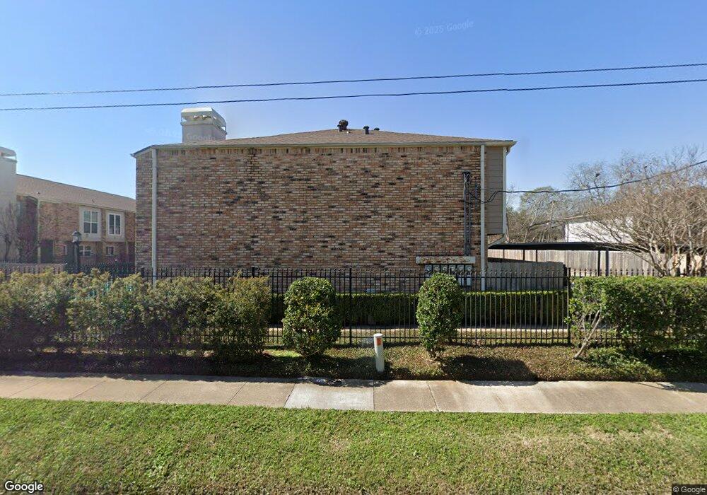
6406 Ferris Dr Unit 23 Houston, TX 77081
Gulfton NeighborhoodEstimated Value: $207,000 - $224,000
2
Beds
2
Baths
1,310
Sq Ft
$166/Sq Ft
Est. Value
About This Home
This home is located at 6406 Ferris Dr Unit 23, Houston, TX 77081 and is currently estimated at $217,764, approximately $166 per square foot. 6406 Ferris Dr Unit 23 is a home located in Harris County with nearby schools including Cunningham Elementary School, Long Academy, and Bellaire High School.
Ownership History
Date
Name
Owned For
Owner Type
Purchase Details
Closed on
May 17, 2013
Sold by
Horz Friedrich and Horz Elen P
Bought by
Huynh Richard
Current Estimated Value
Home Financials for this Owner
Home Financials are based on the most recent Mortgage that was taken out on this home.
Original Mortgage
$117,600
Outstanding Balance
$83,220
Interest Rate
3.45%
Mortgage Type
New Conventional
Estimated Equity
$134,544
Create a Home Valuation Report for This Property
The Home Valuation Report is an in-depth analysis detailing your home's value as well as a comparison with similar homes in the area
Home Values in the Area
Average Home Value in this Area
Purchase History
| Date | Buyer | Sale Price | Title Company |
|---|---|---|---|
| Huynh Richard | -- | None Available |
Source: Public Records
Mortgage History
| Date | Status | Borrower | Loan Amount |
|---|---|---|---|
| Open | Huynh Richard | $117,600 |
Source: Public Records
Tax History Compared to Growth
Tax History
| Year | Tax Paid | Tax Assessment Tax Assessment Total Assessment is a certain percentage of the fair market value that is determined by local assessors to be the total taxable value of land and additions on the property. | Land | Improvement |
|---|---|---|---|---|
| 2025 | $2,767 | $201,345 | $38,256 | $163,089 |
| 2024 | $2,767 | $220,623 | $41,918 | $178,705 |
| 2023 | $2,767 | $220,623 | $41,918 | $178,705 |
| 2022 | $4,124 | $179,159 | $34,040 | $145,119 |
| 2021 | $4,176 | $179,159 | $34,040 | $145,119 |
| 2020 | $4,338 | $179,159 | $34,040 | $145,119 |
| 2019 | $4,534 | $179,159 | $34,040 | $145,119 |
| 2018 | $3,628 | $193,181 | $36,704 | $156,477 |
| 2017 | $4,593 | $185,186 | $35,185 | $150,001 |
| 2016 | $4,176 | $165,146 | $31,378 | $133,768 |
| 2015 | $2,797 | $165,146 | $31,378 | $133,768 |
| 2014 | $2,797 | $143,975 | $27,355 | $116,620 |
Source: Public Records
Map
Nearby Homes
- 6410 Ferris Dr Unit 14
- 6318 Ferris Dr
- 5230 Woodlawn Place Unit 11
- 5200 Beech St
- 6305 S Rice Ave
- 6205 S Rice Ave
- 5005 Chestnut St
- 5004 Chestnut St
- 5001 Beech St
- 4918 Chestnut St
- 5213 Linden St
- 4906 Wedgewood Dr
- 4912 Bellaire Blvd
- 4809 Elm St
- 4916 Linden St
- 6302 1st St
- 7134 Mapleridge St Unit 3G
- 4909 Mayfair St
- 5118 Aspen St
- 5617 Bissonnet St
- 6406 Ferris Dr Unit 18
- 6406 Ferris Dr Unit 1
- 6406 Ferris Dr Unit 15
- 6406 Ferris Dr Unit 21
- 6406 Ferris Dr Unit 20
- 6406 Ferris Dr Unit 19
- 6406 Ferris Dr Unit 17
- 6406 Ferris Dr Unit 14
- 6406 Ferris Dr Unit 12
- 6406 Ferris Dr Unit 11
- 6406 Ferris Dr Unit 10
- 6406 Ferris Dr Unit 9
- 6406 Ferris Dr Unit 8
- 6406 Ferris Dr Unit 7
- 6406 Ferris Dr Unit 6
- 6406 Ferris Dr Unit 5
- 6406 Ferris Dr Unit 4
- 6406 Ferris Dr Unit 3
- 6406 Ferris Dr Unit 2
- 5313 Palmetto St