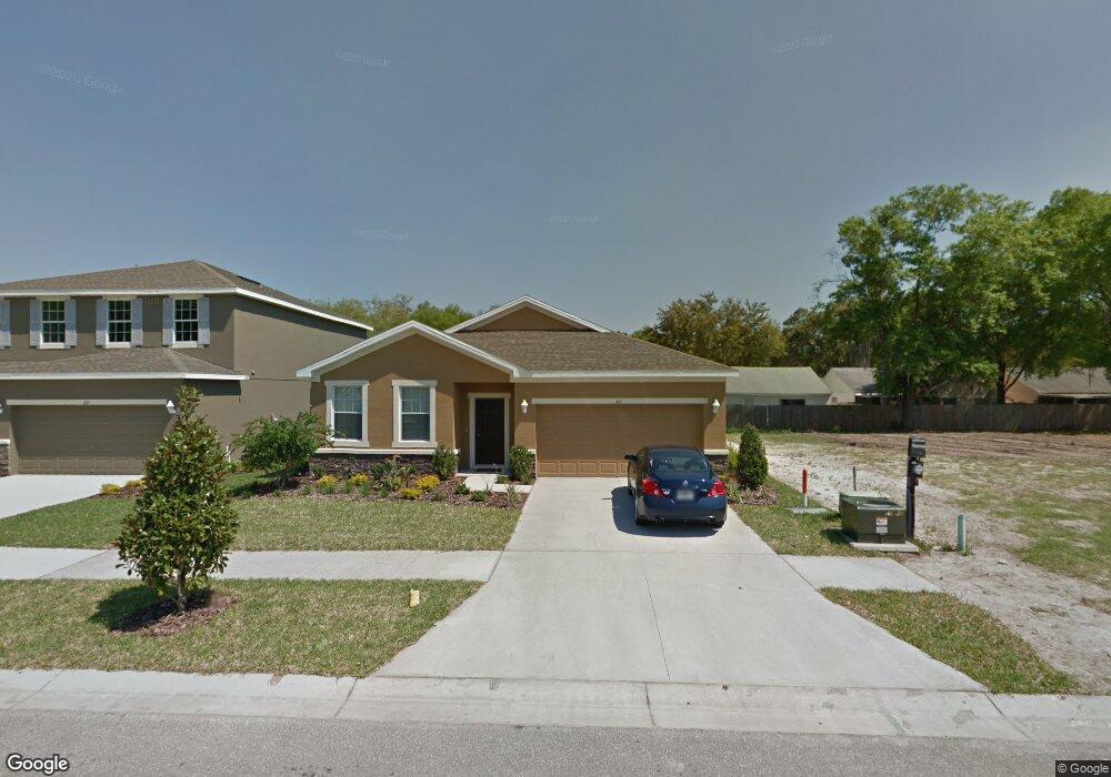
641 Breezeway Ct Brandon, FL 33511
Estimated Value: $362,814 - $387,000
3
Beds
2
Baths
2,400
Sq Ft
$158/Sq Ft
Est. Value
About This Home
This home is located at 641 Breezeway Ct, Brandon, FL 33511 and is currently estimated at $380,204, approximately $158 per square foot. 641 Breezeway Ct is a home located in Hillsborough County with nearby schools including Kingswood Elementary School, Rodgers Middle School, and Bloomingdale High School.
Ownership History
Date
Name
Owned For
Owner Type
Purchase Details
Closed on
Feb 18, 2011
Sold by
D R Horton Inc
Bought by
Mordecai Reubin
Current Estimated Value
Home Financials for this Owner
Home Financials are based on the most recent Mortgage that was taken out on this home.
Original Mortgage
$179,761
Outstanding Balance
$116,431
Interest Rate
3.99%
Mortgage Type
FHA
Estimated Equity
$263,773
Purchase Details
Closed on
Jul 20, 2010
Sold by
Kings Gate Development Llc
Bought by
D R Horton Inc
Create a Home Valuation Report for This Property
The Home Valuation Report is an in-depth analysis detailing your home's value as well as a comparison with similar homes in the area
Home Values in the Area
Average Home Value in this Area
Purchase History
| Date | Buyer | Sale Price | Title Company |
|---|---|---|---|
| Mordecai Reubin | $184,438 | Dhi Title Of Florida Inc | |
| D R Horton Inc | $210,000 | Attorney |
Source: Public Records
Mortgage History
| Date | Status | Borrower | Loan Amount |
|---|---|---|---|
| Open | Mordecai Reubin | $179,761 |
Source: Public Records
Tax History
| Year | Tax Paid | Tax Assessment Tax Assessment Total Assessment is a certain percentage of the fair market value that is determined by local assessors to be the total taxable value of land and additions on the property. | Land | Improvement |
|---|---|---|---|---|
| 2025 | $3,408 | $183,019 | -- | -- |
| 2024 | $3,408 | $177,861 | -- | -- |
| 2023 | $3,285 | $172,681 | $0 | $0 |
| 2022 | $3,238 | $167,651 | $0 | $0 |
| 2021 | $3,148 | $162,768 | $0 | $0 |
| 2020 | $3,063 | $160,521 | $0 | $0 |
| 2019 | $2,966 | $156,912 | $0 | $0 |
| 2018 | $2,913 | $153,986 | $0 | $0 |
| 2017 | $2,874 | $156,059 | $0 | $0 |
| 2016 | $2,809 | $147,717 | $0 | $0 |
| 2015 | $2,834 | $146,690 | $0 | $0 |
| 2014 | $2,801 | $145,526 | $0 | $0 |
| 2013 | -- | $131,969 | $0 | $0 |
Source: Public Records
Map
Nearby Homes
- 607 Center Ave
- 651 Breezeway Ct
- 4104 Maywood Dr
- 212 Excalibur Ct
- 4234 Alafia Blvd
- 645 Pine Forest Dr
- 821 Lucent Sands Ct
- 4162 Alafia Blvd
- 3829 Rippaso Place
- 291 Mossy River Ct
- 3801 Southview Dr
- 1204 Davies Rd
- 3806 Pinedale St
- 3727 Coppertree Cir
- 0 Revels Rd
- 3908 Alafia Blvd
- 931 Estelle Ave
- 6924 Valrie Ln
- 6906 Valrie Ln
- 3602 Southview Ct
- 643 Breezeway Ct
- 639 Breezeway Ct
- 645 Breezeway Ct
- 637 Breezeway Ct
- 4061 Forecast Dr
- 4063 Forecast Dr
- 4059 Forecast Dr
- 4065 Forecast Dr Unit 6
- 4057 Forecast Dr
- 647 Breezeway Ct
- 635 Breezeway Ct
- 642 Breezeway Ct
- 4067 Forecast Dr
- 640 Breezeway Ct
- 602 Center Ave
- 4055 Forecast Dr
- 636 Breezeway Ct
- 649 Breezeway Ct
- 633 Breezeway Ct
- 4069 Forecast Dr
Your Personal Tour Guide
Ask me questions while you tour the home.