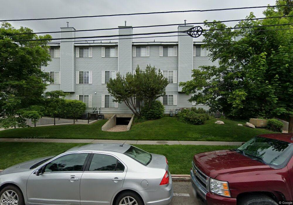
642 N 200 E Provo, UT 84606
Joaquin NeighborhoodEstimated Value: $446,000 - $510,000
4
Beds
1
Bath
1,256
Sq Ft
$372/Sq Ft
Est. Value
About This Home
This home is located at 642 N 200 E, Provo, UT 84606 and is currently estimated at $467,200, approximately $371 per square foot. 642 N 200 E is a home located in Utah County with nearby schools including Provo Peaks School, Centennial Middle School, and Timpview High School.
Ownership History
Date
Name
Owned For
Owner Type
Purchase Details
Closed on
Jan 30, 2019
Sold by
Redhawk Properties Llc
Bought by
Riverstone Llc
Current Estimated Value
Purchase Details
Closed on
Oct 22, 2012
Sold by
Driscoll Frank S and Driscoll Evelyn M
Bought by
Hawkins Gerald W
Home Financials for this Owner
Home Financials are based on the most recent Mortgage that was taken out on this home.
Original Mortgage
$161,625
Interest Rate
3.55%
Mortgage Type
New Conventional
Purchase Details
Closed on
Sep 24, 2012
Sold by
Hawkins Gerald M
Bought by
Redhawk Properties Llc and Mountain Hawk Holdings Llc
Home Financials for this Owner
Home Financials are based on the most recent Mortgage that was taken out on this home.
Original Mortgage
$161,625
Interest Rate
3.55%
Mortgage Type
New Conventional
Purchase Details
Closed on
May 1, 2008
Sold by
Driscoll Frank S and Driscoll Evelyn M
Bought by
Driscoll Frank S and Driscoll Evelyn M
Create a Home Valuation Report for This Property
The Home Valuation Report is an in-depth analysis detailing your home's value as well as a comparison with similar homes in the area
Home Values in the Area
Average Home Value in this Area
Purchase History
| Date | Buyer | Sale Price | Title Company |
|---|---|---|---|
| Riverstone Llc | -- | Us Title Insurance Agency | |
| Hawkins Gerald W | -- | Cornerstone Title Ins Agency | |
| Redhawk Properties Llc | -- | Cornerstone Title Insurance | |
| Hawkins Gerald W | -- | Cornerstone Title Insruance | |
| Driscoll Frank S | -- | None Available |
Source: Public Records
Mortgage History
| Date | Status | Borrower | Loan Amount |
|---|---|---|---|
| Previous Owner | Hawkins Gerald W | $161,625 |
Source: Public Records
Tax History
| Year | Tax Paid | Tax Assessment Tax Assessment Total Assessment is a certain percentage of the fair market value that is determined by local assessors to be the total taxable value of land and additions on the property. | Land | Improvement |
|---|---|---|---|---|
| 2025 | $2,259 | $229,295 | -- | -- |
| 2024 | $2,259 | $222,365 | $0 | $0 |
| 2023 | $2,245 | $217,855 | $0 | $0 |
| 2022 | $2,374 | $232,320 | $0 | $0 |
| 2021 | $1,996 | $340,700 | $40,900 | $299,800 |
| 2020 | $1,969 | $315,000 | $37,800 | $277,200 |
| 2019 | $1,714 | $285,100 | $32,000 | $253,100 |
| 2018 | $1,565 | $264,000 | $32,000 | $232,000 |
| 2017 | $1,424 | $132,000 | $0 | $0 |
| 2016 | $1,413 | $122,100 | $0 | $0 |
| 2015 | $1,322 | $115,500 | $0 | $0 |
| 2014 | $1,160 | $105,600 | $0 | $0 |
Source: Public Records
Map
Nearby Homes
- 466 N 200 E
- 433 N 300 E
- 232 E 400 N
- 380 N 200 E
- 394 N 300 E
- 136 E 400 N Unit 108
- 639 N University Ave Unit 10
- 513 E 700 N
- 36 W 700 N Unit 206
- 541 E 500 N Unit 12
- 620 N 100 St W
- 567 N University Ave Unit 209
- 232 E 300 N
- 386 N 500 E
- 246 N 200 E
- 364 N 500 E
- 261 N 400 E Unit 301
- 194 N 100 E
- 240 N 500 East St
- 250 N 100 W Unit 109
Your Personal Tour Guide
Ask me questions while you tour the home.