Estimated Value: $256,065 - $300,000
--
Bed
2
Baths
1,200
Sq Ft
$227/Sq Ft
Est. Value
About This Home
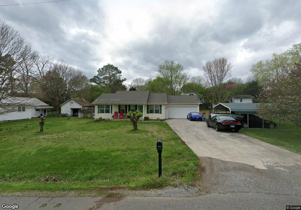
This home is located at 642 N Burn Rd, Niota, TN 37826 and is currently estimated at $272,016, approximately $226 per square foot. 642 N Burn Rd is a home located in McMinn County.
Ownership History
Date
Name
Owned For
Owner Type
Purchase Details
Closed on
May 6, 2003
Sold by
Pmi Mortgage Insurance
Bought by
Amaya Carlos A
Current Estimated Value
Home Financials for this Owner
Home Financials are based on the most recent Mortgage that was taken out on this home.
Original Mortgage
$75,000
Outstanding Balance
$32,480
Interest Rate
5.86%
Estimated Equity
$239,536
Purchase Details
Closed on
Nov 5, 2002
Bought by
Pmi Mortgage Insurance Co
Purchase Details
Closed on
May 18, 2002
Sold by
Larry Mcdaniels
Bought by
Novastar Mortgage Inc
Purchase Details
Closed on
Mar 3, 2000
Bought by
Mcdaniels Larry L and Mcdaniels Darlene
Purchase Details
Closed on
Feb 23, 1999
Bought by
Cook Dale and Cook Helen
Purchase Details
Closed on
Apr 30, 1993
Bought by
Peak Gordon and Peak Catherine
Create a Home Valuation Report for This Property
The Home Valuation Report is an in-depth analysis detailing your home's value as well as a comparison with similar homes in the area
Home Values in the Area
Average Home Value in this Area
Purchase History
| Date | Buyer | Sale Price | Title Company |
|---|---|---|---|
| Amaya Carlos A | $75,000 | -- | |
| Pmi Mortgage Insurance Co | $88,700 | -- | |
| Novastar Mortgage Inc | $75,600 | -- | |
| Mcdaniels Larry L | $83,000 | -- | |
| Cook Dale | $10,000 | -- | |
| Peak Gordon | -- | -- |
Source: Public Records
Mortgage History
| Date | Status | Borrower | Loan Amount |
|---|---|---|---|
| Open | Peak Gordon | $75,000 |
Source: Public Records
Tax History Compared to Growth
Tax History
| Year | Tax Paid | Tax Assessment Tax Assessment Total Assessment is a certain percentage of the fair market value that is determined by local assessors to be the total taxable value of land and additions on the property. | Land | Improvement |
|---|---|---|---|---|
| 2025 | $924 | $47,850 | $0 | $0 |
| 2024 | $924 | $47,450 | $7,650 | $39,800 |
| 2023 | $924 | $47,450 | $7,650 | $39,800 |
| 2022 | $827 | $27,975 | $2,375 | $25,600 |
| 2021 | $772 | $27,975 | $2,375 | $25,600 |
| 2020 | $772 | $27,975 | $2,375 | $25,600 |
| 2019 | $772 | $27,975 | $2,375 | $25,600 |
| 2018 | $716 | $27,975 | $2,375 | $25,600 |
| 2017 | $637 | $24,200 | $1,775 | $22,425 |
| 2016 | $637 | $24,200 | $1,775 | $22,425 |
| 2015 | -- | $24,200 | $1,775 | $22,425 |
| 2014 | $637 | $24,199 | $0 | $0 |
Source: Public Records
Map
Nearby Homes
- 612 Pond Hill Rd
- 307 N Burn Rd
- 216 Crescent Cir
- 220 Crescent Cir
- 224 Crescent Cir
- 228 Crescent Cir
- 232 Crescent Cir
- 236 Crescent Cir
- Aria Plan at Crescent Ridge
- Cali Plan at Crescent Ridge
- Lewis Plan at Crescent Ridge
- Sullivan Plan at Crescent Ridge
- Belhaven Plan at Crescent Ridge
- Wyeth Plan at Crescent Ridge
- Freeport Plan at Crescent Ridge
- Penwell Plan at Crescent Ridge
- Curtis Plan at Crescent Ridge
- 273 Crescent Cir
- 258 Highway 309
- 148 Crescent Cir
- 702 N Burn Rd
- 602 N Burn Rd
- 609 N Burn Rd
- 706 N Burn Rd
- 205 Pond Hill Rd
- 301 Pond Hill Rd
- 810 N Burn Rd
- 507 N Burn Rd
- 816 N Burn Rd
- 429 N Burn Rd
- 0 Pond Hill Rd Lot Unit 5 1058740
- 0 Pond Hill Rd Lot Unit 7 1058738
- 0 Pond Hill Rd Lot Unit 2
- 0 Pond Hill Rd Lot # 2
- 430 N Burn Rd
- 845 N Burn Rd
- 902 N Burn Rd
- 0 Pond Hill Rd Lot # 5
- 406 Pond Hill Rd
- 4 Country Club Rd