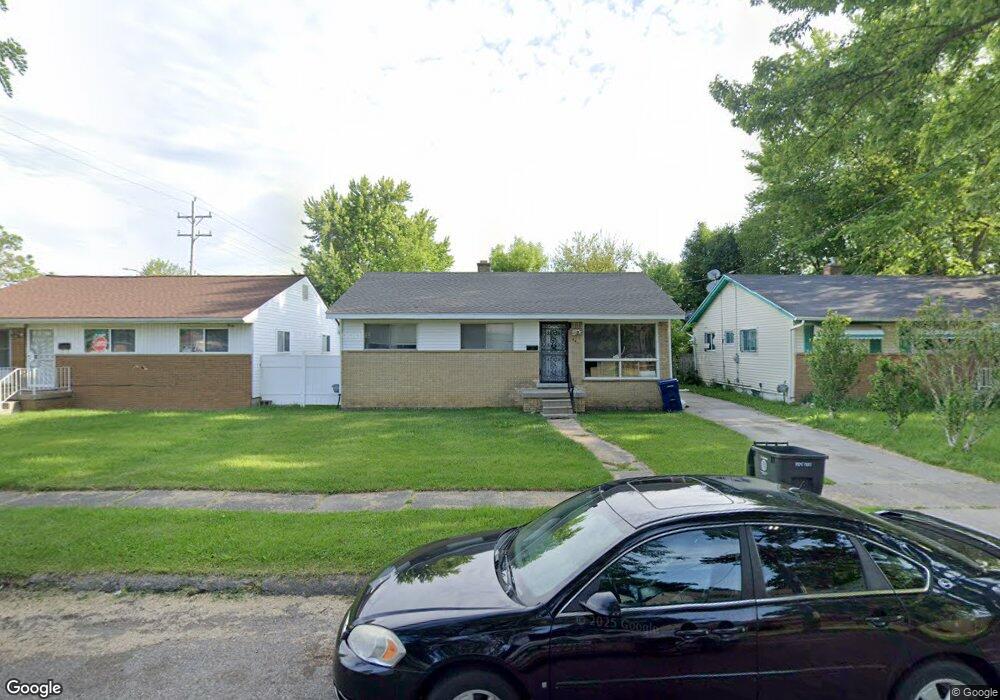
642 W Foss Ave Flint, MI 48505
MLK Circle NeighborhoodEstimated Value: $32,000 - $74,000
3
Beds
2
Baths
1,044
Sq Ft
$49/Sq Ft
Est. Value
About This Home
This home is located at 642 W Foss Ave, Flint, MI 48505 and is currently estimated at $51,223, approximately $49 per square foot. 642 W Foss Ave is a home located in Genesee County with nearby schools including Brownell STEM Academy, The New Standard Academy, and Eagle's Nest Academy.
Ownership History
Date
Name
Owned For
Owner Type
Purchase Details
Closed on
Jul 19, 2018
Sold by
Genesee County Land Bank Authority
Bought by
Player Torreano Da Wquntae
Current Estimated Value
Purchase Details
Closed on
Feb 24, 2016
Sold by
The Genesee County Land Bank Authority
Bought by
Player Torreano Da Quntae
Purchase Details
Closed on
Dec 17, 2015
Sold by
Genesee County
Bought by
Genesee County Land Bank
Purchase Details
Closed on
Feb 5, 2011
Sold by
Player Johnnie and Gloster Player Patricia
Bought by
Player Torreano
Purchase Details
Closed on
Feb 4, 2011
Sold by
Berry Evon
Bought by
Gloster Player Johnnie and Gloster Player Patricia
Create a Home Valuation Report for This Property
The Home Valuation Report is an in-depth analysis detailing your home's value as well as a comparison with similar homes in the area
Home Values in the Area
Average Home Value in this Area
Purchase History
| Date | Buyer | Sale Price | Title Company |
|---|---|---|---|
| Player Torreano Da Wquntae | $3,500 | None Available | |
| Player Torreano Da Quntae | $3,500 | None Available | |
| Genesee County Land Bank | -- | None Available | |
| Player Torreano | -- | None Available | |
| Gloster Player Johnnie | -- | None Available |
Source: Public Records
Mortgage History
| Date | Status | Borrower | Loan Amount |
|---|---|---|---|
| Closed | Player Torreano Da Quntae | $0 |
Source: Public Records
Tax History Compared to Growth
Tax History
| Year | Tax Paid | Tax Assessment Tax Assessment Total Assessment is a certain percentage of the fair market value that is determined by local assessors to be the total taxable value of land and additions on the property. | Land | Improvement |
|---|---|---|---|---|
| 2025 | $677 | $14,600 | $0 | $0 |
| 2024 | $624 | $11,800 | $0 | $0 |
| 2023 | $619 | $9,300 | $0 | $0 |
| 2022 | $0 | $7,100 | $0 | $0 |
| 2021 | $636 | $7,200 | $0 | $0 |
| 2020 | $585 | $6,700 | $0 | $0 |
| 2019 | $583 | $6,700 | $0 | $0 |
| 2018 | $567 | $6,700 | $0 | $0 |
| 2017 | $566 | $0 | $0 | $0 |
| 2016 | $221 | $0 | $0 | $0 |
| 2015 | -- | $0 | $0 | $0 |
| 2014 | -- | $0 | $0 | $0 |
| 2012 | -- | $9,200 | $0 | $0 |
Source: Public Records
Map
Nearby Homes
- 6610 Cranwood Dr
- 6702 Cranwood Dr
- 614 W Holbrook Ave
- 613 W Foss Ave
- 605 W Foss Ave
- 618 W Austin Ave
- 610 W Austin Ave
- 525 W Bundy Ave
- 405 W Bundy Ave
- 6902 Sally Ct
- 1015 W Carpenter Rd
- 536 W Home Ave
- 6628 Orange Ln
- 1499 W Juliah Ave
- 1377 Knickerbocker Ave
- 5714 Suburban Ct
- 5610 Baldwin Blvd
- 242 E Foss Ave
- 225 E Piper Ave
- 1605 Barbara Dr
- 638 W Foss Ave
- 646 W Foss Ave
- 641 W Holbrook Ave
- 637 W Holbrook Ave
- 645 W Holbrook Ave
- 633 W Holbrook Ave
- 618 W Foss Ave
- 641 W Foss Ave
- 6514 Dupont St
- 633 W Foss Ave
- 629 W Holbrook Ave
- 616 W Foss Ave
- 629 W Foss Ave
- 6605 Dupont St
- 6609 Dupont St
- 637 W Foss Ave
- 6601 Dupont St
- 625 W Holbrook Ave
- 6613 Dupont St
- 6529 Dupont St