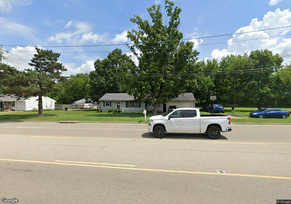
6420 State Route 123 Franklin, OH 45005
Estimated Value: $182,000 - $205,925
2
Beds
1
Bath
1,176
Sq Ft
$166/Sq Ft
Est. Value
About This Home
This home is located at 6420 State Route 123, Franklin, OH 45005 and is currently estimated at $195,231, approximately $166 per square foot. 6420 State Route 123 is a home located in Warren County with nearby schools including Franklin High School.
Ownership History
Date
Name
Owned For
Owner Type
Purchase Details
Closed on
Mar 19, 2021
Sold by
Levangie Michael E
Bought by
Lutsch Cassandra
Current Estimated Value
Home Financials for this Owner
Home Financials are based on the most recent Mortgage that was taken out on this home.
Original Mortgage
$126,172
Outstanding Balance
$113,104
Interest Rate
2.7%
Mortgage Type
FHA
Estimated Equity
$82,127
Purchase Details
Closed on
Mar 1, 2013
Sold by
Jpmorgan Chase Bank Na
Bought by
Levangie Michael E
Purchase Details
Closed on
Jun 3, 1988
Sold by
Ivy Brandenburg and Ivy D.
Bought by
Duibley Duibley and Duibley Anthony G
Create a Home Valuation Report for This Property
The Home Valuation Report is an in-depth analysis detailing your home's value as well as a comparison with similar homes in the area
Home Values in the Area
Average Home Value in this Area
Purchase History
| Date | Buyer | Sale Price | Title Company |
|---|---|---|---|
| Lutsch Cassandra | $128,500 | Home Services Title Llc | |
| Levangie Michael E | $38,000 | Fidelity Land Title | |
| Duibley Duibley | $55,000 | -- |
Source: Public Records
Mortgage History
| Date | Status | Borrower | Loan Amount |
|---|---|---|---|
| Open | Lutsch Cassandra | $126,172 |
Source: Public Records
Tax History Compared to Growth
Tax History
| Year | Tax Paid | Tax Assessment Tax Assessment Total Assessment is a certain percentage of the fair market value that is determined by local assessors to be the total taxable value of land and additions on the property. | Land | Improvement |
|---|---|---|---|---|
| 2024 | $2,530 | $53,790 | $17,970 | $35,820 |
| 2023 | $2,069 | $39,441 | $10,979 | $28,462 |
| 2022 | $2,029 | $39,442 | $10,980 | $28,462 |
| 2021 | $1,965 | $39,442 | $10,980 | $28,462 |
| 2020 | $2,026 | $35,858 | $9,982 | $25,876 |
| 2019 | $1,846 | $35,858 | $9,982 | $25,876 |
| 2018 | $1,822 | $35,858 | $9,982 | $25,876 |
| 2017 | $1,950 | $34,587 | $9,765 | $24,822 |
| 2016 | $1,988 | $34,587 | $9,765 | $24,822 |
| 2015 | $1,988 | $34,587 | $9,765 | $24,822 |
| 2014 | $989 | $33,580 | $9,480 | $24,100 |
| 2013 | $1,686 | $35,340 | $9,980 | $25,360 |
Source: Public Records
Map
Nearby Homes
- 206 Meadow Dr
- 200 Meadow Dr
- 22 Green Meadow Ct
- 191 Lakeview Dr
- 6 Beal Rd
- 0 Kathy Ln Unit 1834240
- 0 Kathy Ln Unit 930066
- 187 Minnick St
- 25 Timber Creek Dr
- 16 Harding Ct
- 60 Pleasant Hill Blvd
- 5756 Union Rd
- 995 E 4th St
- 220 Pleasant Hill Blvd
- 779 Martha Dr
- 218 Roberts Ave
- 388 Thomas Dr
- 452 Greenup Ct
- 445 Beam Dr
- 441 Sunnybrook Dr
- 6420 Franklin Lebanon Rd
- 6430 Ohio 123
- 6430 State Route 123
- 6428 State Route 123
- 6436 State Route 123
- 6440 State Route 123
- 6440 Ohio 123
- 4640 Beal Rd
- 4620 Beal Rd
- 6490 State Route 123
- 6500 State Route 123
- 4643 Beal Rd
- 6510 State Route 123
- 6510 Ohio 123
- 4619 Beal Rd
- 101 Scholl Rd
- 6540 State Route 123
- 121 Scholl Rd
- 141 Scholl Rd
- 161 Scholl Rd