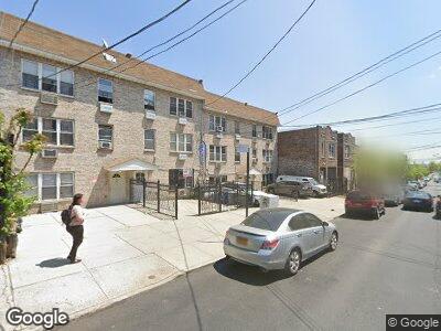
642A Manida St Unit 3 Bronx, NY 10474
Hunts Point NeighborhoodEstimated Value: $915,000 - $1,257,000
3
Beds
2
Baths
3,120
Sq Ft
$343/Sq Ft
Est. Value
About This Home
This home is located at 642A Manida St Unit 3, Bronx, NY 10474 and is currently estimated at $1,071,667, approximately $343 per square foot. 642A Manida St Unit 3 is a home located in Bronx County with nearby schools including P.S. 48 - Joseph R. Drake, Bronx Academy for Multi-Media, and Leaders In Our Neighborhood Charter School.
Ownership History
Date
Name
Owned For
Owner Type
Purchase Details
Closed on
Feb 24, 2014
Sold by
Diaz Joanny M and Tapia Maria C
Bought by
Tapia Edgar G and Tapia Maria C
Current Estimated Value
Home Financials for this Owner
Home Financials are based on the most recent Mortgage that was taken out on this home.
Original Mortgage
$374,700
Interest Rate
4.25%
Mortgage Type
New Conventional
Purchase Details
Closed on
Sep 21, 2004
Sold by
Jen Development Llc
Bought by
Diaz Joanny M and Uzhca Maria C
Home Financials for this Owner
Home Financials are based on the most recent Mortgage that was taken out on this home.
Original Mortgage
$455,918
Interest Rate
5.84%
Mortgage Type
Purchase Money Mortgage
Create a Home Valuation Report for This Property
The Home Valuation Report is an in-depth analysis detailing your home's value as well as a comparison with similar homes in the area
Home Values in the Area
Average Home Value in this Area
Purchase History
| Date | Buyer | Sale Price | Title Company |
|---|---|---|---|
| Tapia Edgar G | -- | -- | |
| Tapia Edgar G | -- | -- | |
| Diaz Joanny M | $475,000 | -- | |
| Diaz Joanny M | $475,000 | -- |
Source: Public Records
Mortgage History
| Date | Status | Borrower | Loan Amount |
|---|---|---|---|
| Open | Tapia Edgar G | $700,000 | |
| Closed | Tapia Edgar G | $374,700 | |
| Previous Owner | Diaz Joannt M | $16,775 | |
| Previous Owner | Diaz Joanny M | $455,918 |
Source: Public Records
Tax History Compared to Growth
Tax History
| Year | Tax Paid | Tax Assessment Tax Assessment Total Assessment is a certain percentage of the fair market value that is determined by local assessors to be the total taxable value of land and additions on the property. | Land | Improvement |
|---|---|---|---|---|
| 2025 | $7,360 | $38,844 | $6,647 | $32,197 |
| 2024 | $7,360 | $36,646 | $5,684 | $30,962 |
| 2023 | $7,021 | $34,572 | $5,755 | $28,817 |
| 2022 | $6,511 | $47,100 | $8,460 | $38,640 |
| 2021 | $6,864 | $43,740 | $8,460 | $35,280 |
| 2020 | $5,624 | $46,680 | $8,460 | $38,220 |
| 2019 | $4,115 | $38,280 | $8,460 | $29,820 |
| 2018 | $2,762 | $28,810 | $7,650 | $21,160 |
| 2017 | $1,658 | $27,180 | $8,460 | $18,720 |
| 2016 | $675 | $31,752 | $8,400 | $23,352 |
| 2015 | $461 | $30,660 | $9,420 | $21,240 |
| 2014 | $461 | $30,300 | $9,420 | $20,880 |
Source: Public Records
Map
Nearby Homes
- 645 Barretto St Unit 3G
- 631 Coster St
- 633 Barretto St
- 664 Manida St
- 526 Barretto St
- 1290 Lafayette Ave Unit 5F
- 1321 Lafayette Ave
- 890 Faile St
- 849 Southern Blvd
- 814 Fox St
- 811 Fox St Unit 4B
- 1027 Leggett Ave Unit 1D
- 715 Fox St Unit 5J
- 715 Fox St Unit 4G
- 950 Hoe Ave Unit 4C
- 776 Hewitt Place
- 1012 Faile St Unit 1012A
- 919 Avenue Saint John
- 1030 Longfellow Ave
- 1032 Longfellow Ave
