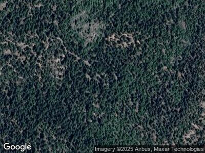
645 Coyote Ridge Ct Emigrant Gap, CA 95715
Estimated Value: $158,000 - $211,808
1
Bed
1
Bath
639
Sq Ft
$282/Sq Ft
Est. Value
About This Home
This home is located at 645 Coyote Ridge Ct, Emigrant Gap, CA 95715 and is currently estimated at $180,269, approximately $282 per square foot. 645 Coyote Ridge Ct is a home with nearby schools including Alta-Dutch Flat Elementary School and Colfax High School.
Ownership History
Date
Name
Owned For
Owner Type
Purchase Details
Closed on
Jun 15, 2000
Sold by
Cook Daryl L & Phyllis Trustees
Bought by
French Ryan T Bernard and French Ryan Laura
Current Estimated Value
Purchase Details
Closed on
Dec 22, 1997
Sold by
Bernstein Suzi
Bought by
The Cook Family Trust
Purchase Details
Closed on
Sep 28, 1995
Sold by
Cook Daryl L and Cook Phyllis
Bought by
Bernstein Suzi
Home Financials for this Owner
Home Financials are based on the most recent Mortgage that was taken out on this home.
Original Mortgage
$55,000
Interest Rate
7.67%
Mortgage Type
Seller Take Back
Create a Home Valuation Report for This Property
The Home Valuation Report is an in-depth analysis detailing your home's value as well as a comparison with similar homes in the area
Home Values in the Area
Average Home Value in this Area
Purchase History
| Date | Buyer | Sale Price | Title Company |
|---|---|---|---|
| French Ryan T Bernard | $49,500 | Placer Title Company | |
| The Cook Family Trust | $58,433 | Placer Title Company | |
| Bernstein Suzi | $60,000 | Old Republic Title |
Source: Public Records
Mortgage History
| Date | Status | Borrower | Loan Amount |
|---|---|---|---|
| Previous Owner | Bernstein Suzi | $55,000 |
Source: Public Records
Tax History Compared to Growth
Tax History
| Year | Tax Paid | Tax Assessment Tax Assessment Total Assessment is a certain percentage of the fair market value that is determined by local assessors to be the total taxable value of land and additions on the property. | Land | Improvement |
|---|---|---|---|---|
| 2023 | $895 | $73,101 | $51,693 | $21,408 |
| 2022 | $864 | $71,669 | $50,680 | $20,989 |
| 2021 | $845 | $70,265 | $49,687 | $20,578 |
| 2020 | $835 | $69,545 | $49,178 | $20,367 |
| 2019 | $818 | $68,182 | $48,214 | $19,968 |
| 2018 | $790 | $66,846 | $47,269 | $19,577 |
| 2017 | $775 | $65,537 | $46,343 | $19,194 |
| 2016 | $759 | $64,253 | $45,435 | $18,818 |
| 2015 | $740 | $63,289 | $44,753 | $18,536 |
| 2014 | $728 | $62,050 | $43,877 | $18,173 |
Source: Public Records
Map
Nearby Homes
- 1 Emigrant Gap Rd
- 41855 Nyack Rd
- 0 Skyline Dr Unit 224073608
- 0 Last Chance Mine Rd Unit 224130169
- 16352 Last Chance Mine Rd
- 12664 Last Chance Mine Rd
- 10671 Lowell Hill Rd
- 38787 Kearsarge Mill Rd
- 0 Railfence Rd Unit 225056391
- 0 Culberson Rd Unit 224093567
- 0 Culberson Rd Unit 224086156
- 850 Sugar Pine Rd
- 12422 Alpha Loop
- 500 Lee Rd
- 0000 Hampshire Rocks Rd
- 13393 Placer Ln
- 34460 Alta Bonnynook Rd
- 31004 Relief Hill Rd Unit 3
- 31004 Relief Hill Rd Unit 6
- 34282 E Towle Rd
