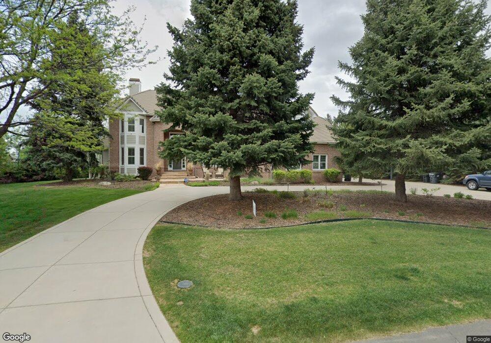
645 Front Range Rd Littleton, CO 80120
Heritage NeighborhoodEstimated Value: $2,134,000 - $3,004,000
4
Beds
6
Baths
5,200
Sq Ft
$504/Sq Ft
Est. Value
About This Home
This home is located at 645 Front Range Rd, Littleton, CO 80120 and is currently estimated at $2,622,938, approximately $504 per square foot. 645 Front Range Rd is a home located in Arapahoe County with nearby schools including Runyon Elementary School, Euclid Middle School, and Heritage High School.
Ownership History
Date
Name
Owned For
Owner Type
Purchase Details
Closed on
Oct 19, 2006
Sold by
Merrill Ronald B and Merrill Karen
Bought by
Heringer Kevin G and Heringer Jill E
Current Estimated Value
Home Financials for this Owner
Home Financials are based on the most recent Mortgage that was taken out on this home.
Original Mortgage
$775,000
Outstanding Balance
$452,946
Interest Rate
6.37%
Mortgage Type
Purchase Money Mortgage
Estimated Equity
$2,169,992
Purchase Details
Closed on
Mar 2, 1993
Sold by
Tradition Concepts Inc
Bought by
Merrill Karen Merrill Ronald B
Purchase Details
Closed on
May 8, 1992
Sold by
Conversion Arapco
Bought by
Tradition Concepts Inc
Purchase Details
Closed on
May 1, 1981
Sold by
Conversion Arapco
Bought by
Conversion Arapco
Purchase Details
Closed on
Jul 4, 1776
Bought by
Conversion Arapco
Create a Home Valuation Report for This Property
The Home Valuation Report is an in-depth analysis detailing your home's value as well as a comparison with similar homes in the area
Home Values in the Area
Average Home Value in this Area
Purchase History
| Date | Buyer | Sale Price | Title Company |
|---|---|---|---|
| Heringer Kevin G | $1,250,000 | Land Title | |
| Merrill Karen Merrill Ronald B | -- | -- | |
| Tradition Concepts Inc | -- | -- | |
| Conversion Arapco | -- | -- | |
| Conversion Arapco | -- | -- |
Source: Public Records
Mortgage History
| Date | Status | Borrower | Loan Amount |
|---|---|---|---|
| Open | Heringer Kevin G | $775,000 |
Source: Public Records
Tax History
| Year | Tax Paid | Tax Assessment Tax Assessment Total Assessment is a certain percentage of the fair market value that is determined by local assessors to be the total taxable value of land and additions on the property. | Land | Improvement |
|---|---|---|---|---|
| 2025 | $20,138 | $186,500 | -- | -- |
| 2024 | $18,832 | $196,940 | -- | -- |
| 2023 | $18,832 | $196,940 | $0 | $0 |
| 2022 | $12,357 | $121,709 | $0 | $0 |
| 2021 | $12,322 | $121,709 | $0 | $0 |
| 2020 | $12,324 | $125,254 | $0 | $0 |
| 2019 | $11,594 | $125,254 | $0 | $0 |
| 2018 | $10,193 | $117,043 | $0 | $0 |
| 2017 | $9,445 | $117,043 | $0 | $0 |
| 2016 | $10,122 | $120,514 | $0 | $0 |
| 2015 | $10,148 | $120,514 | $0 | $0 |
| 2014 | -- | $76,678 | $0 | $0 |
| 2013 | -- | $77,660 | $0 | $0 |
Source: Public Records
Map
Nearby Homes
- 7019 S Windermere St
- 7604 S Datura Cir W
- 1148 W Hinsdale Dr
- 7252 S Costilla St
- 7265 S Sundown Cir
- 6852 S Greenwood St
- 6710 S Foresthill St
- 7290 S Sundown Cir
- 2805 W Davies Dr
- 7132 S Bryant St Unit 232
- 7132 S Bryant St Unit 231
- 2002 W Ridge Rd
- 2480 W Jamison Way
- 6521 S Cedar St
- 7475 S Houstoun Waring Cir
- 7120 S Clay St
- 6483 S Sycamore St
- 7945 S Elati Cir
- 7751 S Curtice Dr Unit F
- 2783 W Long Dr Unit B
- 635 Front Range Rd
- 655 Front Range Rd
- 605 Front Range Rd
- 600 Front Range Rd
- 705 Front Range Rd
- 620 Front Range Rd
- 555 Front Range Rd
- 580 Front Range Rd
- 570 Front Range Rd
- 502 Shadycroft Ln
- 602 Shadycroft Ln
- 745 Front Range Rd
- 400 Shadycroft Ln
- 501 Shadycroft Ln
- 702 Shadycroft Ln
- 640 Front Range Rd
- 590 Front Range Rd
- 7109 S Windermere St
- 660 Front Range Rd
- 601 Shadycroft Ln
Your Personal Tour Guide
Ask me questions while you tour the home.