Estimated Value: $301,000 - $317,000
3
Beds
3
Baths
1,680
Sq Ft
$182/Sq Ft
Est. Value
About This Home
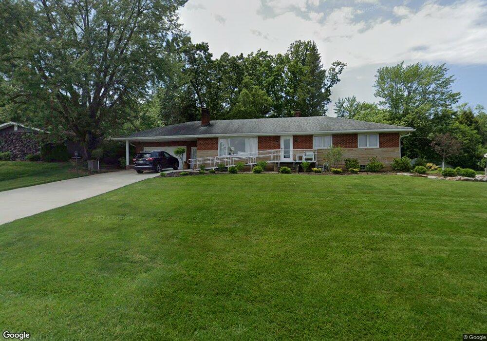
This home is located at 646 Moorfield Rd, Akron, OH 44333 and is currently estimated at $306,384, approximately $182 per square foot. 646 Moorfield Rd is a home located in Summit County with nearby schools including Copley-Fairlawn Middle School, Copley High School, and Fairlawn Lutheran School.
Ownership History
Date
Name
Owned For
Owner Type
Purchase Details
Closed on
Jul 2, 2020
Sold by
Morrison Nancy J
Bought by
Nancy J Morrison Trust
Current Estimated Value
Purchase Details
Closed on
Jun 25, 2020
Sold by
Morrison Nancy J
Bought by
Morrison Nancy J and The Nancy J Morrison Trust
Purchase Details
Closed on
Oct 10, 2007
Sold by
Frey Karen M
Bought by
Morrison Nancy J
Home Financials for this Owner
Home Financials are based on the most recent Mortgage that was taken out on this home.
Original Mortgage
$166,500
Interest Rate
6.49%
Mortgage Type
Purchase Money Mortgage
Purchase Details
Closed on
Mar 20, 2003
Sold by
Frey Janet E
Bought by
Frey Janet E and The Janet E Frey Revocable Trust
Create a Home Valuation Report for This Property
The Home Valuation Report is an in-depth analysis detailing your home's value as well as a comparison with similar homes in the area
Home Values in the Area
Average Home Value in this Area
Purchase History
| Date | Buyer | Sale Price | Title Company |
|---|---|---|---|
| Nancy J Morrison Trust | -- | None Listed On Document | |
| Morrison Nancy J | -- | None Available | |
| Morrison Nancy J | $166,500 | Lawyers Title Ins | |
| Frey Janet E | -- | -- |
Source: Public Records
Mortgage History
| Date | Status | Borrower | Loan Amount |
|---|---|---|---|
| Previous Owner | Morrison Nancy J | $166,500 |
Source: Public Records
Tax History Compared to Growth
Tax History
| Year | Tax Paid | Tax Assessment Tax Assessment Total Assessment is a certain percentage of the fair market value that is determined by local assessors to be the total taxable value of land and additions on the property. | Land | Improvement |
|---|---|---|---|---|
| 2025 | $3,483 | $87,564 | $20,913 | $66,651 |
| 2024 | $3,483 | $87,564 | $20,913 | $66,651 |
| 2023 | $3,483 | $87,564 | $20,913 | $66,651 |
| 2022 | $3,403 | $70,795 | $17,140 | $53,655 |
| 2021 | $3,197 | $70,795 | $17,140 | $53,655 |
| 2020 | $3,125 | $70,800 | $17,140 | $53,660 |
| 2019 | $2,458 | $49,620 | $18,410 | $31,210 |
| 2018 | $2,409 | $49,620 | $18,410 | $31,210 |
| 2017 | $2,567 | $49,620 | $18,410 | $31,210 |
| 2016 | $2,566 | $49,620 | $18,410 | $31,210 |
| 2015 | $2,567 | $49,620 | $18,410 | $31,210 |
| 2014 | $2,557 | $49,620 | $18,410 | $31,210 |
| 2013 | $2,551 | $49,620 | $18,410 | $31,210 |
Source: Public Records
Map
Nearby Homes
- 595 Moorfield Rd
- 2385 Covington Rd Unit 402
- 2375 Covington Rd Unit 311
- 2445 Chatham Rd
- 288 Kenridge Rd
- 2520 Holgate Rd
- 177 Caladonia Ave
- 342 S Miller Rd
- 135 Southwood Rd
- 2595 Sand Run Pkwy
- 320 Caladonia Ave
- 441 Sandhurst Rd
- 48 S Wheaton Rd
- 128 Overwood Rd
- 47 S Wheaton Rd
- 2239 Woodpark Rd
- 3081 Bancroft Rd
- 2267 Woodpark Rd
- 257 Sand Run Rd
- 3143 Morewood Rd
- 639 Moorfield Rd
- 658 Moorfield Rd
- 0 Moorfield Rd
- 668 Moorfield Rd
- 640 Hampshire Rd
- 664 Hampshire Rd
- 630 Moorfield Rd
- 630 Hampshire Rd
- 670 Hampshire Rd
- 622 Moorfield Rd
- 615 Moorfield Rd
- 616 Hampshire Rd
- 684 Hampshire Rd
- 606 Moorfield Rd
- 667 Hampshire Rd
- 655 Hampshire Rd
- 633 Hampshire Rd
- 673 Hampshire Rd
- 608 Hampshire Rd
- 627 Hampshire Rd