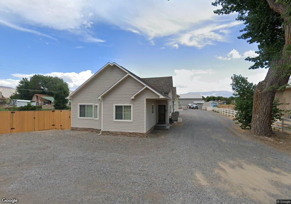
648 29 1/2 Rd Grand Junction, CO 81504
Northeast Grand Junction NeighborhoodEstimated Value: $541,000 - $659,296
4
Beds
3
Baths
2,560
Sq Ft
$241/Sq Ft
Est. Value
About This Home
This home is located at 648 29 1/2 Rd, Grand Junction, CO 81504 and is currently estimated at $617,574, approximately $241 per square foot. 648 29 1/2 Rd is a home located in Mesa County with nearby schools including Thunder Mountain Elementary School, Bookcliff Middle School, and Central High School.
Ownership History
Date
Name
Owned For
Owner Type
Purchase Details
Closed on
Apr 10, 2025
Sold by
Lobato Cameron A
Bought by
Cameron And Rachel Lobato Living Trust
Current Estimated Value
Purchase Details
Closed on
Mar 19, 2013
Sold by
Lobato Cameron A and Lobato Heidi R
Bought by
Lobato Cameron A
Purchase Details
Closed on
Jul 12, 2002
Sold by
Hower Donald L and Darlene Hower E
Bought by
Lobato Cameron A and Lobato Heidi R
Home Financials for this Owner
Home Financials are based on the most recent Mortgage that was taken out on this home.
Original Mortgage
$160,200
Interest Rate
6.76%
Purchase Details
Closed on
Aug 30, 1994
Sold by
Carver Randy
Bought by
Lobato Cameron A
Purchase Details
Closed on
Dec 16, 1991
Sold by
Morrill Earl E
Bought by
Lobato Cameron A
Create a Home Valuation Report for This Property
The Home Valuation Report is an in-depth analysis detailing your home's value as well as a comparison with similar homes in the area
Home Values in the Area
Average Home Value in this Area
Purchase History
| Date | Buyer | Sale Price | Title Company |
|---|---|---|---|
| Cameron And Rachel Lobato Living Trust | -- | None Listed On Document | |
| Lobato Cameron A | -- | None Available | |
| Lobato Cameron A | $178,000 | -- | |
| Lobato Cameron A | $94,900 | -- | |
| Lobato Cameron A | $65,000 | -- |
Source: Public Records
Mortgage History
| Date | Status | Borrower | Loan Amount |
|---|---|---|---|
| Previous Owner | Lobato Cameron A | $160,200 |
Source: Public Records
Tax History Compared to Growth
Tax History
| Year | Tax Paid | Tax Assessment Tax Assessment Total Assessment is a certain percentage of the fair market value that is determined by local assessors to be the total taxable value of land and additions on the property. | Land | Improvement |
|---|---|---|---|---|
| 2024 | $2,645 | $43,210 | $9,450 | $33,760 |
| 2023 | $2,645 | $35,230 | $9,280 | $25,950 |
| 2022 | $2,321 | $30,180 | $4,870 | $25,310 |
| 2021 | $2,266 | $31,050 | $5,010 | $26,040 |
| 2020 | $2,011 | $28,040 | $5,360 | $22,680 |
| 2019 | $1,840 | $28,040 | $5,360 | $22,680 |
| 2018 | $1,772 | $24,220 | $4,680 | $19,540 |
| 2017 | $1,741 | $29,690 | $4,680 | $25,010 |
| 2016 | $1,637 | $28,480 | $5,170 | $23,310 |
| 2015 | $1,401 | $21,590 | $5,170 | $16,420 |
| 2014 | $1,266 | $19,430 | $3,580 | $15,850 |
Source: Public Records
Map
Nearby Homes
- 2948 Joan Way
- 639 Mount Julian Dr
- 667 Cloverglen Dr
- 651 Springbrook Dr
- 670 Welig Ct
- 2961 Brookside Dr
- 2940 Braxton Ct
- 0 Tbd Unit 829372
- 623 Broken Spoke Rd
- 2919 Brodick Way
- 690 Arran Way Unit B
- 692 Arran Way Unit B
- 694 Arran Way Unit A
- 2949 Erika Rd
- 2923 Bonito Ave
- 648 Hudson Bay Ct
- 2990 1/2 Brookwood Dr
- 2916 Arabesque Dr
- 694 29 1 2 Rd
- 2925 Wagon Place
- 648 Long Peak Dr
- 648 Longs Peak Dr
- 646 Long Peak Dr
- 2948 Trinity Peaks Way
- 644 Long Peak Dr
- 654 29 1 2 Rd
- 2946 Trinity Peaks Way
- 654 29 1/2 Rd
- 642 Long Peak Dr
- 642 Longs Peak Dr
- 2948 F 1/2 Rd
- 649 Long Peak Dr
- 647 Long Peak Dr
- 647 Longs Peak Dr
- 2944 Trinity Peaks Way
- 644 1/2 29 1/2 Rd
- 0 Longs Peak Dr Unit 616893
- 0 Longs Peak Dr Unit 647474
- 657 29 1/2 Rd
- 2943 Trinity Peaks Way