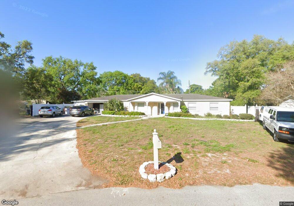
648 Marphil Loop Unit 2 Brandon, FL 33511
Estimated Value: $438,000 - $553,000
5
Beds
3
Baths
3,005
Sq Ft
$167/Sq Ft
Est. Value
About This Home
This home is located at 648 Marphil Loop Unit 2, Brandon, FL 33511 and is currently estimated at $501,711, approximately $166 per square foot. 648 Marphil Loop Unit 2 is a home located in Hillsborough County with nearby schools including Kingswood Elementary School, Rodgers Middle School, and Brandon High School.
Ownership History
Date
Name
Owned For
Owner Type
Purchase Details
Closed on
Sep 21, 2016
Sold by
Gertinisan Michael K and Gertinisan Cynthia
Bought by
Lory Diane Breaz
Current Estimated Value
Home Financials for this Owner
Home Financials are based on the most recent Mortgage that was taken out on this home.
Original Mortgage
$198,000
Interest Rate
3.43%
Mortgage Type
New Conventional
Purchase Details
Closed on
Nov 20, 1998
Sold by
Oglesby Shirley M
Bought by
Gertinisan Michael K and Gertinisan Cynthia
Create a Home Valuation Report for This Property
The Home Valuation Report is an in-depth analysis detailing your home's value as well as a comparison with similar homes in the area
Home Values in the Area
Average Home Value in this Area
Purchase History
| Date | Buyer | Sale Price | Title Company |
|---|---|---|---|
| Lory Diane Breaz | $265,000 | Executive Title Of Florida I | |
| Gertinisan Michael K | $140,000 | -- |
Source: Public Records
Mortgage History
| Date | Status | Borrower | Loan Amount |
|---|---|---|---|
| Previous Owner | Lory Diane Breaz | $198,000 |
Source: Public Records
Tax History
| Year | Tax Paid | Tax Assessment Tax Assessment Total Assessment is a certain percentage of the fair market value that is determined by local assessors to be the total taxable value of land and additions on the property. | Land | Improvement |
|---|---|---|---|---|
| 2025 | $4,719 | $282,403 | -- | -- |
| 2024 | $4,719 | $274,444 | -- | -- |
| 2023 | $4,352 | $254,968 | $0 | $0 |
| 2022 | $4,149 | $247,542 | $0 | $0 |
| 2021 | $4,082 | $240,332 | $52,853 | $187,479 |
| 2020 | $4,442 | $220,486 | $44,722 | $175,764 |
| 2019 | $3,564 | $214,724 | $0 | $0 |
| 2018 | $3,468 | $210,720 | $0 | $0 |
| 2017 | $3,767 | $183,688 | $0 | $0 |
| 2016 | $3,305 | $157,277 | $0 | $0 |
| 2015 | $1,863 | $120,873 | $0 | $0 |
| 2014 | $1,838 | $119,914 | $0 | $0 |
| 2013 | -- | $118,142 | $0 | $0 |
Source: Public Records
Map
Nearby Homes
- 114 Barkfield St
- 613 Royal Crest Way
- 110 W Brentridge Dr
- 2210 Tanglewood Way
- 614 Huntington St
- 611 Huntington St
- 614 Vintage Way
- 1030 Summer Breeze Dr
- 2703 Breakwater Ct
- 602 Hickory Lake Dr
- 1001 English Bluffs Ct
- 952 Vista Cay Ct
- 1006 Vista Cay Ct
- 2518 Knight Island Dr
- 2510 Knight Island Dr
- 2712 Conch Hollow Dr
- 2310 Medford Ln
- 2808 Conch Hollow Dr
- 2456 Knight Island Dr
- 101 Kiana Dr
- 646 Marphil Loop
- 650 Marphil Loop
- 607 Marphil Loop
- 609 Marphil Loop
- 605 Marphil Loop
- 643 Marphil Loop
- 612 Rosemarie Ave
- 644 Marphil Loop
- 614 Rosemarie Ave
- 610 Rosemarie Ave
- 652 Marphil Loop
- 616 Rosemarie Ave
- 611 Marphil Loop
- 608 Rosemarie Ave
- 641 Marphil Loop
- 618 Rosemarie Ave
- 608 Marphil Loop
- 642 Marphil Loop
- 603 Marphil Loop
- 606 Rosemarie Ave
Your Personal Tour Guide
Ask me questions while you tour the home.