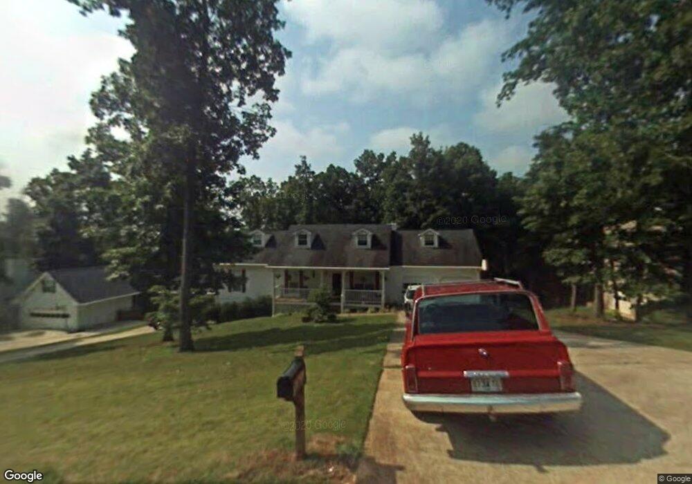
648 Mckenzie Cir Stockbridge, GA 30281
Estimated Value: $281,924 - $304,000
3
Beds
2
Baths
1,682
Sq Ft
$176/Sq Ft
Est. Value
About This Home
This home is located at 648 Mckenzie Cir, Stockbridge, GA 30281 and is currently estimated at $296,231, approximately $176 per square foot. 648 Mckenzie Cir is a home located in Henry County with nearby schools including Woodland Elementary School, Woodland Middle School, and Woodland High School.
Ownership History
Date
Name
Owned For
Owner Type
Purchase Details
Closed on
Sep 1, 2020
Sold by
Durden Lonar H
Bought by
Durden Lonar H and Durden Douglas Melinda
Current Estimated Value
Purchase Details
Closed on
Jun 30, 1994
Sold by
Ga Homes
Bought by
Durden Lonar H and Durden Angela K
Home Financials for this Owner
Home Financials are based on the most recent Mortgage that was taken out on this home.
Original Mortgage
$101,550
Interest Rate
8.51%
Create a Home Valuation Report for This Property
The Home Valuation Report is an in-depth analysis detailing your home's value as well as a comparison with similar homes in the area
Home Values in the Area
Average Home Value in this Area
Purchase History
| Date | Buyer | Sale Price | Title Company |
|---|---|---|---|
| Durden Lonar H | -- | -- | |
| Durden Lonar H | $106,900 | -- |
Source: Public Records
Mortgage History
| Date | Status | Borrower | Loan Amount |
|---|---|---|---|
| Previous Owner | Durden Lonar H | $101,550 |
Source: Public Records
Tax History Compared to Growth
Tax History
| Year | Tax Paid | Tax Assessment Tax Assessment Total Assessment is a certain percentage of the fair market value that is determined by local assessors to be the total taxable value of land and additions on the property. | Land | Improvement |
|---|---|---|---|---|
| 2025 | $849 | $132,972 | $18,000 | $114,972 |
| 2024 | $849 | $120,400 | $18,000 | $102,400 |
| 2023 | $642 | $122,480 | $16,000 | $106,480 |
| 2022 | $774 | $99,160 | $12,000 | $87,160 |
| 2021 | $764 | $83,600 | $12,000 | $71,600 |
| 2020 | $759 | $75,320 | $10,800 | $64,520 |
| 2019 | $757 | $72,560 | $10,800 | $61,760 |
| 2018 | $754 | $66,880 | $10,000 | $56,880 |
| 2016 | $1,436 | $53,040 | $10,000 | $43,040 |
| 2015 | $1,592 | $45,880 | $7,200 | $38,680 |
| 2014 | $1,474 | $42,560 | $7,200 | $35,360 |
Source: Public Records
Map
Nearby Homes
- 608 Mckenzie Cir
- 564 Mckenzie Ave
- 0 Mckenzie Ave Unit 10593345
- 164 Mckenzie Ct
- 320 Mckenzie Dr
- 551 Hood Rd
- 719 Erin Dr
- 1720 Highway 138 E
- 805 Anna Kathryn Dr
- 825 Anna Kathryn Dr
- 809 Anna Kathryn Dr
- 807 Anna Kathryn Dr
- 829 Anna Kathryn Dr
- 830 Anna Kathryn Dr
- 811 Anna Kathryn Dr
- 831 Anna Kathryn Dr
- 813 Anna Kathryn Dr
- 95 Fern Ct
- 1810 Highway 138 E
- 100 Kim Trail
- 640 Mckenzie Cir
- 656 Mckenzie Cir
- 632 Mckenzie Cir
- 664 Mckenzie Cir
- 312 Stonecutters Cove
- 649 Mckenzie Cir
- 308 Stonecutters Cove
- 641 Mckenzie Cir
- 316 Stonecutters Cove
- 657 Mckenzie Cir
- 672 Mckenzie Cir
- 625 Mckenzie Cir
- 665 Mckenzie Cir
- 624 Mckenzie Cir
- 1304 Byron Ct Unit LOT 247 - MERIDIAN
- 320 Stonecutters Cove
- 304 Stonecutters Cove
- 0 Stonecutters Cove Unit 3198771
- 0 Stonecutters Cove Unit 8117538
- 503 Mckenzie Ave