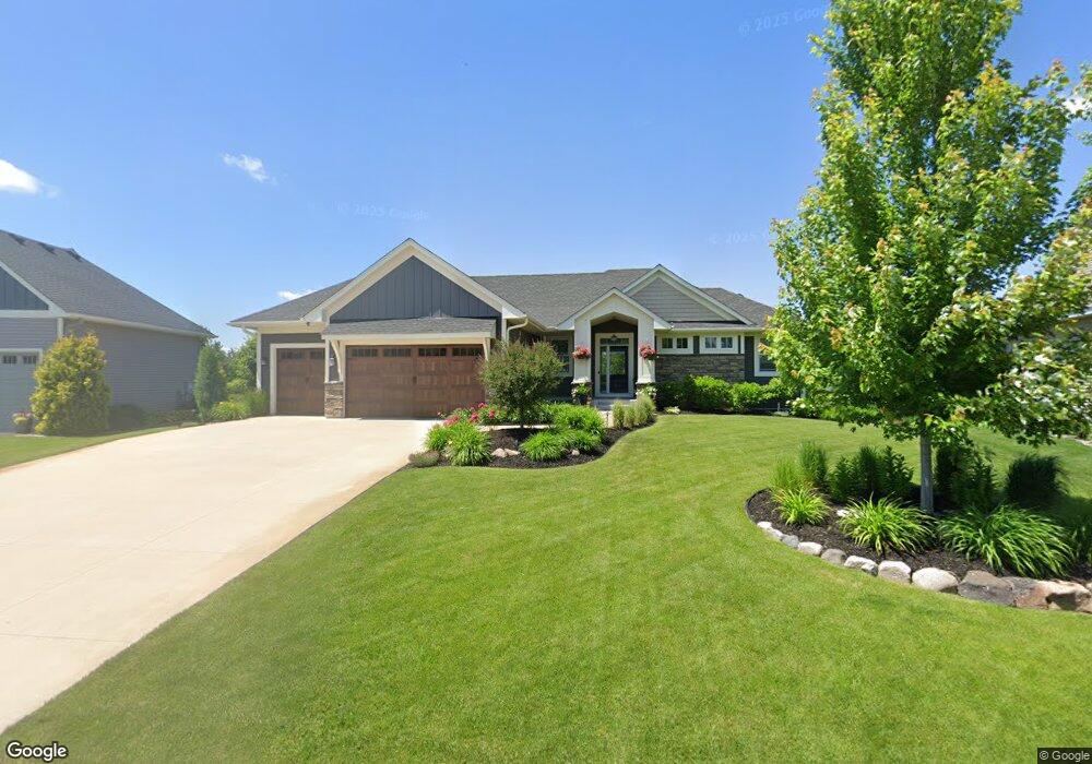
6481 Pheasant Run S Circle Pines, MN 55014
Estimated Value: $546,000 - $745,000
3
Beds
3
Baths
2,974
Sq Ft
$221/Sq Ft
Est. Value
About This Home
This home is located at 6481 Pheasant Run S, Circle Pines, MN 55014 and is currently estimated at $658,089, approximately $221 per square foot. 6481 Pheasant Run S is a home located in Anoka County with nearby schools including Rice Lake Elementary School, Centennial Middle School, and Centennial High School.
Ownership History
Date
Name
Owned For
Owner Type
Purchase Details
Closed on
Mar 30, 2020
Sold by
Arvold Michael and Arvold Rachel Gayle
Bought by
Arvold Michael and Arvold Rachel Gayle
Current Estimated Value
Purchase Details
Closed on
Nov 18, 2016
Sold by
Southwind Builders Inc
Bought by
Arvold Michael
Home Financials for this Owner
Home Financials are based on the most recent Mortgage that was taken out on this home.
Original Mortgage
$398,175
Outstanding Balance
$319,665
Interest Rate
3.42%
Mortgage Type
New Conventional
Estimated Equity
$338,424
Purchase Details
Closed on
May 4, 2016
Sold by
Sb Commercial Construction Company
Bought by
Southwind Builders Inc
Create a Home Valuation Report for This Property
The Home Valuation Report is an in-depth analysis detailing your home's value as well as a comparison with similar homes in the area
Home Values in the Area
Average Home Value in this Area
Purchase History
| Date | Buyer | Sale Price | Title Company |
|---|---|---|---|
| Arvold Michael | -- | Lendserv National Title | |
| Arvold Michael | $530,900 | Network Title Inc | |
| Southwind Builders Inc | $117,500 | Fsa Title Services Llc | |
| Sb Commercial Construction Company | -- | Fsa Title Services Llc |
Source: Public Records
Mortgage History
| Date | Status | Borrower | Loan Amount |
|---|---|---|---|
| Open | Arvold Michael | $398,175 |
Source: Public Records
Tax History
| Year | Tax Paid | Tax Assessment Tax Assessment Total Assessment is a certain percentage of the fair market value that is determined by local assessors to be the total taxable value of land and additions on the property. | Land | Improvement |
|---|---|---|---|---|
| 2025 | $7,370 | $641,100 | $193,200 | $447,900 |
| 2024 | $7,370 | $595,600 | $157,000 | $438,600 |
| 2023 | $6,610 | $594,900 | $138,500 | $456,400 |
| 2022 | $6,555 | $581,100 | $129,500 | $451,600 |
| 2021 | $6,433 | $505,800 | $115,500 | $390,300 |
| 2020 | $6,623 | $483,900 | $115,500 | $368,400 |
| 2019 | $6,604 | $479,000 | $119,700 | $359,300 |
| 2018 | $5,918 | $451,000 | $0 | $0 |
| 2017 | $1,014 | $440,100 | $0 | $0 |
| 2016 | $2,586 | $98,600 | $0 | $0 |
| 2015 | $2,522 | $98,600 | $98,600 | $0 |
| 2014 | -- | $0 | $0 | $0 |
Source: Public Records
Map
Nearby Homes
- 6559 Black Duck Dr S
- 965 Pheasant Run S
- 6478 Fox Rd
- 922 Pheasant Run S
- 1150 Durango Point
- 907 Fox Rd
- 6657 White Birch Ct
- 1205 Choke Cherry Rd
- 1241 Holly Dr E
- 1229 Choke Cherry Rd
- 849 Fox Cove
- 1295 Velvetleaf Ln
- 6766 E Shadow Lake Dr
- 749 Fox Rd
- 6326 White Owl Dr
- 1415 Sherman Lake Rd
- 1428 Sherman Lake Rd
- 6824 W Shadow Lake Dr
- 553 Hawthorn Rd
- 78 Rapp Farm Ln
- 6473 Pheasant Run S
- 6487 Pheasant Run S
- 6493 Pheasant Run S
- 6467 Pheasant Run S
- 6472 Pheasant Run S
- 6497 Pheasant Run S
- 6459 Pheasant Run S
- 6511 Pheasant Run S
- 6478 Killdeer Dr
- 6458 Killdeer Dr
- 6470 Killdeer Dr
- 6519 Pheasant Run S
- 6490 Killdeer Dr
- 6441 Pheasant Run S
- 6527 Pheasant Run S
- 6496 Killdeer Dr
- 6452 Killdeer Dr
- 6508 Killdeer Dr
- 1047 Aspen Ln
- 1055 Aspen Ln
Your Personal Tour Guide
Ask me questions while you tour the home.