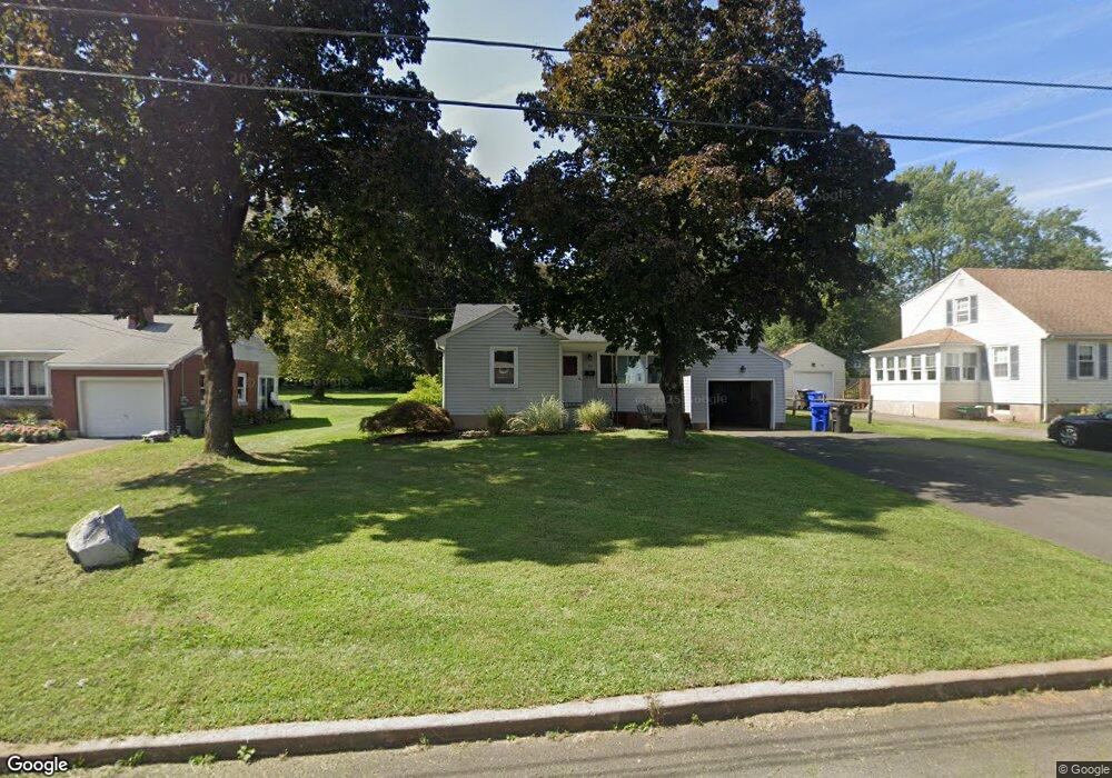
65 Berkeley Rd Middletown, CT 06457
Estimated Value: $299,000 - $440,000
2
Beds
3
Baths
957
Sq Ft
$362/Sq Ft
Est. Value
About This Home
This home is located at 65 Berkeley Rd, Middletown, CT 06457 and is currently estimated at $346,730, approximately $362 per square foot. 65 Berkeley Rd is a home located in Middlesex County with nearby schools including Wilbert Snow Elementary School, Middletown High School, and St John Paul II School.
Ownership History
Date
Name
Owned For
Owner Type
Purchase Details
Closed on
Jul 27, 1994
Sold by
Strohm David L and Strohm Brenda L
Bought by
Lutz Michael R and Dess Michele R
Current Estimated Value
Home Financials for this Owner
Home Financials are based on the most recent Mortgage that was taken out on this home.
Original Mortgage
$116,850
Interest Rate
2%
Mortgage Type
Unknown
Purchase Details
Closed on
Dec 20, 1993
Sold by
Holt Lillian K
Bought by
Strohm David L and Strohm Brenda L
Home Financials for this Owner
Home Financials are based on the most recent Mortgage that was taken out on this home.
Original Mortgage
$108,000
Interest Rate
7%
Mortgage Type
Unknown
Create a Home Valuation Report for This Property
The Home Valuation Report is an in-depth analysis detailing your home's value as well as a comparison with similar homes in the area
Purchase History
| Date | Buyer | Sale Price | Title Company |
|---|---|---|---|
| Lutz Michael R | $127,000 | -- | |
| Strohm David L | $120,000 | -- |
Source: Public Records
Mortgage History
| Date | Status | Borrower | Loan Amount |
|---|---|---|---|
| Closed | Strohm David L | $109,000 | |
| Closed | Strohm David L | $116,850 | |
| Previous Owner | Strohm David L | $108,000 |
Source: Public Records
Tax History
| Year | Tax Paid | Tax Assessment Tax Assessment Total Assessment is a certain percentage of the fair market value that is determined by local assessors to be the total taxable value of land and additions on the property. | Land | Improvement |
|---|---|---|---|---|
| 2025 | $5,986 | $153,880 | $65,810 | $88,070 |
| 2024 | $5,663 | $153,880 | $65,810 | $88,070 |
| 2023 | $5,401 | $153,880 | $65,810 | $88,070 |
| 2022 | $4,871 | $110,710 | $43,880 | $66,830 |
| 2021 | $4,871 | $110,710 | $43,880 | $66,830 |
| 2020 | $4,893 | $110,710 | $43,880 | $66,830 |
| 2019 | $4,916 | $110,710 | $43,880 | $66,830 |
| 2018 | $4,838 | $110,710 | $43,880 | $66,830 |
| 2017 | $4,750 | $112,030 | $51,200 | $60,830 |
| 2016 | $4,616 | $112,030 | $51,200 | $60,830 |
| 2015 | $4,436 | $112,030 | $51,200 | $60,830 |
| 2014 | $4,481 | $112,030 | $51,200 | $60,830 |
Source: Public Records
Map
Nearby Homes
- 13 Mckenna Dr
- 45 Mckenna Dr
- 58 Durant Terrace
- 56 Coles Rd
- 236 Cross St
- 21 Butternut Knolls
- 11 Mansfield Terrace
- 122 Baldwin Dr
- 32 Burr Ave
- 23 Hotchkiss St
- 91 Gleeson Rd
- 217 Ridge Rd
- 10 Guarino Dr
- 57 Edgewood Dr
- 909 Randolph Rd
- 0 Dunn St Unit 24162046
- 201 College St Unit 26
- 160 Boston Rd
- Lot 3 Coleman Rd
- 211 Boston Rd
Your Personal Tour Guide
Ask me questions while you tour the home.