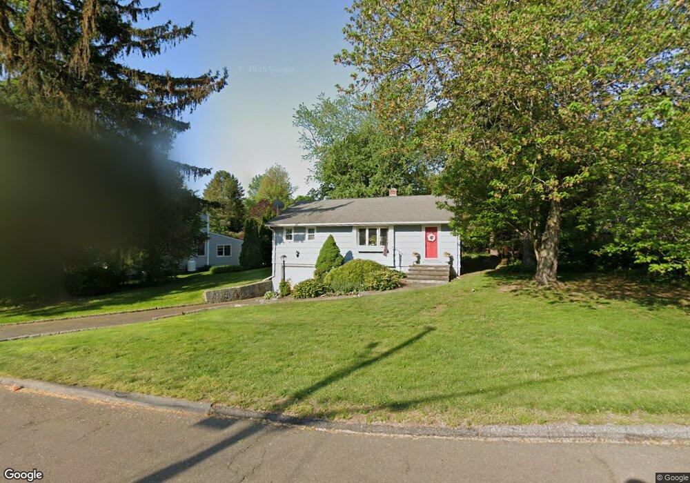
65 Craig Ln Trumbull, CT 06611
West Trumbull NeighborhoodEstimated Value: $463,000 - $564,000
3
Beds
2
Baths
920
Sq Ft
$558/Sq Ft
Est. Value
About This Home
This home is located at 65 Craig Ln, Trumbull, CT 06611 and is currently estimated at $513,705, approximately $558 per square foot. 65 Craig Ln is a home located in Fairfield County with nearby schools including Frenchtown Elementary School, Madison Middle School, and Trumbull High School.
Ownership History
Date
Name
Owned For
Owner Type
Purchase Details
Closed on
Jun 20, 2003
Sold by
Shea Michael P and Shea Elizabeth R
Bought by
Peters Renee H
Current Estimated Value
Home Financials for this Owner
Home Financials are based on the most recent Mortgage that was taken out on this home.
Original Mortgage
$155,000
Interest Rate
5.71%
Purchase Details
Closed on
Apr 23, 1991
Sold by
Vlamis John
Bought by
Shea Michael P and Shea Elizabeth R
Home Financials for this Owner
Home Financials are based on the most recent Mortgage that was taken out on this home.
Original Mortgage
$130,500
Interest Rate
9.4%
Mortgage Type
Unknown
Purchase Details
Closed on
Sep 28, 1987
Sold by
Vlamis James
Bought by
Vlamis John
Create a Home Valuation Report for This Property
The Home Valuation Report is an in-depth analysis detailing your home's value as well as a comparison with similar homes in the area
Home Values in the Area
Average Home Value in this Area
Purchase History
| Date | Buyer | Sale Price | Title Company |
|---|---|---|---|
| Peters Renee H | $289,000 | -- | |
| Shea Michael P | $145,000 | -- | |
| Vlamis John | $200,000 | -- |
Source: Public Records
Mortgage History
| Date | Status | Borrower | Loan Amount |
|---|---|---|---|
| Open | Vlamis John | $122,666 | |
| Closed | Vlamis John | $155,000 | |
| Previous Owner | Vlamis John | $130,000 | |
| Previous Owner | Vlamis John | $130,500 |
Source: Public Records
Tax History Compared to Growth
Tax History
| Year | Tax Paid | Tax Assessment Tax Assessment Total Assessment is a certain percentage of the fair market value that is determined by local assessors to be the total taxable value of land and additions on the property. | Land | Improvement |
|---|---|---|---|---|
| 2025 | $7,730 | $209,370 | $142,730 | $66,640 |
| 2024 | $7,518 | $209,370 | $142,730 | $66,640 |
| 2023 | $7,397 | $209,370 | $142,730 | $66,640 |
| 2022 | $7,279 | $209,370 | $142,730 | $66,640 |
| 2021 | $6,206 | $169,820 | $118,930 | $50,890 |
| 2020 | $7,284 | $169,820 | $118,930 | $50,890 |
| 2018 | $5,938 | $169,820 | $118,930 | $50,890 |
| 2017 | $5,818 | $169,820 | $118,930 | $50,890 |
| 2016 | $5,701 | $169,820 | $118,930 | $50,890 |
| 2015 | $5,794 | $170,600 | $118,900 | $51,700 |
| 2014 | $5,669 | $170,600 | $118,900 | $51,700 |
Source: Public Records
Map
Nearby Homes
- 8 Moorland Rd
- 60 Lillian Dr
- 33 Rexview Cir
- 26 Grove St
- 58 Daniels Farm Rd
- 122 Paugusett Cir
- Lot 31 Valley View Rd
- 33 Enclave Dr Unit 33
- 121 Paugusett Cir
- 7 Manor Dr
- 11 Laurel St
- 1675 Old Town Rd
- 45 Rogerson Cir
- 87 Parkway Dr
- 715 Frenchtown Rd Unit 31
- 1800 Chopsey Hill Rd
- 90 Sequoia Rd
- 1 Village Dr
- 253 Mayfield Dr Unit 253
- 267 Mayfield Dr