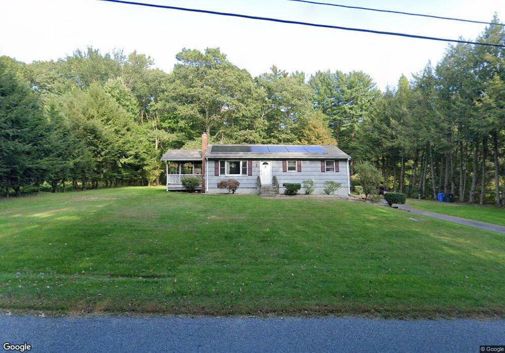
650 Buff Cap Rd Tolland, CT 06084
Estimated Value: $269,000 - $334,000
3
Beds
2
Baths
1,008
Sq Ft
$293/Sq Ft
Est. Value
About This Home
This home is located at 650 Buff Cap Rd, Tolland, CT 06084 and is currently estimated at $295,493, approximately $293 per square foot. 650 Buff Cap Rd is a home located in Tolland County with nearby schools including Tolland High School.
Ownership History
Date
Name
Owned For
Owner Type
Purchase Details
Closed on
Sep 25, 1996
Sold by
Fnma
Bought by
Condry Glenn and Condry Sharon
Current Estimated Value
Home Financials for this Owner
Home Financials are based on the most recent Mortgage that was taken out on this home.
Original Mortgage
$96,100
Interest Rate
7.83%
Mortgage Type
Purchase Money Mortgage
Purchase Details
Closed on
Mar 30, 1992
Sold by
Skangalis Marja
Bought by
Nimirowski Gary and Mcgee Melanie
Create a Home Valuation Report for This Property
The Home Valuation Report is an in-depth analysis detailing your home's value as well as a comparison with similar homes in the area
Home Values in the Area
Average Home Value in this Area
Purchase History
| Date | Buyer | Sale Price | Title Company |
|---|---|---|---|
| Condry Glenn | $97,000 | -- | |
| Condry Glenn | $97,000 | -- | |
| Nimirowski Gary | $116,000 | -- | |
| Nimirowski Gary | $116,000 | -- |
Source: Public Records
Mortgage History
| Date | Status | Borrower | Loan Amount |
|---|---|---|---|
| Open | Nimirowski Gary | $130,000 | |
| Closed | Nimirowski Gary | $138,200 | |
| Closed | Nimirowski Gary | $96,100 |
Source: Public Records
Tax History
| Year | Tax Paid | Tax Assessment Tax Assessment Total Assessment is a certain percentage of the fair market value that is determined by local assessors to be the total taxable value of land and additions on the property. | Land | Improvement |
|---|---|---|---|---|
| 2025 | $4,799 | $176,500 | $65,600 | $110,900 |
| 2024 | $4,634 | $122,700 | $62,500 | $60,200 |
| 2023 | $4,580 | $122,700 | $62,500 | $60,200 |
| 2022 | $4,488 | $122,700 | $62,500 | $60,200 |
| 2021 | $4,553 | $122,700 | $62,500 | $60,200 |
| 2020 | $4,423 | $122,700 | $62,500 | $60,200 |
| 2019 | $4,283 | $118,800 | $64,500 | $54,300 |
| 2018 | $4,158 | $118,800 | $64,500 | $54,300 |
| 2017 | $4,062 | $118,800 | $64,500 | $54,300 |
| 2016 | $4,062 | $118,800 | $64,500 | $54,300 |
| 2015 | $3,963 | $118,800 | $64,500 | $54,300 |
| 2014 | $4,049 | $130,400 | $71,600 | $58,800 |
Source: Public Records
Map
Nearby Homes
- 8 Neff Hill Rd
- 15 Usher Ridge
- 68 Usher Ridge
- 36 Usher Ridge
- 110 Neff Hill Rd
- 130 Neff Hill Rd
- 105 Neff Hill Rd
- 137 Neff Hill Rd
- 77 Neff Hill Rd
- 84 Neff Hill Rd
- 42 Ladd Rd
- 71 Neff Hill Rd
- 40 Buff Cap Rd
- 487 Buff Cap Rd
- 0 Tolland Turnpike
- 127 Sandy Beach Rd
- 68 Cook Rd
- 26 Green St
- 5 Melissa Way
- 3 Lake View Terrace
- 654 Buff Cap Rd
- 638 Buff Cap Rd
- 783 Old Stafford Rd
- 662 Buff Cap Rd
- 630 Buff Cap Rd
- 645 Buff Cap Rd
- 670 Buff Cap Rd
- 775 Old Stafford Rd
- 784 Old Stafford Rd
- 799 Old Stafford Rd
- 678 Buff Cap Rd
- 768 Old Stafford Rd
- 751 Old Stafford Rd
- 811 Old Stafford Rd
- 682 Buff Cap Rd
- 669 Buff Cap Rd
- 754 Old Stafford Rd
- 807 Old Stafford Rd
- 683 Buff Cap Rd
- 812 Old Stafford Rd